Chapter 27
ZONING
|
|
|
|
Art. I. |
In General, §§ 27-1--27-20. |
|
Art. II. |
Administration and Enforcement, §§ 27-21--27-30. |
|
Art. III. |
Board of Adjustment, §§ 27-31--27-35. |
|
Art. IV. |
Amendments, §§ 27-36--27-45. |
|
Art. V. |
Nonconforming Uses and Structures, §§ 27-46--27-55. |
|
Art. VI. |
Conditional Uses, §§ 27-56--27-60. |
|
Art. VII. |
Districts, §§ 27-61--27-220. |
|
|
Div. 1. Generally, §§ 27-61--27-70. |
|
|
Div. 2. District A, Agricultural District, §§ 27-71--27-74. |
|
|
Div. 3. District R-R, Rural Residential District, §§ 27-75--27-80. |
|
|
Div. 4. District S-R, Suburban Residential District, §§
27-81--27-90. |
|
|
Div. 5. District R-1, Single-family Residential District, §§
27-91--27‑100. |
|
|
Div. 6. District R-2, One and Two Family Residential District,
§§ 27-101--27-110. |
|
|
Div. 7. District R-3, Multiple-family Residential District,
§§ 27-111--27‑120. |
|
|
Div. 8. District R-M, Mobile Home District, §§ 27-121--27-130. |
|
|
Div. 9. District R-O, Limited Residential Office District,
§§ 27-131--27‑140. |
|
|
Div. 10. District O-D, Office District, §§ 27-141--27-150. |
|
|
Div. 11. District C-1, Local Business District, §§ 27-151--27-160. |
|
|
Div. 12. District C-2, Central Business District, §§ 27-161--27-170. |
|
|
Div. 13. District C-2A, Special Business District, §§ 27-171--27-180. |
|
|
Div. 14. District C-3, Service Commercial District, §§ 27-181--27-190. |
|
|
Div. 15. District B-P, Business Park District, §§ 27-191 – 27-194 |
|
|
Div. 16. District I-1, Light Industrial District, §§ 27-195--27-200. |
|
|
Div. 17. District I-2, Heavy Industrial District, §§ 27-201--27-220. |
|
|
Div. 18. District I-3, Limited Industrial District, §§ 27-211--27-220. |
|
Art.
VIII. |
Special and Overlay Districts, §§ 27-221--27-280. |
|
|
Div. 1. Mixed Use Special
District, §§ 27-221--27-230. |
|
|
Div. 2. Planned Development Overlay District, §§ 27-231--27-240. |
|
|
Div. 3. Flood Plain Overlay District, §§ 27-241--27-260. |
|
|
Div. 4. Airport Overlay District, §§ 27-261--27-280. |
|
|
Div. 5. Special and Overlay Districts, §§
27-271--27-279 |
|
Art. IX. |
Supplemental Regulations, §§ 27-281--27-300. |
|
Art. X. |
Landscaping and Screening, §§
27-301--27-320 |
|
Art. XI. |
Signs, §§ 27-321--27-340. |
|
Art.
XII. |
Off-street Parking and Loading, §§ 27-341 -
27-400. |
|
Art.
XIII. |
Land Use Matrix, § 27-401. |
|
|
|
ARTICLE I. IN GENERAL
Sec.
27-1. Short title.
This chapter shall be known and cited as the “Zoning Regulations of the City of
Norfolk, Nebraska.”
Source: Ord. No. 4603, § 1, 9-16-02
Sec.
27-2. Definitions.
For the purpose of this
chapter, the following words and terms as used herein are defined.
Certain articles or divisions contain definitions which are additional to those
listed herein. Words in the present tense shall include the future; the
singular shall include the plural and the plural the singular; the word
"structure" shall include the word "building," and the word
"shall" is mandatory.
Abandonment
shall mean to cease or discontinue a use or activity without intent to resume
as distinguished from short term interruptions such as during periods of
remodeling, maintenance or normal periods of vacation or seasonal closure.
Abutting
shall mean to border on, being contiguous with or have property or district
lines in common, including property separated by an alley.
Access
shall mean a way or means of approach or entrance, a means of ingress or
egress.
Accessory
building (see Building, accessory)
Accessory
structure shall mean a detached subordinate structure located on the
same lot with the principal structure, the use of which is incidental and
accessory to that of the principal structure.
Accessory
use shall mean a subordinate use which serves an incidental function to
that of the main use of the premises.
Active
recreation shall mean a recreational activity requiring physical
exertion such as swimming, tennis, soccer, baseball, softball, running and
playgrounds.
Addition
shall mean any construction which increases the size of a building or
structure.
Adjacent shall mean
near to or in the vicinity with or without touching or bordering upon.
Adult
entertainment businesses shall mean any business activity which offers
the opportunity to view specified sexual activities or view and touch specified
anatomical areas in a manner that lacks serious literary, artistic, political,
or scientific value. This category includes the sale or viewing of visual
or print materials that meet this criteria if the sale of such material
constitutes more than 20% of the sales or retail floor area of the
establishment. For the purposes of this definition, specified anatomical
areas include the following if less than opaquely covered: human genitals, the
pubic region, pubic hair, or the female breast below a point immediately above
the top of the areola. Specified sexual activities include any of the
following conditions:
(1) Human genitals in
a state of sexual stimulation or arousal.
(2) Acts or
representations of acts of human masturbation, sexual intercourse with humans
or animals, oral sex, or flagellation.
(3) Fondling or erotic
touching of human genitals, pubic region, buttock, or female breast.
(4) Excretory functions
as part of or in connection with any activities set forth in (1) through (3)
above.
Typical uses include retail
services or stores which are distinguished by an emphasis on activities or
materials that emphasize primarily sexual content in their inventory and
marketing practices; businesses which offer live performances characterized by
exposure of specified anatomical areas; and adult theaters. Businesses
may be classified as adult entertainment businesses without regard to
service of alcoholic beverages.
Agricultural
and farm buildings and structures shall mean any building or structure
which is necessary or incidental to the normal conduct of a farm including but
not limited to residence of the operator, residence of hired men, barns,
buildings and sheds for housing livestock, poultry and farm machinery,
buildings for the storage or shelter of grain, hay and other crops, silos,
windmills and water storage tanks.
Agriculture
shall mean the use of a tract of land for the growing of crops, pasturage,
nursery, or the raising of poultry, including the structures necessary for
carrying out farming operations, the residence or residences of those owning or
operating the premises, a member of the family thereof, or persons employed
thereon, and the family thereof, but such use shall not include feedlots.
The raising of livestock and poultry shall be an agricultural use if the area
in which the livestock or poultry is kept is ten (10) acres or more in area.
Agronomic
Rates shall mean the application of plant nutrients, from all sources,
to meet, but not exceed, the estimated annual nutrient needs of the crop being
produced, based upon past or projected yields, so as to avoid build-up of
nutrients including, but not limited to, nitrate, chloride, ammonia and
phosphorus. Determination of the agronomic rate shall include the
available nutrients in the soil, the nitrogen content of any irrigation water,
and the nutrient content of any animal wastes, sludges and commercial fertilizer
to be applied.
Airport
shall mean an area designed and set aside for the landing and takeoff of
aircraft, including all necessary facilities for housing and maintenance of
aircraft. (also see Heliport)
Alley
shall mean a dedicated public right-of-way, the right-of-way of which is twenty
(20) feet or less in width, other than street, which provides only a secondary
means of access from the abutting property, to the street.
Alteration
shall mean any change, addition or modification in construction or occupancy of
an existing structure.
Alteration,
structural (see Structural alteration)
Amusement
arcade shall mean a building or a part of a building where five or more
pinball machines, video games, or other similar player-orientated amusement
devices are available and are maintained for use.
Animal
hospital (see Hospital, animal)
Animals,
domestic (see Household pet)
Animals,
farm shall mean livestock associated with agricultural uses, commonly
kept or raised as a part of a farming operation including but not limited to
horses, cattle, sheep, swine, goats, chickens and turkeys.
Antenna
shall mean any attached or external system of wires, poles, rods, reflecting
disks or similar devices used for the transmission or reception of
electromagnetic waves. (also see Satellite dish antenna and Tower)
Apartment
shall mean a room or a suite of rooms within an apartment house or
multiple-family dwelling arranged, intended or designed for a place of
residence of a single-family or group of individuals living together as a
single housekeeping unit. (also see Dwelling unit)
Apartment
hotel shall mean a multiple-family dwelling under resident supervision
which maintains an inner lobby through which all tenants must pass to gain
access to the apartments and which may furnish services ordinarily furnished by
hotels, such as drug store, barber shop, beauty parlor, shoeshine shop,
cosmetologists shop, cigar stand or newsstand, when such uses are located
entirely within the building with no entrance from the street nor visible from
any public sidewalk, and having no sign or display visible from the outside of
the building indicating the existence of such use.
Apartment
house (see Residential uses)
Approved
lot (see Lot, approved)
Aquifer
shall mean a geological unit in which porous and permeable conditions exist and
thus are capable of bearing and producing usable amounts of water.
Aquifer
recharge area shall mean an area that has soils and geological features
that are conducive to allowing significant amounts of surface water to
percolate into groundwater.
Architectural
canopy sign (see Sign, architectural canopy)
Arterial
street (see Street, arterial)
Attached
permanently shall mean attached to real estate in such a way as to
require dismantling, cutting away, unbolting from permanent foundation or
structural change in such structure in order to relocate it to another site.
Automobile
service station (see Service station)
Automobile
wrecking yard shall mean the dismantling or wrecking of used motor
vehicles or trailers, or the storage, sale, or dumping of dismantled or wrecked
vehicles or their parts. The presence on any lot or parcel of land of two
or more vehicles, which, for a period exceeding 30 days, have not been capable
of operating under their own power and from which parts have been or are to be
removed for reuse or sale, shall constitute prima facie evidence of an
automobile wrecking yard. (also see Junkyard)
Bar
shall mean any establishment whose principal business is serving alcoholic
beverages at retail for consumption on the premises. (also see Nightclub)
Basement
shall mean that portion of a building which is partly or completely below
grade.
Bed and
breakfast inn shall mean a house, or portion thereof, where short-term
lodging rooms and meals are provided. The operator of the inn shall live
on the premises or in adjacent premises.
Bedroom
shall mean a room within a dwelling unit planned and intended for sleeping,
separable from other rooms by a door.
Best
interest of community shall mean interests of the community at large
and not interest of the immediate neighborhood.
Billboard
(see Sign, billboard)
Block
shall mean a tract of land within a subdivision bounded by streets, streams,
railroads, the exterior boundaries of the subdivision, or any combination
thereof.
Block frontage shall
mean that section of a block fronting on a street between two intersecting
streets or other block boundary.
Board of
adjustment shall mean that board which has been created by the city and
which has the statutory authority to hear and determine appeals,
interpretations of and variances to the zoning regulations.
Boarding/Rooming House shall mean the use of a site for the
residence of more than three unrelated persons, not otherwise defined as a
family in which occupants are accommodated in rooms not defined as dwelling
units.
Borrow pit
shall mean any place or premises where dirt, soil, sand, gravel or other
material is removed below the grade of surrounding land for any purpose other
than that necessary and incidental to site grading or building construction.
Broadcasting
tower shall mean a structure for the transmission or broadcast of
radio, television, radar, or microwaves which exceeds the maximum height
permitted in the district in which it is located; provided, however, that
noncommercial radio towers not exceeding fifty (50) feet in height shall not be
considered broadcast towers.
Buffer
shall mean a strip of land established to protect one type of land use from
another incompatible land use or between a land use and a private or public
road. (also see Screening)
Building
shall mean any structure having a roof and walls, and used, or intended for the
enclosure, shelter, or protection of persons, animals, chattels, or
property. (also see Structure)
Building,
accessory shall mean any detached subordinate building which serves a
function customarily incidental to that of the main building or main use of the
premises. Customary accessory building includes garages, carports, and
small storage sheds.
Building
coverage (see Lot coverage)
Building,
height shall mean the vertical distance above grade to the highest
point of the coping of a flat roof or to the deck line of a mansard roof, or to
the average height of the highest gable of a pitched, hipped, or shed roof,
measured from the highest adjoining sidewalk or ground surface within a five
(5) foot horizontal distance at the exterior wall of the building. (also
see Height)
Building
line shall mean a line parallel to the lot line, beyond which a
building or land use cannot extend according to the terms of the applicable
district regulations. (also see Setback and Yard)
Building
moratorium shall mean a period of time established by the city council
when no construction, additions, improvements or subdivision shall occur within
a given area.
Building,
principal shall mean a building within which the main or primary use of
the lot or premises is located. (also see Principal use)
Building
sign (see Sign, building)
Bulk
Storage shall mean the storage of materials for distribution to other
locations and not for use or consumption of such materials on the premises.
Business
use shall mean all uses of land, buildings or structures other than
agricultural, residential, public, semi-public or industrial uses.
Camper
Campground (see Recreational vehicle) shall mean a parcel of land
intended for the temporary occupancy of tents, campers and major recreational vehicles
and which primary purpose is recreational, having open areas that are natural
in character.
Car wash
shall mean a building or structure or an area of land with machine or hand
operated facilities for the cleaning, washing, polishing, or waxing of motor
vehicles.
Carry out
restaurant (see Restaurant, fast food and Restaurant, drive-in)
Cemetery
shall mean a tract of land used or intended to be used for the burial of the
dead, including columbariums, and mausoleums when in conjunction with and
located within the boundaries of the cemetery.
Charitable
shall mean a public or semi-public institutional use of a philanthropic,
charitable, benevolent, religious or eleemosynary character, but not including
sheltering or caring of animals.
Church
shall mean a place where religious worship is conducted including
accessory uses as schools, day care centers, bingo parlors and halls.
City
shall mean City of Norfolk, Nebraska.
City
council shall mean the City Council of the City of Norfolk, Nebraska.
Clear view
zone shall mean the area of a corner lot closest to the intersection
which is kept free of visual impairment to allow full view of both pedestrian
and vehicular traffic. (also see Sight triangle)
Clinic
shall mean a building designed and used for the examination, diagnosis and
treatment of human patients and not including overnight care facilities.
Closed
sign (see Sign, closed)
Club
shall mean a nonprofit organization with limited membership which is controlled
by the membership into which admission can only be obtained by invitation, and
in which the property is owned in common or held for the benefit of the
members.
Cluster
development shall mean a development designed to concentrate buildings
in specific areas on a site to allow the remaining land to be used for
recreation, common open space, and the preservation of environmentally
sensitive areas.
Cocktail
lounge (see Bar)
Collector
street (see Street, collector)
Commercial
use shall mean an occupation, employment, or enterprise that is carried
on for profit by the owner, owners, lessee or licensee.
Commission
shall mean the Norfolk Planning Commission.
Common area shall
mean that area within a development not occupied by buildings, owned in common
by property owners within the development, designed and intended to provide
access, parking, required yards, walkways, and services to the residents of the
development. Common area does not apply as open space nor common open
space. (also see Open space, common)
Common open
space (see Open space, common)
Community
center shall mean a place, structure or other facility used for and
providing either religious, fraternal, social, and/or recreational programs
generally open to the public and designed to accommodate and serve various
segments of the community.
Community
sanitary sewer system shall mean an approved central sewer collecting
system, meeting state and city requirements, available to each platted lot and
discharging into a treatment facility. This does not include individual
septic systems.
Community
water supply system shall mean a public water supply system which
serves at least fifteen service connections used by year round residents or
regularly serves 25 or more year round residents.
Compatible
uses shall mean a land use which is congruous with, tolerant of, and
has no adverse effects on existing neighboring uses. Incompatibility may
be affected by pedestrian or vehicular traffic generation, volume of goods
handled and environmental elements such as noise, dust, odor, air pollution,
glare, lighting, debris generated, vibration, electrical interference and
radiation.
Comprehensive
plan shall mean the Comprehensive Plan of Norfolk, Nebraska as adopted
by the Norfolk City Council, setting forth policies for the present and
foreseeable future community welfare as a whole and meeting the purposes and
requirements set forth in Section 19-903, R.R.S. 1943, as the same may, from
time to time, be amended.
Concept
plan (see Site plan)
Conditional
use shall mean a use where allowed by the district regulations, that
would not be appropriate generally throughout the zoning district without
restrictions, but which, if controlled as to number, size, area, location,
relation to the neighborhood or other minimal protective characteristics would
not be detrimental to the public health, safety and general welfare.
Conditional
use permit shall mean a permit issued by the planning commission that
authorizes the recipient to make conditional use of property in accordance with
the requirements of this chapter as well as additional requirements imposed by
the commission.
Condominium
shall mean an estate in real property consisting of an undivided interest in
common with other purchasers in a portion of a parcel of real property,
together with a separate interest in space in a residential building, such as
an apartment. A condominium may include, in addition, a separate interest
in other portions of such real property.
Confinement
feeding of livestock and poultry (see Feedlot)
Conflicting
land use shall mean the use of property which transfers over
neighboring property lines negative economic, or environmental effects,
including, but not limited to traffic, noise, vibration, odor, dust, glare,
smoke, pollution, water vapor, mismatched land uses and/or density, height,
mass, mismatched layout of adjacent uses, loss of privacy, and unsightly views.
Congregate
housing shall mean a residential facility for four or more persons
fifty-five (55) years or over, their spouses, or surviving spouses, providing
living and sleeping facilities including meal preparation, dining areas,
laundry services, room cleaning and common recreational, social, and service
facilities for the exclusive use of all residents including resident staff
personnel who occupy a room or unit in the residential facility. (also
see Housing for the elderly)
Conservation
areas shall mean environmentally sensitive and valuable lands protected
from any activity that would significantly alter their ecological integrity,
balance or character, except in overriding public interest, including but not
limited to wetlands, floodways, flood plains, drainage ways, river or stream
banks and areas of significant biological productivity or uniqueness.
Conservation
easement shall mean an easement granting a right or interest in real
property that is appropriate to retaining land or water areas predominantly in
their natural, scenic, open, or wooded condition and retaining such areas as
suitable habitat for fish, plants or wildlife or maintaining existing land
uses.
Convenience
food sales (see food sales)
Copy areas
(see Sign, copy area)
Corner lot
(see Lot, corner)
Country
club shall mean buildings and facilities owned and operated by a
corporation or association of persons for social and recreational purposes, but
not operated for a profit. The affairs and management of such club are
conducted by a board of directors, executive committee, or similar body chosen
by the members. It is designed to serve food and alcoholic beverages on
such premises to members and their guests, provided that the serving of food
and alcoholic beverages is secondary to some other principal purpose of the
association or corporation. Customary country clubs include, but are not
limited to swimming, tennis and golf course country clubs.
Court
shall mean an open, unoccupied space, other than a yard, bounded on three (3)
or more sides by exterior walls of a building, or by exterior walls of a
building and lot lines on which walls are allowable.
Cul-de-sac
shall mean a local street which is a single continuous stretch of road one end
of which is closed and terminated by a circular turn around.
Curb level
shall mean the mean level of the curb in front of the lot, or in case of a
corner lot, along that abutting street where the mean curb level is the
highest.
Curvilinear
street (see Street, curvilinear)
Dead end
street (see Cul-de-sac)
Density
shall mean the number of dwelling units per gross acre of land.
Destination
sign (see Sign, destination)
Developer
shall mean any person, corporation, partnership or entity that is responsible
for any undertaking that requires a building or zoning permit, conditional use
permit or sign permit.
Development
shall mean any manmade change to improved or unimproved real estate, including
but not limited to buildings or other structures, mining, dredging, filling,
grading, paving, excavation or drilling operations for which necessary permits
may be required.
Development
area shall mean an area of land either subdivided or not with three or
more homes per nine (9) acres.
Development
concept plan (see Site plan)
Development
review shall mean the review, by the city of subdivision plats, site
plans, rezoning requests or permit review.
District
(see Zoning district)
Dog kennel
(see Kennel, commercial and Kennel, private)
Domestic
animals (see Household pet)
Dormitory
shall mean a building used as group living quarters for a student body,
religious order, or other group as accessory use to a college, university,
boarding school, orphanage, convent, monastery, farm labor camp, or other
similar use where group kitchen facilities may be provided to serve all
residents.
Double
frontage lot (see Lot, double frontage)
Downzoning
shall mean a change in zoning classification of land to a less intensive or
more restrictive district such as from commercial district to residential
district or from a multiple-family residential district to single-family
residential district.
Drive-in
facility shall mean an establishment where customers can be served
without leaving the confinement of their vehicle.
Drive-in
restaurant (see Restaurant, drive-in and Restaurant, fast food)
Duplex
residential (see Residential uses)
Dwelling
shall mean a building or a portion thereof that provides living facilities for
one or more families, but not including hotels, motels, boarding or lodging
houses and shall include manufactured dwellings. (see also Residential Uses)
Dwelling
(or housing) unit shall mean a single unit consisting of one or a group
of rooms providing complete, independent living facilities for one family,
including permanent provisions for living, sleeping, eating, cooking and
sanitation.
Dwelling, secondary shall mean a living
facility located within a detached accessory building which living facility
is equipped for cooking and sleeping and which is located on the same lot,
parcel, or tract as the main dwelling unit. The secondary living unit
may be used by a member of the family or guest of the main dwelling unit.
Dwelling
(or housing) unit, efficiency shall mean a dwelling unit consisting of
one principal room with no separate sleeping room.
Easement
shall mean the right of a person, government agency, or public utility company
to use public or private land owned by another for a specific purpose.
Educational
institution shall mean a public or nonprofit institution or facility
which conducts regular academic instruction at preschool, kindergarten,
elementary, secondary and collegiate levels, including graduate schools,
universities, junior colleges, trade schools, nonprofit research institutions
and religious institutions. Such institutions must either (1) offer
general academic instruction equivalent to the standards established by the
State Board of Education, or (2) confer degrees as a college or university of
undergraduate or graduate standing, or (3) conduct research, or (4) give
religious instruction. Private schools, academies or institutes,
incorporated or otherwise, which operate for a profit, commercial or private
trade schools are not included in this definition.
Effective
date shall mean the date that this chapter shall have been adopted,
amended or the date land areas became subject to the regulations contained in
this chapter as a result of such adoption or amendment or the extension of the
city's extraterritorial zoning jurisdiction.
Eleemosynary
institution shall mean an institution supported by charity and designed
to assist persons such as those recovering from mental or emotional illness.
Emergency
shelter mission shall mean a facility which provides temporary housing
for one or more individuals who are indigent, needy, homeless or transient.
Encroachment
shall mean an intrusion or infringement beyond the lines or limits established
by the applicable district regulations, and/or to infringe or trespass into or
upon the possession or rights of others without permission.
Enlargement
shall mean the expansion of a building, structure or use in volume, size, area,
height, length, width, depth, capacity, ground coverage, or in number.
Erected
shall mean constructed upon or moved onto a site.
Expressway
shall mean a street or road which provides fast and efficient movement of large
volumes of vehicular traffic between areas and does not provide direct access
to property.
Extraterritorial
jurisdiction shall mean the area beyond the corporate limits, in which
the city has been granted the powers by the state to exercise zoning
regulations and is exercising such powers.
Facade
shall mean the exterior wall of a building exposed to public view from the
building's exterior.
Factory
shall mean a structure or plant within which something is made or manufactured
from raw or partly wrought materials into forms suitable for use.
Family
shall mean an individual or married couple and the children thereof with not
more than two other persons related directly to the individual or married
couple by blood or marriage; or a group of not more than five unrelated
persons, living together as a single housekeeping unit in a dwelling
unit. The following persons shall be considered related as “children” or
“related” for the purpose of this Chapter:
(a) Persons
related by blood, marriage, or adoption.
(b) Persons residing
with a family for the purpose of adoption.
(c) Not more
than eight persons residing with a family for the purpose of receiving foster
care from such family, licensed and approved by the State of Nebraska.
A family shall under no
circumstances be construed as the occupants of a boarding or rooming house,
fraternity or sorority house, club, lodging house, hotel, motel, or commune.
Family day
care shall mean the provision of services in lieu of parental
supervision for children under thirteen (13) years of age for compensation,
either directly or indirectly, on the average of less than twelve (12) hours
per day, but more than two (2) hours per week, and shall include any
employer-sponsored day care, family day care homes, day care centers,
before-and-after-school day care programs, before-and-after-school services
pursuant to Section 79-444, R.R.S. 1943, as the same may, from time to time, be
amended, or preschools or nursery schools; but shall not include casual care at
irregular intervals, a recreation camp, classes or services provided by a
religious organization other than day care or preschool or nursery schools, a
preschool program conducted in a school approved pursuant to Section 79-328,
R.R.S. 1943, as the same may, from time to time, be amended, or child care as
defined in Section 79-1901, R.R.S. 1943, as the same may, from time to time, be
amended.
Farming
shall mean the planting, cultivating, harvesting and storage of grains, hay or
plants commonly grown in Nebraska.
Feedlot
shall mean any tract of land or structure, pen, or corral, wherein cattle,
horses, sheep, goats or swine are maintained in close quarters for the purpose
of fattening such livestock for final shipment to market.
Flea
market shall mean a building or open area in which stalls or sale areas
are set aside, and rented or otherwise provided, and which are intended for use
by various unrelated individuals to sell articles that are either new, old,
homemade, homegrown, handcrafted, obsolete, or antique and may include the
selling of goods at retail by businesses or individuals who are generally
engaged in retail trade. This definition does not include informal or
private garage or yard sales.
Flood
plain (see Sec. 27-241 et seq. of this Code for all definitions
relating to flood plain regulations and management)
Floor
area, gross shall mean the sum of the areas of the several floors of a
building, including areas used for human occupancy in basements, attics, and
penthouses, as measured from the exterior faces of the walls. It does not
include cellars, unenclosed porches, or attics not used for human occupancy, or
any floor space in accessory buildings or in the main building intended and
designed for the parking of motor vehicles in order to meet the parking
requirements of this bylaw, or any such floor space intended and designed for
accessory heating and ventilating equipment. It shall include the
horizontal area at each floor level devoted to stairwells and elevator shafts.
Floor area ratio
shall mean the maximum percentage of allowable floor area of a building or a
group of buildings on the same lot, computed by dividing the floor areas by the
area of the lot.
Food sales shall mean the establishments or places of business
primarily engaged in the retail sale of food or household products for home
consumption or use. Food sales establishments may include the sale of
non-food items. However, the sales of non-food items may account for no
more than the lesser of 25% of the sales area or 10,000 square feet of the food
sales establishment. Typical uses include groceries, delicatessens, meat
markets, retail bakeries, and candy shops.
1.
Convenience food sales: Establishments occupying buildings of less than
5,000 square feet; and characterized by sales of specialty foods or a limited
variety of general items, and by the sales of fuel for motor vehicles.
2.
Limited food sales: Establishments occupying buildings of less than
10,000 square feet; and characterized by sales of specialty foods or a limited
variety of general items, but excluding the accessory sale of fuel for motor
vehicles. Typical uses include delicatessens, meat markets, retail
bakeries, candy shops, small grocery stores.
3.
General food sales: Establishments selling a wide variety of food
commodities and related items, using facilities larger than 10,000 but less
than 40,000 square feet. Typical uses include grocery stores and locker
plants.
4.
Supermarkets: Establishments selling a wide variety of food commodities,
related items, and often providing a variety of non-food goods and services,
using facilities larger than 40,000 square feet. Typical uses include
large grocery stores.
Freestanding
sign (see Sign, freestanding)
Front lot
line (see Lot line, front)
Front yard
(see Yard, front)
Frontage
(see Lot frontage)
Funeral
home shall mean a building or part thereof used for human funeral
services. Such building may contain space and facilities for (1) a
funeral chapel; (2) embalming and the performance of other services used in
preparation of the dead for burial; (3) the performance of autopsies and other
surgical procedures; (4) the storage of caskets, funeral urns, and other
related funeral supplies; (5) the storage of funeral vehicles; and (6)
facilities for cremation.
Garage,
private shall mean an accessory building designed or used for the
storage of not more than four (4) motor vehicles without provisions for
repairing or servicing such vehicles for profit.
Garage,
public shall mean a building designed and used for the storage of over
four (4) motor vehicles and operated as a business enterprise with a service
charge or fee being paid to the owner or operator for the parking or storage of
privately owned vehicles, campers or motor powered boats.
Garage,
repair shall mean a building designed and used for the storage, care,
repair, or refinishing of motor vehicles including both minor and major
mechanical overhauling, paint, and body work. (also see Service station)
Garbage
shall mean any waste food material of an animal or vegetable nature, including
that which may be used for the fattening of livestock.
Gasoline
and diesel service stations (see Service station)
General food sales (see Food sales)
Generator,
traffic shall mean a use of land which generates large concentrations
of population during designated periods of time.
Glare
shall mean a sensation of brightness within the visual field that causes
annoyance, discomfort, or loss in visual performance and/or visibility.
Grade
shall mean the average of the finished ground level at the center of all walls
of a building. In case walls are parallel to and within five feet of a
sidewalk, the ground level shall be measured at the sidewalk.
Greenhouse
shall mean a building or premises used for growing plants, preparation of
floral arrangements for off-site delivery to customers, cold storage of flowers
or dry storage of materials used for agricultural or horticultural purposes.
Gross
leasable area shall mean the total floor area designed for tenant
occupancy and exclusive use, including basements, mezzanines, and upper floors,
measured from the center line of joint partitions and from outside wall faces.
Ground
cover shall mean plant material used in landscaping which remains less
than twelve (12) inches in height at maturity. (also see Landscaping)
Ground coverage
(see Lot coverage)
Ground
water shall mean water occurring beneath the surface of the ground that
fills available openings in the rock or soil materials such that they may be
considered saturated.
Group care
facility shall mean a facility licensed or approved by the State of
Nebraska or other appropriate agency, which provides for the care and short or
long-term, continuous multi-day occupancy of more than five unrelated persons
who require and receive therapy or counseling on-site as part of an organized
and therapeutic ongoing program for any of the purposes listed below.
Such facilities shall exclude those uses that fall under the category of group
home. Group care facilities include facilities that provide for:
1. Adaptation
to living with, or rehabilitation from, the handicaps of emotional or mental
disorder or dysfunction; or of mental retardation if such facility has an
overnight occupancy of more than eight persons.
2. Rehabilitation
from the effects of alcoholism or other substance abuse.
3. Supervision
while under a program alternative to imprisonment, including but not limited to
pre-release, work-release, and probationary programs.
4. Any
residential setting for eligible purposes under the group home use type but
including more than eight unrelated residents, unless such facilities have
independent living units which permit classification as a multi-family
residential use.
Group home
shall mean a facility licensed or approved by the State of Nebraska in which no
more than eight persons, not including resident managers or house parents, who
are unrelated by blood, marriage, or adoption reside while receiving therapy,
training, or counseling for the purpose of living with or rehabilitation from a
physical, mental, or developmental impairment that substantially limits one or
more of such person's major life activities so that such person is incapable of
living independently. Persons who have a clinical history of or are
regarded as having such an impairment are included as residents under this
definition. Examples of group homes include residential or residential
therapeutic settings for persons with cerebral palsy or related disabilities,
autism, mental retardation or other developmental disabilities; or Alzheimer’s
or vascular dementia, or similar conditions. The term "group home"
shall not include residential settings for the treatment of alcoholism or other
substance abuse, work release facilities for convicts or ex-convicts, or other
housing serving as an alternative to incarceration.
Group
housing shall mean two or more separate buildings on a lot, each
containing one or more dwelling units.
Group
residential shall mean the use of a site for the residence of more than
three unrelated persons, not otherwise defined as a family, in which occupants
are accommodated in rooms not defined as dwelling units. Group
residential uses are limited to facilities that are officially recognized or
operated by a college or university, government agency, or nonprofit organization.
Typical uses include fraternity or sorority houses and dormitories not
incorporated into a college and university use type.
Handicap
shall mean, with respect to a person: (1) a physical or mental impairment
which substantially limits one or more of such person's major life activities;
(2) a record of having such an impairment; or (3) being regarded as having such
an impairment. Handicap shall not include current, illegal use of or
addiction to a controlled substance as defined by Section 28-401, R.R.S. 1943,
as the same may, from time to time, be amended.
Hazardous
substances shall mean any substances or materials that, by reason of
their toxic, caustic, corrosive, abrasive, or otherwise injurious properties,
may be detrimental or deleterious to the health of any person handling or
otherwise coming into contact with such material or substance.
Health
care facilities shall mean a facility licensed or approved by the state
or an appropriate agency, if required, used in any of the following: (1)
hospitals including offices of medical societies, offices of charitable public
health associations and private office space for the practice of medicine and
dentistry under a license from the Department of Health of the State of
Nebraska; provided, that any such private offices for the practice of medicine
and dentistry shall be occupied only by those on the staff of the hospital; (2)
convalescent or nursing home; (3) a facility for outpatient physical,
occupational, or vocational therapy or rehabilitation; (4) public health
clinics and facilities; and (5) ambulatory surgical care center which does not
allow for overnight stay by patients. Except as herein provided, health
care facilities do not include doctors' or dentists' professional offices and
private clinics.
Health
club shall mean privately owned for profit facilities such as
gymnasiums, athletic clubs, health clubs, recreational clubs, reducing salons,
and weight control establishments.
Health/recreation
facility shall mean an indoor or outdoor facility including uses such
as game courts, exercise equipment, locker rooms, whirlpool spa and/or sauna
and pro shop.
Height
shall mean the vertical distance above grade from the base of a structure or
building to its highest point.
Heliport
shall mean a designated landing area used for the landing and taking off of
helicopters and may include all necessary passenger and cargo facilities,
fueling, and emergency service facilities.
Helistop
shall mean any landing area used for the landing and taking off of helicopters
for the purpose of picking up or discharging of passengers or cargo. No
fueling, refueling, or service facilities.
Highest
use (see Use, highest)
Historic
district shall mean an area containing buildings or places in which historic
events occurred or having special public value because of notable architectural
or other features relating to the cultural or artistic heritage of the
community, of such significance as to warrant conservation and preservation.
Holding
zone shall mean a zoning district, usually a very low density district,
placed on property for the purpose of temporarily holding back the development
of land for a more intensive desired use as indicated by the comprehensive plan
until such time as community facilities are economically available and thereby
avoiding the "leap frogging" of land uses.
Home
occupation shall mean an occupation, profession, activity, or use that
is clearly an incidental and secondary use of a residential dwelling unit,
carried on by a member or members of the family who occupy the dwelling for
living purposes, which does not alter the exterior of the property or affect
the residential character of the neighborhood.
Homeowners
association shall mean a private, nonprofit corporation or association
of homeowners of properties in a fixed area, established for the purpose of
owning, operating, and maintaining various common properties and facilities.
Hospital
shall mean an institution providing health and emergency services of medical or
surgical nature to human patients and injured persons and are licensed by the
state to provide facilities and services in surgery, obstetrics, and general
medical practice.
Hospital,
animal shall mean a place where animals or pets are given medical or
surgical treatment and are cared for during the time of treatment. Use as
a kennel shall be limited to short-time boarding and shall be only incidental
to such hospital use.
Hotel
shall mean a building or portion thereof, or a group of buildings, offering transient
lodging accommodations on a daily rate to the general public and providing
additional services, such as restaurants, meeting rooms, and recreational
facilities. The word "hotel" includes motel, inn, automobile
court, motor inn, motor lodge, motor court, tourist court, motor hotel, or
other similar designations.
Household
pet shall mean an animal that is customarily kept for personal use or
enjoyment within the home. Household pet shall include but not be limited
to domestic dogs, domestic cats, domestic tropical birds, fish, and rodents.
Housing
for the physically handicapped shall mean a building containing a
dwelling or a group of dwellings in which each occupied dwelling unit is
occupied by at least one physically handicapped person with a mobility
impairment which requires certain construction design features for ingress,
egress, and freedom of movement within the premises.
Impervious
surface shall mean a surface that has been compacted or covered with a
layer of material making the surface highly resistant to infiltration by water,
such as compacted sand, rock, gravel, or clay and conventionally surfaced
streets, roofs, sidewalks, parking lots, and driveways.
Incidental
use shall mean a use which is subordinate to the main use of a premise.
Individual
septic system shall mean a wastewater treatment system for a dwelling
that has a septic tank and absorption system.
Industrial
park shall mean a planned coordinated development of a tract of land
with two or more separate industrial buildings. The development is
planned, designed, constructed, and managed on an integrated and coordinated
basis with an enforceable master plan and/or covenants, conditions, and
restrictions with special attention to on-site vehicular circulation, parking, utility
needs, building design and orientation and open space.
Industrial uses shall mean uses involved in the manufacture or
processing of products. Industrial uses may be classified as light,
general, or heavy, depending on their degree of environmental control and
utilization of outside storage. The same use, developed in different
ways, may be classified in any of these categories.
1. Light industrial uses: Establishments engaged in the manufacture
or processing of finished products from previously prepared materials,
including processing, fabrication, assembly, treatment, and packaging of such
products, and incidental storage, sales, and distribution. Establishments
classified as light industrial uses have no measurable or objectively offensive
external environmental effects across property lines and include no unscreened
or unenclosed outdoor storage. Typical uses include commercial bakeries,
dressed beef processing plants, soft drink bottling, apparel assembly from fabrics,
electronics, manufacturing, print shops and publishing houses, provided that
these uses are operated in such a way as to prevent external effects.
These uses are generally located in districts I-1 or I-3 (with no retail
sales).
2. General industrial uses: Enterprises engaged in the processing,
manufacturing, compounding, assembly, packaging, treatment or fabrication of
materials and products from prepared materials or from raw materials without
noticeable noise, odor, vibration, or air pollution effects across property
lines. General industrial uses may include outdoor storage. These
uses are generally located in districts I-1 or I-2.
3. Heavy industrial uses: Enterprises involved in the basic
processing and manufacturing of products, predominately from raw materials,
with noticeable noise, odor, vibration, or air pollution effects across
property lines; or a use or process engaged in the storage of or processes
involving potentially or actually hazardous, explosive, flammable, radioactive,
or other commonly recognized hazardous materials. These uses are
generally located in districts I-2.
Infill
land shall mean vacant tracts of land surrounded by developed
properties containing improvements.
Inoperable
motor vehicle shall mean any motor vehicle which (1) does not have a
current state license plate or (2) which may or may not have a current state
license plate, but is disassembled or wrecked in part or in whole, or is unable
to move under its own power, or is not equipped as required by Nebraska State
Law for operation upon streets or highways. A vehicle which is wholly or
partially dismantled shall not be considered inoperable when said vehicle is
inside a completely enclosed building.
Intensity
shall mean the degree to which land is used referring to the levels of
concentration or activity in uses ranging from uses of low intensity being
agricultural and residential to uses of highest intensity being heavy
industrial uses. High intensity uses are normally uses that generate
concentrations of vehicular traffic and daytime population and are less
compatible with lower intensive uses.
Interim
zoning or development controls shall mean a process to freeze or
severely restrict development for a short period, during which a comprehensive
plan for an area or a new set of zoning regulations is prepared.
Interior
lot (see Lot, interior)
Junk
shall mean dilapidated or worn out scrap or abandoned metal, paper, building
material and equipment, bottles, glass, plastics, appliances, furniture, rags,
rubber, motor vehicles or parts thereof, or other waste that has been abandoned
from its original use.
Junkyard
shall mean any area or parcel of land where accumulation of discarded junk,
salvaged or salvageable materials are stored, baled, packed, disassembled or
handled in any manner. The materials may include, but not be limited to
inoperable motor vehicles or vehicle parts, inoperable machinery or equipment
or parts, used lumber, or scrap or salvaged metal. An area or parcel of
land shall not be considered a junkyard if the material stored thereon is a
permitted accessory use to the main permitted use of the premises. The
terms junkyard and salvage yard shall be synonymous. (also see Automobile
wrecking yard)
Kennel,
commercial shall mean an establishment where four (4) or more dogs or
cats or any combination thereof, or other household pets are groomed, bred,
boarded, trained or sold as a business.
Kennel,
private shall mean any premises used for the keeping of (4) or less
dogs or cats or a combination thereof by the owner/occupant or occupant of the
premises for the purpose of show, hunting, or as pets. The dogs and cats
shall belong to the owner/occupant or occupant and their keeping shall be
accessory to the main use of the premises.
Kiosk
shall mean a freestanding structure used for the purposes of posting
information, notices, announcements and posters of a temporary nature.
Lagoon
(see Wastewater lagoon)
Landfill
shall mean a disposal site employing a method of disposing solid wastes in a
manner that minimizes environmental hazards in accordance with state and
federal requirements.
Landscaping
shall mean the changing, rearranging, or adding to a piece of land to produce
an aesthetic effect appropriate for the use to which the land is put.
This may include the reshaping of the land, adding vegetation, sculptures,
decorative lighting, structures, decorative surfacing or other enhancement for
aesthetical, ecological and environmental reasons. (also see Ground
cover)
Laundry,
self-service shall mean an establishment that provides home-type
washing, drying, and/or ironing facilities for customers on the premises.
Leapfrog
development shall mean the development of cheaper land on the urban
fringe by jumping over more expensive land located immediately adjacent to
existing development resulting in inadequate or lack of support services such
as access to a street system designed to carry high volume traffic, utilities,
and other public services such as police, fire, schools and parks, thus adding
to the tax burden of the general public and being an uneconomical growth
pattern to the community.
Life care
facility shall mean a facility for the transitional residency of the
elderly and/or disabled persons, progressing from independent living to
congregate apartment living where residents share common meals and culminating
in full health and continuing care nursing home facility.
Limited
food sales (see Food sales)
Limited
retail services (see Retail services)
Livestock
(see Animals, farm)
Living
floor area shall mean the square foot area of a dwelling unit,
excluding the garage, attics and areas within a full basement that do not have
ground level access to the outside, as measured between the face of the
interior walls.
Loading
space, off-street shall mean the space logically and conveniently
located for bulk pickups and deliveries, scaled to delivery vehicles expected
to be used, and accessible to such vehicles when required off-street parking spaces
are filled. Required off-street loading space is not to be included as
off-street parking space in computation of required off-street parking space.
Local
street (see Street, local)
Lodging
house (see Boarding/Rooming house)
Lot
shall mean a parcel of land occupied by or suitable for occupation by one main
building, or a unit group of buildings where specifically authorized within a
zoning district, and the accessory buildings or uses customarily incident
thereto, including such open spaces as are required under this chapter, and
having its principal frontage upon and access to a public street or approved
place. A lot as used herein may consist of one or more platted lots, or
tracts, as conveyed, or parts thereof when authorized by this chapter.
Lot,
approved shall mean a lot in separate ownership as of January 1, 1983,
whose boundary lines, along their entire length touched lands under other
ownership as shown by plat or deed recorded in the office of the Madison County
Register of Deeds, on or before January 1, 1983. (also see Lot of
record)
Lot area
shall mean the total horizontal area within the lot lines of a lot.
Lot,
corner shall mean a lot abutting upon two (2) or more streets at their
intersection.
Lot
coverage shall mean the lot area covered by buildings or roofed areas,
excluding allowed projecting eaves, balconies, and similar features.
Lot depth
shall mean the mean horizontal distance between the front and rear lot lines.
Lot,
double frontage shall mean a lot having a frontage on two
nonintersecting streets as distinguished from a corner lot.
Lot, flag
shall mean a lot with frontage and access provided to the bulk of the lot by
means of a narrow corridor.
Lot
frontage shall mean the side of a lot abutting on a legally accessible
street right-of-way other than an alley. For the purposes of this
definition, on corner lots, all sides of a lot adjacent to streets shall be
considered frontage.
Lot,
interior shall mean a lot other than a corner lot bounded only on one side
by a street.
Lot line
shall mean a line dividing one lot from a street, alley or another lot.
(also see Street line)
Lot line,
front shall mean on an interior lot, the lot line abutting a street; on
a corner lot, the street line with the least dimension, unless otherwise
specified by the zoning official or his or her designee; on a through lot, the
street line providing the primary access to the lot; and on a flag lot, the
street line providing access to the lot. (also see Yard, front)
Lot line,
rear shall mean a lot line opposite the front lot line. A lot
bounded by only three lot lines will have no rear lot line.
Lot line,
side shall mean a lot line not a front or rear line. A side lot
line may be a party lot line, a line bordering on an alley or place or a street
line on a corner lot.
Lot line,
zero shall mean the location of a detached building on a lot line in
such a manner that one or more of the building's sides rests directly on a lot
line.
Lot,
nonstandard shall mean a lot or parcel of land that has less than the
required minimum area or width as established by the zoning district in which
it is located as of the effective date of this chapter.
Lot of
record shall mean a lot whose existence, location, and dimensions have
been legally recorded in a deed or on a plat in the office of the Madison
County Register of Deeds prior to the effective date of zoning in the area
where the lot is located. (also see Lot, approved)
Lot,
parking (see Parking lot)
Lot,
reverse frontage shall mean a through lot without accessibility from
one of the nonintersecting streets upon which it abuts.
Lot,
subdivision identification shall mean a privately owned and maintained
parcel of ground within the right-of-way of a street upon which is located a
sign identifying the name of the subdivision.
Lot,
through (see Lot, double frontage)
Lot width
shall mean the horizontal distance between side lines, measured at the minimum
front yard setback line.
Machine
shop shall mean a work shop, including tool and die shops, that turns,
shapes, planes, mills or otherwise reduces or finishes metal by
machine-operated tools.
Maintenance
guarantee shall mean any security, other than cash, that may be
accepted by the city to insure that required improvements will be
maintained. (also see Performance guarantee)
Major
highway entrance shall mean a street or road which provides through
traffic movement between and around areas and across the county or city;
subject to necessary control of entrances and curb uses. This includes
U.S. Highways 81 and 275, and State Highways 35 and 24.
Manufactured home dwelling shall mean a factory built
single-family dwelling, structure which is to be used as a place for human
habitation, which is manufactured or constructed under the authority of 42 U.S.
Sec. 5403, Federal Manufactured Home Construction and Safety Standards
promulgated by the U.S. Department of Housing and Urban Development, and which
is not constructed or equipped with a permanently attached to its body or frame
any wheels or axles, and which complies with the following architectural and
aesthetic standards listed below. For the purpose of any of these
regulations, manufactured home dwellings shall be considered the same as a
single-family detached dwelling. In common with single-family detached
dwellings, a manufactured home dwelling unit shall have the following
characteristics:
1. The home shall have at least 650 square feet of floor
area;
2. The home shall have an exterior width of at least 18 feet;
3.
The roof shall be pitched with a maximum vertical rise of 2.5 inches for each
12 inches of horizontal run.
4.
The exterior material is of a color, material, and scale comparable with those
existing in the residential site on which the manufactured home dwelling is
being permanently installed.
5. The home shall have a nonreflective roof material which
is or simulates asphalt or wood shingles, tile, or rock;
6. Permanent utility connections shall be installed in
accordance with local regulations;
7. The home shall have all wheels, axles, transporting
lights, and towing apparatus removed; and
8. The home shall be installed upon a permanent foundation
that is constructed and built in accordance with local regulations.
Manufactured
home subdivision shall mean any area, piece, parcel, tract or plot of
ground subdivided and used or intended to be used for the purpose of selling
lots for occupancy by manufactured home dwellings.
Manufacturing
shall mean uses primarily engaged in the mechanical or chemical transformation
of materials or substances into new products. These uses are usually
described as plants, factories or mills and characteristically use power driven
machines and materials handling equipment. Uses engaged in assembling
component parts of manufactured products are also considered manufacturing if
the new product is neither a structure nor other fixed improvement. Also
included is the blending of materials such as lubricating oils, plastics, resins
or liquors. Manufacturing production is usually carried on for the
wholesale market, for interplant transfer, or to order for industrial users,
rather than for direct sale to the domestic consumer.
Map,
official zoning district shall mean a map delineating the boundaries of
zoning districts which, along with the zoning text, is officially adopted by
the mayor and city council as the zoning ordinance for the City of Norfolk,
Nebraska.
Marquee
sign (see Sign, architectural canopy)
Mass
retail services (see Retail services)
Massage
parlor (see Adult uses)
Median
shall mean the center of a road, street or other thoroughfare which separates
the direction of traffic movement either by surface marking or separation of
the road surface.
Medical or
dental clinic shall mean any building or portion thereof, other than a
hospital, used or intended to be used as an office for the practice of any type
of medicine, including chiropractic, dentistry or optometry.
Medium
retail services (see Retail services)
Message
sign (see Sign, electronic message board)
Mini-storage
or mini warehouse (see Self-service storage facility)
Mission
(see Emergency shelter mission)
Mobile home shall mean a building type designed to be
transportable in one or more sections, constructed on a permanent chassis or
undercarriage, and designed to be used as a dwelling unit or other use with or
without a permanent foundation when connected to the required utilities, but
not bearing a seal attesting to the approval and issuance of the Nebraska
Department of Health or conformance to the manufactured home procedural and
enforcement regulations, as adopted by the U.S. Department of Housing and Urban
Development; or not otherwise satisfying the definition of Manufactured home
dwellings.
Mobile home park shall mean unified development under single
ownership, developed, subdivided, planned, and improved for the placement of
mobile home units for non-transient use. Mobile home parks, include
common areas and facilities for management, recreation, laundry, utility
services, storage, storm shelter, and other services; but do not include mobile
home sales lots on which unoccupied mobile homes are parked for the purposes of
display, inspection, sale, or storage.
Mobile
home space shall mean a plot of ground within a mobile home park which
can accommodate one mobile home dwelling and which provides the necessary
utility services.
Mobile home subdivision shall mean a development subdivided,
planned, and improved for the placement of mobile home units on lots for uses
by the individual owners of such lots. Mobile home subdivisions may
include common areas and facilities for management, recreation, laundry,
utility services, storage storm shelter, and other services; but do not include
mobile home sales lots on which unoccupied mobile homes are parked for the
purpose of display, inspection, sale, or storage.
Motel
(see Hotel)
Motor
vehicle shall mean every self-propelled land vehicle, not operated upon
rails, except mopeds and self-propelled invalid chairs.
Multiple-family
residential (see Residential uses)
Nightclub
shall mean a commercial establishment dispensing beverages for consumption on
the premises and in which dancing is permitted or entertainment is
provided. (also see Bar)
Noncommunity
water supply system shall mean any public water supply system that is
not a community water supply system.
Nonconforming
use shall mean the use of any dwelling, building, lot, land or
premises, or part thereof, which was existing and lawful at the time of the
effective date of this chapter and which does not conform with the provisions
of this chapter and any amendments thereto.
Nonstandard
use shall mean the category of nonconformance consisting of lots
occupied by buildings or structures or uses which lawfully existed at the time
of the effective date of this chapter which fail to comply with the minimum lot
requirements for area, density, width, front yard, side yard, rear yard,
height, unobstructed open space or parking for the district in which they are
located, even though the use of the premises conforms to the permitted uses
within the district as set out in the provisions of this chapter.
Nuisance
shall mean anything that interferes with the use or enjoyment of property,
endangers personal health or safety, or is offensive to the senses such as
noise, dust, odor, smoke, gas, pollution, congestion, lighting, and litter.
Nursery
shall mean the use of a premises for the propagation, cultivation and growth of
trees, shrubs, plants, vines and the like from seed or stock, and the sale
thereof, and including the sale of trees, shrubs, plants, vines, and the like
purchased elsewhere and transplanted into the soil of the premises. In
connection with the sale of plants, such fungicides, insecticides, chemicals,
peat moss, humus, mulches and fertilizers as are intended to be used in
preserving the life and health of the plants may be sold.
Nursing
home shall mean a facility used or occupied by persons recovering from
illness or suffering from infirmities of old age requiring skilled nursing care
and related medical services and licensed by the appropriate state or federal
agency or agencies.
Obsolete
sign (see Sign, obsolete)
Offices shall mean uses providing for administration, professional
services, and allied activities. These uses often invite public clientele
but are more limited in external effects than commercial uses.
1.
Corporate offices. Use of a site for administrative, processing, or
research offices, which generally does not provide service to clientele from
Norfolk and the surrounding region. Corporate offices are destinations
for commuters drawn from a relatively wide region around Norfolk, as well as from
the community itself. Typical uses include corporate headquarters
offices, telemarketing, or information processing offices.
2.
General offices. Use of a site for business, professional, or
administrative offices who may invite clients from both local and regional
areas. Typical uses include real estate, insurance, management, travel,
accounting, or other business offices; organization and association offices; or
professional offices.
3.
Financial services. Provision of financial and banking services to
consumers or clients. Walk-in and drive-in services to consumers are
provided onsite. Typical uses include banks, savings and loan
associations, savings banks, and loan companies. An ATM (Automatic Teller
Machine) which is not accompanied onsite by an office of its primary
financial institution is considered a personal use as defined in this chapter.
4. Medical offices. Use of a site for facilities which
provide diagnoses and outpatient care on a routine basis, but which does not
provide prolonged, in-house medical or surgical care. Medical offices are
operated by doctors, dentists, or similar medical practitioners licensed for
practice in the State of Nebraska.
Office
park shall mean a tract of land that has been planned, developed, and
operated as an integrated facility for a number of office buildings and
supporting accessory uses, with special attention given to circulation,
parking, utility needs, aesthetics, and compatibility.
Official
map (see Map, official zoning district)
Off-street
parking area or vehicular use area shall refer to all off-street areas
and spaces designed, used, required or intended to be used for parking,
including driveways or accessways in and to such areas.
One-family
dwelling (see Residential uses)
Open sign
(see Sign, open)
Open space
shall mean an area that is intended to provide light and air, and is designed
for either environmental, scenic, or recreational purposes including but not
limited to lawns, decorative or natural plantings, walkways, active and passive
recreation areas, playgrounds, fountains, swimming pools, ponds, wooded areas,
and water courses. Rights-of-way, driveways, parking lots, or other
surfaces designed or intended for vehicular use shall not be included as open
space.
Open
space, common shall mean a separate and distinct area set aside as open
space within or related to a development, and not on individually owned lots or
dedicated for public use, but which is designed and intended for the common use
or enjoyment of the residents of the development. Rights-of-way, private
streets, driveways, parking lots or other surfaces designed or intended for
vehicular use or required yards shall not be included as common open space.
Outdoor
storage (see Storage)
Overlay
district shall mean a district in which additional requirements act in
conjunction with the underlying zoning district. The original zoning
district designation does not change.
Owner
shall mean one or more persons, including corporations, who have title to the
property, building or structure in question.
Parcel
shall mean a lot or a contiguous group of lots in single ownership or under
single control which may be considered as a unit for purposes of development.
Park
shall mean any public or private land available for recreational, educational,
cultural, or aesthetic use.
Parking
lot shall mean an area, unenclosed, where six or more motor vehicles
may be stored for the purposes of temporary, daily, or overnight off-street
parking. (also see Garage, public)
Parking,
shared shall mean the development and use of parking on two or more
separate properties for joint use by the businesses on those properties.
Parking
space shall mean an area, enclosed or unenclosed, of not less than
eight and one half (8 1/2) feet by nineteen (19) feet, designed and reserved
for the parking of one (1) automobile and having access to a street or alley.
Performance
guarantee shall mean a financial guarantee to ensure that all
improvements, facilities, or work required by this chapter will be completed in
compliance with these regulations as well as with approved plans and
specifications of a development. (also see Maintenance guarantee)
Permanent
foundation shall mean a base constructed from either poured concrete or
laid masonry block or brick and placed on a footing located below ground level
upon which a building or structure is permanently attached.
Permanently
attached shall mean connected to real estate in such a way as to
require dismantling, cutting away or unbolting in order to remove, relocate or
replace.
Permitted
use shall mean any land use allowed without condition within a zoning
district.
Personal
services shall mean establishments or places of business
primarily engaged in the provision of services of a personal nature.
Typical uses include beauty and barber shops; seamstress, tailor, or shoe
repair shops; photography studios; television or electronics repair; or dry
cleaning stations serving individuals and households. Personal services
include establishments providing for the administration of massage or massage
therapy carried out by persons licensed by the State of Nebraska as a part of
the profession or trade for which licensed or persons performing massage
services under the direction of a person so licensed; or persons performing
massage services or therapy pursuant to the written direction of a licensed
physician.
Pet
(see Household pet)
Pipestem
lot (see Lot, flag)
Place
(see Street, private)
Place of
worship (see Church)
Planned
development shall mean land under unified control, planned and
developed with uses allowed within the zoning district and as a whole in a
single development operation or in established phases.
Planning
commission shall mean the Planning Commission of the City of Norfolk,
Nebraska.
Plant
nursery (see Nursery)
Plat
shall mean a map showing the location, boundaries, and legal description of
individual properties.
Policy
shall mean a statement or document of the city, such as the comprehensive plan,
that forms the basis for enacting legislation or making decisions.
Portable
sign (see Sign, portable)
Premises
shall mean a tract of land, consisting of one lot or irregular tract, or more
than one lot or irregular tract, provided such lots or tracts are under common
ownership, contiguous and used as a single tract. A building or land
within a prescribed area.
Principal
building (see Building, principal)
Principal
use (see Use, principal)
Private
club (see Club)
Private
garage (see Garage, private)
Private
stable (see Stable, private)
Private
well shall mean a well which provides water supply to less than fifteen
(15) service connections and regularly serves less than twenty-five (25)
individuals.
Prohibited
use shall mean any use of land, other than nonconforming, which is not
listed as a permitted use or conditional use within a zoning district.
Projection
sign (see Sign, projecting)
Promotional
device shall mean any sign intended to be displayed either with or
without a frame, with or without characters, letters, illustrations or other
material, on a fabric of any kind. National flags, flags of political
subdivisions or symbolic flags of any institution or business shall not be
considered a promotional device for the purpose of this definition.
Banners, pennants, inflatable characters, streamers or fringe-type ribbons or
piping, shall be considered as a promotional device.
Public
garage (see Garage, public)
Public
stable (see Stable, public)
Public
utility shall mean any business which furnishes the general public
telephone service, telegraph service, electricity, natural gas, water and
sewer, or any other business so affecting the public interest as to be subject
to the supervision or regulation by an agency of the state or federal government.
Public
water supply shall mean a water supply system designed to provide
public piped water fit for human consumption, if such system has at least
fifteen (15) service connections or regularly serves at least twenty-five
individuals. This definition shall include (1) any collection, treatment,
storage, or distribution facilities under the control of the operator of such
system and used primarily in connection with such system; and (2) any
collection or pretreatment storage facilities not under such control which are
used primarily in the connection with such system.
Rear lot
line (see Lot line, rear)
Rear yard
(see Yard, rear)
Recreational
facility shall mean facilities for the use by the public for passive
and active recreation including tennis, handball, racquetball, basketball,
track and field, jogging, baseball, soccer, skating, swimming or golf.
This shall include country clubs, and athletic clubs but not facilities
accessory to a private residence used only by the owner and guests, nor arenas
or stadiums used primarily for spectators to watch athletic events.
Recreational
vehicle (RV) shall mean a vehicular unit less than forty (40) feet in
overall length, eight (8) feet in width, or twelve (12) feet in overall height,
primarily designed as a temporary living quarters for recreational camping or
travel use having either its own power or designed to be mounted on or drawn by
a motor vehicle. Recreational vehicle includes motor home, truck camper,
travel trailer, camping trailer, and fifth wheel.
Recreational
vehicle (RV) park shall mean a tract of land upon which two or more
recreational vehicle sites are located, established, or maintained for
occupancy by recreational vehicles of the general public as temporary living
quarters for recreation or vacation purposes by campers, vacationers, or
travelers.
Recycling
center shall mean a facility other than a junkyard in which recoverable
resources such as paper, glass, metal cans, and plastics, are collected,
bundled, stored, flattened, crushed, or reduced in some manner within a
completely enclosed building, in preparation for shipment to others for reuse.
Recycling
collection point shall mean a drop-off point for temporary storage of
recoverable resources such as paper, glass, cans and plastics, and where no
processing of such items takes place.
Recycling
plant shall mean a facility other than a junkyard where recoverable
resources such as paper products, glass, metal cans and other products, are
recycled, reprocessed, and treated to return the products to a condition in
which they may be reused for production.
Research
laboratory or center shall mean a building or group of buildings in
which are located facilities for scientific research, investigation, testing,
or experimentation, and not including manufacture or sale of products, except
as incidental to the main purpose of the laboratory.
Residence
shall mean a building used, designed, or intended to be used as a home or
dwelling for one (1) or more families. (also see Dwelling)
Residents
association (see Homeowners association)
Residential uses shall mean uses providing wholly or primarily
non-transient living accommodations. They exclude institutional living
arrangements providing 24-hour skilled nursing or medical care, forced
residence, or therapeutic settings.
1. Single-family
residential
The use of a site for one dwelling
unit, occupied by one family. Mobile home units are not a single-family
use type. See below categories for such units.
a.
Single-family residential (detached): A single-family residential use in
which one dwelling unit is located on a single lot, with no physical or
structural connection to any other dwelling unit. (may include zero lot
line) See following diagrams:

Single-Family
Residential (Detached)

Single-Family
Residential (Detached) utilizing Zero Lot Line
b.
Single-family residential (attached): A single-family residential use in
which one dwelling unit is located on a single lot and is attached by a common
vertical wall to only one other adjacent dwelling unit on another single
lot. See following diagram:

Single-Family
Residential (Attached)
2. Duplex
residential
The use of a legally-described lot
for two dwelling units, each occupied by one family within a single building,
excluding manufactured or mobile home units, but including modular housing
units. See following diagram:

Duplex Residential
3.
Two-family residential
The use of a site for two dwelling
units, each occupied by one family, each in a separate building, excluding a
mobile home unit.
4. Townhouse
residential
The use of a site for three or
more attached dwelling units, each occupied by one family and separated by
vertical side walls extending from foundation through roof without openings.
Each townhouse unit must have at least two exposed exterior walls. See
following diagram:

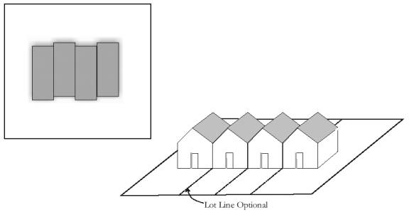
Townhouse Residential
5. Multiple-family
residential
The use of a
site for three or more dwelling units within one building not otherwise defined
as townhouse units.
Restaurant
shall mean a public eating establishment at which the primary function is the
preparation and serving of food primarily to persons seated within the
building.
Restaurant,
drive-in shall mean an establishment which has the facilities to serve
prepared food and/or beverages to customers seated within motor vehicles for
consumption either on or off the premises.
Restaurant,
fast food shall mean an establishment whose principal business is the
sale of food and/or beverages in ready-to-consume individual servings, for
consumption either within the establishment, for carry out or drive-in and
where foods and/or beverages are usually served in paper, plastic or other
disposable containers.
Retail services shall mean sale
or rental with incidental service of commonly used goods and merchandise for
personal or household use but excludes those goods and merchandise classified
more specifically by these use type classifications. Typical uses include
department stores, apparel stores, furniture stores, or establishments
providing the following products or services: Household cleaning and
maintenance products; drugs, cards, stationery, notions, books, tobacco
products, cosmetics, and specialty items; flowers, plants, hobby materials,
toys, and handcrafted items; apparel jewelry, fabrics and like items; cameras,
photograph services, household electronic equipment, records, sporting
equipment, kitchen utensils, home furnishing and appliances, art supplies and
framing, arts and antiques, paint and wallpaper, hardware, carpeting and floor
covering; interior decorating services; office supplies; mail order or catalog
sales; bicycles; and automotive parts and accessories (excluding service and
installation). General Retail Services include:
1.
Limited retail services: Establishments providing retail services,
occupying facilities of 10,000 square feet or less. Typical establishments
provide for specialty retailing or retailing oriented to Norfolk and its
surrounding vicinity.
2.
Medium retail services: Establishments providing retail services,
occupying facilities between 10,000 and 40,000 square feet in a single
establishment or multi-tenant facility. Typical establishments provide for
specialty retailing or general purpose retailing oriented to Norfolk and its
surrounding vicinity.
3. Mass retail services: Establishments providing
retail services, occupying facilities over 40,000 square feet in a single
establishment or multi-tenant facility. Typical establishments provide for
general purpose retailing oriented to Norfolk and the surrounding region.
Retirement
residential shall mean a building or group
of buildings which provide residential facilities for more than four residents
of at least sixty years of age, or households headed by a householder of at
least sixty-two years of age. A retirement residence may provide a range
of residential building types and may also provide support services to
residents, including but not limited to food service, general health
supervision, medication services, housekeeping services, personal services,
recreation facilities, and transportation services. The retirement
residence may accommodate food preparation in independent units or meal service
in one or more common areas. Retirement residences may include additional
health care supervision or nursing care.
Rezoning
shall mean an amendment to or change in the zoning ordinance either to the text
or map or both.
Rezoning,
piecemeal shall mean the zoning reclassification of individual lots
resulting in uncertainty in the future compatible development of the area.
Riding
stable (see Stable, riding)
Right-of-way
shall mean an area or strip of land, either public or private, on which an
irrevocable right of passage has been dedicated, recorded, or otherwise legally
established for the use of vehicles or pedestrians or both.
Road,
private shall mean a way, other than driveways, open to vehicular
ingress and egress established for the benefit of certain, adjacent
properties. (also see Right-of-way and Street)
Road,
public shall mean all public right-of-way reserved or dedicated for
street traffic. (also see Right-of-way and Street)
Roadside
stand shall mean a temporary structure or vehicle used solely for the
sale of farm products produced on the premises or adjoining premises.
Roof sign
(see Sign, roof)
Rooming
house (see Boarding/Rooming house)
Salvage
yard (see Junkyard)
Satellite
dish antenna shall mean a round, parabolic antenna incorporating a
reflective surface that is solid, open mesh, or bar configured and is in the
shape of a shallow dish, or cone and used to transmit and/or receive radio or
electromagnetic waves.
Scenic
easement shall mean an easement for the purpose of limiting land
development in order to preserve a view or scenic area.
School
shall mean a facility that provides a curriculum of elementary or secondary
academic instruction, including kindergartens, elementary schools, junior high
or middle schools, and high schools.
School,
private shall mean a facility that provides a curriculum of elementary
or secondary academic instruction, including kindergartens, elementary schools,
junior high or middle schools, and high schools operated by a nongovernmental
organization.
School,
trade shall mean an institution offering extensive instruction in the
technical, commercial, or trade skills and operated by a nongovernmental organization.
Screening
shall mean a method by which a view of one site from another adjacent site is
shielded, concealed, or hidden during all seasons of the year and may include
fences, walls, hedges, berms, or other features. (also see Buffer)
Self-service
station shall mean an establishment where motor fuels are stored and
dispensed into the fuel tanks of motor vehicles by persons other than the
service station attendant and may include facilities available for the sale of
other retail products.
Self-service
storage facility shall mean a building or group of buildings containing
individual, compartmentalized, and controlled access stalls or lockers for
storage.
Service
floor area shall mean the total floor area of a building, exclusive of
stairways, restrooms, storage rooms, hallways, or other areas which are not
regularly used by inhabitants, visitors, employees, clients, customers,
patients or patrons in their normal everyday use of the building.
Service
station shall mean buildings and premises where the primary use is the
supply and dispensing at retail of motor fuels, lubricants, batteries, tires,
and motor vehicle accessories and where light maintenance activities such as
engine tune-ups, lubrication, and washing may be conducted, but not including
heavy maintenance and repair such as engine overhauls, painting and body
repair. (also see Garage, repair)
Setback
shall mean the required minimum horizontal distance between the building or
structure and the related front, rear or side lot line. (also see
Building line and Yard)
Shelter
(see Emergency shelter mission)
Shopping
center shall mean a grouping of retail business and service uses on a
single site with common parking facilities.
Side lot
line (see Lot line, side)
Side yard
(see Yard, side)
Sidewalk
cafe shall mean an area adjacent to a street-level eating or drinking
establishment located adjacent to the public pedestrian walkway and used
exclusively for dining, drinking and pedestrian circulation. The area may
be separated from the public sidewalk by railings, fencing, or landscaping or a
combination thereof.
Sight
triangle shall mean an area at a street or road intersection in which
nothing shall be erected, placed, painted or allowed to grow in such a manner
as to materially impede vision of traffic at an intersection. See Sec.
27-290 of this Code.
Sign
shall mean any fabricated sign or outdoor display structure, including its
structure, consisting of any letter, figure, character, logo, mark, point,
plane, marquee sign, design, poster, pictorial, picture, stroke, strip, line,
trademark, reading matter illumination device, constructed, attached, erected,
fastened, manufactured or painted in any manner whatsoever so that the same
shall be used for the attraction of the public, performance, article, machine
or merchandise whatsoever, and displayed in any manner out of doors for
recognized advertising purposes, or any letter, figure, character, etc. as set
forth herein that is permanently painted on or adhered to any doors or windows
of building or structures. (also see Sign, billboard and Promotional
device)
Sign,
architectural canopy shall mean an enclosed, illuminated (backlit
awning) or non-illuminated structure that is attached to the wall of a building
with the face of the sign approximately parallel to the wall and with the
sign's copy area integrated into its surface.
Sign area
shall mean the entire area including the background of a sign on which copy can
be placed but not including the minimal supporting framework or bracing.
The area of individually painted letter signs, individual letter signs or
directly or indirectly illuminated individual letter signs, shall be calculated
on the basis of the smallest geometric figure that will enclose the entire copy
area of the sign. Any such calculation shall include the areas between
the letters and lines, as well as the areas of any devices, illuminated or
non-illuminated.
Sign,
awning, canopy or marquee (see Sign, architectural canopy)
Sign,
billboard shall mean a sign that identifies or communicates a
commercial or noncommercial message related to an activity conducted, a service
rendered, or a commodity sold at a location other than where the sign is
located.
Sign,
building shall mean any sign supported by, painted on or otherwise
attached to any building or structure.
Sign,
closed shall mean a sign in which more than fifty percent (50%)
of the entire area is solid or tightly closed or covered.
Sign, copy
area shall mean all lettering, wording, and accompanying designs,
symbols, logos, and trademarks on a sign area.
Sign,
destination shall mean a sign used to inform and direct the public to
important public places and buildings, landmarks and historical sites in the
most simple, direct and concise manner possible.
Sign,
directional shall mean a sign which provides directional assistance to
access an establishment conveniently and safely.
Sign,
electronic message board shall mean a sign that uses changing lights to
form a sign message or messages wherein the sequence of messages and the rate
of change is electronically programmed and can be modified by electronic
processes.
Sign,
flashing shall mean a sign, which, by method or manner of illumination,
flashes on or off, winks, or blinks with varying light intensity, shows motion,
or creates the illusion of being on or off.
Sign,
freestanding shall mean any sign supported by uprights or braces placed
on or in the ground, which is used principally for advertising or
identification purposes and is not supported by any building.
Sign,
illuminated shall mean a sign illuminated in any manner by an
artificial light source.
Sign, low
profile shall mean a sign mounted directly to the ground with a maximum
height not to exceed six (6) feet.
Sign,
message (see Sign, electronic message board)
Sign,
monument (see Sign, low profile)
Sign,
obsolete shall mean a sign that advertises a business no longer in
existence or a product no longer offered for sale and has advertised such
business or product for a period of six (6) months after the termination of the
existence of such business or the termination of sale of the product
advertised.
Sign, open
shall mean a sign attached to or hung from a marquee, canopy or other covered
structure, projecting from and supported by the building and extending beyond
the building wall, building line or street lot line.
Sign,
portable shall mean a sign, usually of a temporary nature, not securely
anchored to the ground or to a building or structure and which obtains some or
all of its structural stability with respect to wind or other normally applied
forces by means of its geometry or character.
Sign,
projecting shall mean a display sign which is attached directly to the
building wall, and which extends more than fifteen (15) inches from the face of
the wall.
Sign, roof
shall mean a sign which is erected, constructed and maintained above the roof
of the building.
Sign
setback shall mean the horizontal distance from the property line to
the nearest projection of the existing or proposed sign.
Sign,
subdivision identification shall mean a sign erected on a subdivision
identification lot which identifies the platted subdivision where the sign is
located.
Sign,
temporary shall mean a sign constructed of cloth, fabric or other
material with or without a structural frame intended for a limited period of
display, including displays for holidays or public demonstrations.
Temporary signs shall include portable signs as defined in this section.
Sign, wall
shall mean a sign which is painted on or is directly attached to a fence or on
the surface of masonry, concrete, frame or other approved building walls, and
which extends not more than fifteen (15) inches from the face of the fence or
wall.
Sign,
window shall mean a sign painted, stenciled, or affixed on a window,
which is visible from a right-of-way.
Similar
use shall mean the use of land, building or buildings, or structures of
like kind or general nature with other uses within a zoning district as related
to bulk, intensity of use, traffic generation and congestion, function, public
services requirements, aesthetics or other similarities.
Single-family
residential (see Residential uses)
Site plan
shall mean a plan, prepared to scale, showing accurately and with complete
dimensioning, the boundaries of a site and the location of all buildings,
structures, uses, drives, parking, drainage, landscape features, and other
principal site development improvements for a specific parcel of land.
Site,
septic shall mean the area bounded by the dimensions required for the
proper location of the septic tank system.
Slope
(see Grade)
Spot
zoning shall mean an arbitrary zoning or rezoning of a small tract of
land, usually surrounded by other uses or zoning categories that are of a
markedly or substantially different intensity, that is not consistent with the
comprehensive land use plan and that primarily promotes the private interest of
the owner rather than the general welfare.
Stable,
private shall mean an accessory building or use of land to an existing
residential use, that shelters or confines horses for the exclusive use of the
occupants of the premises.
Stable,
public shall mean a building or land where horses are kept for
commercial purposes including boarding, hire, sale, riding, or show.
Stable,
riding shall mean a structure in which horses or ponies, used
exclusively for pleasure riding or driving, are housed, boarded, or kept for
remuneration, hire or sale.
Standard
system shall mean a sewage treatment system employing a building sewer,
septic tank, and a standard soil absorption system.
State
shall mean the State of Nebraska.
Storage
shall mean the keeping, in a roofed or unroofed area, of any goods, junk,
material, merchandise, or vehicles on the same tract or premises for more than
thirty (30) days.
Story
shall mean that part of a building included between the surface of a floor and
the upper surface of the floor or roof next above.
Street
shall mean a public or private thoroughfare used, or intended to be used, for
passage or travel by motor vehicles.
Street,
arterial shall mean a street designed with the primary function of
efficient movement of through traffic between and around areas of the city with
controlled access to abutting property. All section line roads are
considered arterial streets unless otherwise designated.
Street,
collector shall mean a street designed to provide for the efficient
movement between local streets and arterial streets allowing direct access to
abutting properties.
Street, cul-de-sac (see Cul-de-sac)
Street,
curvilinear shall mean local streets which deviate from straight
alignment and change direction without sharp corners or bend
Street
line shall mean a dividing line between a lot, tract, or parcel of land
and the contiguous street.
Street,
local shall mean a street designed for local traffic which provides
direct access to abutting residential, commercial or industrial properties.
Street,
looped shall mean a continuous local street without intersecting streets
and having its two (2) outlets connected to the same street.
Street,
private shall mean an open, unoccupied space, other than a street or
alley dedicated to the public, but permanently established as the principal
means of vehicular access to abutting properties. The term "private
street" includes the term "place".
Structural
alteration shall mean any alteration involving a change in or addition
to the supporting members of a building, structure, or sign such as bearing
walls, columns, beams, girders or poles.
Structure
shall mean anything constructed or erected which requires permanent location on
the ground or which is attached to something having permanent location on the
ground, but not including driveways, sidewalks or other surfacing, or public
items such as utility poles, street lights, and street signs, or minor
landscape features such as bird fountains, clotheslines, landscape lighting,
and sculptures.
Subdivision
shall mean the division of land, lot, tract, or parcel into two or more lots,
parcels, plats, or sites, or other divisions of land for the purpose of sale,
lease, offer, or development, whether immediate or future. The term shall
also include the division of residential, commercial, industrial, agricultural,
or other land whether by deed, metes and bounds description, lease, map, plat,
or other instrument.
Subdivision
identification lot (see Lot, subdivision identification)
Subdivision
identification sign (see Sign, subdivision identification)
Supermarket
(see Food sales)
Surface
water class A - primary contact recreation shall mean surface waters
which are used, or have a high potential to be used, for primary contact
recreational activities. Primary contact recreation includes activities
where the body may come into prolonged or intimate contact with the water, such
that water may be accidentally ingested and sensitive body organs (e.g., eyes,
ears, nose, etc.) may be exposed. Although the water may be accidentally
ingested, it is not intended to be used as a potable water supply unless
acceptable treatment is supplied. These waters may be used for swimming,
water skiing, canoeing, and similar activities.
Surface
waters shall mean all waters within the jurisdiction of this state,
including all streams, lakes, ponds, impounding reservoirs, marshes, wetlands,
watercourses, waterways, springs, canal systems, drainage systems, and all
other bodies or accumulations of water, natural or artificial, public or
private, situated wholly or partly within or bordering upon the state.
Tavern
(see Bar)
Temporary
sale (see Flea market)
Temporary
sign (see Sign, temporary)
Temporary
use shall mean a use intended for limited duration to be located in a
zoning district not permitting such use.
Through
lot (see Lot, through)
Tower
shall mean a structure situated on a site that is intended for transmitting or
receiving television, radio, or telephone communication. (also see
Antenna)
Townhouse
(see Residential uses)
Transitional
use shall mean a permitted use or structure that by nature or level and
scale of activity acts as a transition or buffer between two or more
incompatible uses.
Truck
repair shall mean the repair, including major mechanical and body work,
straightening of body parts, painting, welding or other work that may include
noise, glare, fumes, smoke, or other characteristics to an extent greater than
normally found in gasoline service stations, of trucks having a hauling
capacity of over one (1) ton and buses but excluding pickups and other vehicles
designed for the transport of under eight (8) passengers.
Truck
terminal shall mean a building or an area in which freight brought by
truck is assembled and/or stored for routing or reshipment, or in which semi
trailers, including tractor and/or trailer units and other trucks, are parked
or stored for a short time period.
Two-family
dwelling (see Residential uses)
Upzoning
shall mean a change in zoning classification of land to a more intensive or
less restrictive district such as from residential district to commercial
district or from a single-family residential district to a multiple-family
residential district.
Use,
accessory (see Accessory use)
Use, best
shall mean the recommended use or uses of land contained in an adopted
comprehensive plan. Such uses represent the best use of public
facilities, and promote health, safety and general welfare.
Use,
highest shall mean an appraisal or real estate market concept that
identifies the use of a specific tract of land that is most likely to produce
the greatest net return on investment.
Use,
principal shall mean the main use of land or structures, as
distinguished from an accessory use. (also see Building, principal)
Variance
shall mean a relief from or variation of the provisions of this chapter, other
than use regulations, as applied to a specific piece of property, as distinct
from rezoning.
Vehicle
shall mean every device in, upon, or by which any person or property is or may
be transported or drawn upon a highway, excepting devices moved solely by human
power or used exclusively upon stationary rails or tracks.
Vehicle,
motor (see Motor vehicle)
Wall sign
(see Sign, wall)
Warehouse
shall mean a building used primarily for the storage of goods and materials.
Warehouse
and distribution shall mean a use engaged in storage, wholesale, and
distribution of manufactured products, supplies, and equipment.
Warehouse,
personal storage (see Self-service storage facility)
Wastewater
lagoon shall mean a shallow body of water in which organic wastes are
decomposed by bacteria in the presence of free oxygen.
Water
Well shall mean any excavation that is drilled, cored, bored, washed,
driven, dug, jetted, or otherwise constructed for the purpose of exploring for
ground water, monitoring ground water, utilizing the geothermal properties of
the ground, obtaining hydrogeologic information, or extracting water from the
underground water reservoir. Water well includes any excavation made for
any purpose if groundwater flows into the excavation under natural pressure and
a pump or other device is placed in the excavation for the purpose of
withdrawing water from the excavation for irrigation (commonly called 'Pit'
wells). For such excavations, construction means placing a pump or other
device into the excavation for the purpose of withdrawing water for irrigation.
Water well does not include:
a)
any excavation made for obtaining or prospecting for oil or natural gas or for
inserting media to re-pressure oil or natural gas bearing formations regulated
by the Nebraska Oil and Gas Conservation Commission;
b)
any excavation that is used to inject fluid as defined in Nebraska Revised
Statutes § 81-1502 into the underground water reservoir; or
c)
any structure requiring a permit by the Department of Natural Resources used to
exercise surface water appropriation. [Neb. Rev. Stat. § 46-601.01(1)]
Waters of
the state shall mean all waters within the jurisdiction of this state,
including all streams, lakes, ponds, impounding reservoirs, marshes, wetlands,
watercourses, waterways, wells, springs, irrigation systems, drainage systems,
and all other bodies or accumulations of water surface or underground, material
or artificial, public or private, situated wholly within or bordering upon the
state.
Wetland
shall mean an area that is inundated or saturated by surface water or ground
water at a frequency and duration sufficient to support, and that, under normal
circumstances, does support, a prevalence of vegetation typically adapted for
life in saturated soil conditions, commonly know as hydrophytic vegetation.
Wholesale
establishment shall mean an establishment for the on-premises sales of
goods primarily to customers engaged in the business of reselling the goods.
Wholesale
trade shall mean a use primarily engaged in selling merchandise to
retailers; to industrial, commercial, institutional, farm or professional
business users; or to other wholesalers; or acting as agents or brokers in
buying merchandise for or selling merchandise to such persons or
companies. The principal types of establishments included are: merchant
wholesalers; sales branches and sales offices (but not retail stores)
maintained by manufacturing enterprises apart from their plants for the purpose
of marketing their products; agents, merchandise or commodity brokers, and
commission merchants; petroleum bulk storage, assemblers, buyers, and
associations engaged in cooperative marketing of farm products. The chief
functions of uses in wholesale trade are selling goods to trading
establishments, or to industrial, commercial, institutional, farm and
professional; and bringing buyer and seller together. In addition to
selling, functions frequently performed by wholesale establishments include
maintaining inventories of goods; extending credit; physically assembling, sorting
and grading goods in large lots, breaking bulk and redistribution in smaller
lots; delivery; refrigeration; and various types of promotion such as
advertising and label designing.
Yard
shall mean the required open space on a lot adjoining a lot line, containing
only landscaping or other uses as provided by this chapter.
Yard,
front shall mean a yard extending along the full width of a front lot
line between side lot lines and from the front lot line to the front building
line. There shall be a required front yard of each street side of a
corner lot and a double frontage lot. (also see Lot line, front and Lot,
corner)
Yard, rear
shall mean a yard extending across the full width of the rear lot line between
side lot lines and from the rear lot line to the rear building line. The
depth of the rear yard is measured at right angles to the rear line of the
lot. On corner lots, the required rear yard may be to the rear of either
street. On interior lots, the required rear yard shall be at the opposite
end of the lot from the front yard. On pointed or irregular lots, the
required rear yard shall be comprised of an area that begins at the rear point
of the lot and continues to an imaginary line parallel to and farthest from the
front lot line, not less than ten feet long and wholly within the lot.
Yard, side
shall mean a yard between the side lot line and the side building line lying
between the front yard and the rear yard.
Zero lot
line (see Lot line, zero)
Zoning
official shall mean the person or persons authorized and empowered by
the city to administer and enforce the requirements of this chapter.
Zoning official as used in this Code shall also include other staff designated
by the zoning official to perform any particular function.
Zoning
districts shall mean areas, as designated on the zoning district map,
within the city and within the extraterritorial jurisdiction for which
regulations governing the use of buildings, structures and premises, the height
of buildings and structures, size of yards, and the intensity of use are
uniform.
Source: Ord. No. 4170, § 1, 5-20-96; Ord. No.
4223, § 1, 11-18-96; Ord. No. 4603, § 1, 9-16-02; Ord. No. 5025, § 1,
8-18-08; Ord. No. 5145, § 1, 12-20-10
Sec.
27-3. Authority.
This chapter is
adopted pursuant to authority granted by the state.
Source: Ord. No. 4603, § 1, 9-16-02
Sec. 27-4. Purpose and intent.
These regulations are adopted with
the purpose and intent of promoting the health, safety, morals, convenience,
order, prosperity, and welfare of the present and future population of Norfolk
and its jurisdictional area, consistent with the guidelines established in the
Norfolk Comprehensive Plan.
These regulations are designed to
be consistent with purposes set forth in Section 19-903, R.R.S. 1943, as the
same may, from time to time, be amended, which include efforts to lessen
congestion in the streets; to secure safety from fire and other dangers; to
promote health and the general welfare; to provide adequate light and air; to
prevent overcrowding of land; to secure safety from flood; to avoid undue
concentration of population; to facilitate the adequate provision of
transportation, water, sewerage, schools, parks and other public requirements;
to protect the tax base; and, to secure economy in governmental expenditures;
among other purposes.
Source: Ord. No. 4603, § 1, 9-16-02
Sec. 27-5.
Jurisdiction.
This chapter shall apply to all
land, buildings and structures within the corporate limits of Norfolk and all
of the unincorporated area within two (2) miles of the nearest point of the
Norfolk corporate limits as set forth in Sec. 1-11 of this Code. Any
section or provision of this Code not completely set forth but referred to in
this chapter shall be incorporated by reference and considered as part of the
provisions of this chapter.
Source: Ord. No. 4603, § 1, 9-16-02
Sec. 27-6. Zoning
district map, boundaries.
(a) This chapter divides the
city and its extraterritorial jurisdiction into various zoning districts.
The boundaries of the zoning districts are shown on maps which are made a part
hereof by reference, and are designated as “City of Norfolk, Nebraska, Zoning
Map”. Other maps referenced in this chapter include, but are not limited
to, the “Floodway, Flood Boundary and Floodway Map,” “Flood Insurance Rate Map
(FIRM),” and “Norfolk Municipal Airport, Location Sketch and Zoning Map”.
These maps and all the notations, references and other information shown
thereon are also made a part of these regulations by reference and have the
same force and effect as if the maps and all the notations, references and other
information shown thereon were fully set forth or described herein. These
original official maps shall be located in and kept current in the office of
the zoning official.
(b) Where uncertainty exists
relative to the location of a district boundary on the maps referenced in this
section, the boundaries shall be construed as being either the center of
streams, streets, alleys, railroad rights-of-way, or vacated streets, alleys,
and rights-of-way, or along platted lot lines or the extensions thereof.
(c) In unsubdivided property
or in areas where the boundary may be questionable, the boundary shall be
determined by use of the scale of the map. In cases of disagreement, the
board of adjustment shall determine the location of the district boundary in
question.
Source: Ord. No. 4603, § 1, 9-16-02
Sec.
27-7. Annexation and exemptions.
All unincorporated territory which
may hereinafter become the jurisdiction of the city as a result of annexation or
addition shall immediately become classified in conformance with the zones noted
herein and shall remain so zoned until an amendment to the official zoning map
or this chapter shall place such land in a different zone or zones.
a. Equivalent
zones for property in Madison County:
|
Madison County Zone |
City of Norfolk Zone |
| AG1 (Intensive Agriculture) |
A (Agricultural) |
| AG2 (General Agriculture) |
A (Agricultural) |
| AT (Agricultural Transition) |
R-R (Rural Residential) |
| RR (Rural Residential - District) |
R-R (Rural Residential) |
| MH (Mobile Home - District) |
R-M (Mobile Home) |
| C3 (Highway Services District) |
C-3 (Service Commercial) |
| I (Industrial - District) |
I-1 (Light Industrial) |
| EC (Environmental Corridor) |
A (Agricultural) |
| MUD (Mixed Use Development) |
M-U (Mixed Use Special) |
Any
conditional use permit existing in an area which becomes subject to the zoning
jurisdiction of the city remains in force under the same terms and conditions as
it existed in the county zoning jurisdiction and shall be treated as a
conditional use permit under city code.
b. Equivalent
zones for property in Stanton County:
|
Stanton County Zone |
City of Norfolk Zone |
| A-1 (Agriculture Overlay) |
A (Agricultural) |
| A-2 (Agricultural - Transitional) |
A (Agricultural) |
| R-1 (Residential-Suburban)
lot size less than
12,000 sq. ft. |
R-1 (Single-Family Residential) |
| R-1 (Residential-Suburban)
lot size 12,000 or
more sq. ft. |
R-R (Rural Residential) |
| R-M (Mobile Home Residential) |
R-M (Mobile Home) |
| C-1 (Commercial) |
C-3 (Service Commercial) |
| I-1 (Light Industrial) |
I-1 (Light Industrial) |
| I-2 (General Industrial) |
I-2 (Heavy Industrial) |
| M-U-D (Mixed Use Development) |
M-U (Mixed Use Special) |
Any
conditional use permit existing in an area which becomes subject to the zoning
jurisdiction of the city remains in force under the same terms and conditions as
it existed in the county zoning jurisdiction and shall be treated as a
conditional use permit under city code.
Source: Ord. No. 4603, § 1, 9-16-02; Ord. No.
4951, § 1, 6-18-07
Sec.
27-8. Comprehensive plan relationship.
This chapter is designed to implement various
elements of the Norfolk Comprehensive Plan as required by state statutes.
Any amendment to the district regulations or map shall conform to the
comprehensive plan adopted by the city council.
Source: Ord. No. 4603, § 1, 9-16-02
Sec.
27-9. Compliance generally.
All requirements in this chapter
are mandatory unless stated otherwise or outlined in specific exceptions or
variances thereto. The following paragraphs are general requirements,
applicable throughout this chapter.
(1) No building or structure shall be erected, constructed, reconstructed, moved or
altered, nor shall any building, structure or land be used for any purpose
other than is permitted in the district in which such building, structure or
land is situated. If a use is not listed in a specific zoning district,
the land use matrix in Sec. 27-401 shall determine the zoning district in which
a particular use shall be allowed as a permitted use or a conditional use.
(2)
No building or structure shall be erected, constructed, reconstructed, moved or
altered to exceed the height or area limit or violate the yard or parking
requirement herein established for the district in which such building or
structure is located.
(3)
No lot area shall be reduced or diminished so that the yards or other open
spaces shall be smaller than prescribed by this chapter, nor shall the density
of population be increased in any manner, except in conformity with the area
regulations established herein.
(4)
Every building hereafter erected or altered shall be located on a lot as herein
defined and in no case shall there be more than one main building on one lot
within a zoning district except as provided herein.
(5)
Except as otherwise provided in this subsection, in all zoning districts, no alcoholic liquor, including beer and wine, shall be
sold, either on-sale, or off-sale, within one hundred fifty (150) feet of any
church, school, hospital, home for aged or indigent persons, home for veterans,
their wives or children, or a college or university campus; or within five
hundred (500) feet of any city park. The one hundred fifty (150) foot
requirement shall be measured from the nearest walls of the buildings in
question, and the five hundred (500) foot requirement shall be measured from
property line to property line. This subsection shall not apply to any
application for a one-day liquor license which may be applied for by a
charitable organization or nonprofit corporation. If a proposed location
for the sale at retail of any alcoholic liquor is within one hundred fifty (150)
feet of any church, the retail sale of alcoholic liquor shall be allowed if a
license is issued by the Nebraska Liquor Control Commission pursuant to Section
53-177 of the Nebraska Revised Statutes.
(6) The repair, restoring, remodeling, assembly, disassembly, storage or standing
of any inoperable vehicle other than in a district permitting and regulating
such occurrence is prohibited. Inoperable vehicles may be stored or may
stand only in a legally conforming auto wrecking yard, a fully enclosed private
garage, or in a fully enclosed storage structure as allowed by this
chapter.
Source: Ord. No. 4603, § 1, 9-16-02;
Ord. No. 5147, § 1,12-20-10
Sec. 27-10.
Interpretation.
In interpreting and applying the
provisions of this chapter, they shall be held to be the minimum requirements
for the promotion of the public safety, health, convenience, comfort, morals,
prosperity, and general welfare. It is not intended by this chapter to
interfere with or abrogate or annul any easements, covenants or other
agreements between parties, or any statute, ordinance or regulation, except
that if this chapter imposes a greater restriction or higher standard this
chapter shall control.
Source: Ord. No. 4603, § 1, 9-16-02
Sec. 27-11. Violation and
penalty.
The owner or agent of a building or
premises in or upon which a violation of any provision of this chapter has been
committed or shall exist, or the lessee or tenant of an entire building or
entire premises in or upon which a violation has been committed or shall exist,
or the agent, architect, building contractor or any other person who commits,
takes part or assists in any violation or who maintains any building or
premises in or upon which such violation shall exist, shall be guilty of a
misdemeanor and shall be punished by a fine not to exceed one hundred dollars
($100). Each and every day such violation continues after notice of
violation is given to the offender or offenders shall be considered a separate
offense.
In case any building or structure
is erected, constructed, reconstructed, altered, repaired, converted or
maintained, or any building, structure or land is used in violation of this
chapter, the appropriate authorities of the city in addition to other remedies,
may institute injunction, mandamus or other appropriate action or proceeding to
prevent such unlawful erection, construction, alteration, conversion,
maintenance or use, or to correct or abate such violation, or to prevent the
occupancy of the building, structure or land.
Source: Ord. No. 4603, § 1, 9-16-02
Sec. 27-12.
Validity.
If any section, subsection,
sentence, clause or phrase of this chapter is for any reason held to be
unconstitutional or invalid, such decision shall not affect the validity of the
remaining portions of this chapter.
Source: Ord. No. 4603, § 1, 9-16-02
Secs. 27-13--27-20.
Reserved.
ARTICLE II.
ADMINISTRATION AND ENFORCEMENT
Sec.
27-21. Responsibility; zoning official.
Except as otherwise provided, the
fire division and its zoning official shall be responsible for the enforcement
and administration of this chapter and shall be responsible to expeditiously
review and process all applications according to the provisions of this
chapter; conduct necessary surveys, investigations and field studies; keep
records; and shall prepare such reports, maps or other exhibits necessary in
the administration of this chapter.
Source: Ord. No. 4603, § 1, 9-16-02
Sec. 27-22.
Applications.
No building or other structure
shall be constructed, erected, moved or substantially altered prior to the
issuance of a permit. Applications for a permit shall be on forms
provided by the city. Applications for a conditional use permit and for
appeal to the board of adjustment shall be on forms provided by the city.
All permit applications may require supplementary information.
Source: Ord. No. 4603, § 1, 9-16-02
Sec.
27-23. Interpretation of chapter.
In the interpretation of this
chapter should it be found that any provisions herein are in conflict with any
other Code provisions or ordinance of the city, or any state or federal
statutes, the more restrictive regulation shall apply. The zoning
official may, subject to other provisions contained herein, render
interpretations of any provision of this chapter. The decision of the
zoning official may be appealed according to the provisions of this
chapter.
Source: Ord. No. 4603, § 1, 9-16-02
Sec.
27-24. Permits issued by others.
Any permit, license or certificate
for any use, building or structure issued which may be in conflict with the
provisions of this chapter shall be null and void as to those provisions which
may be in conflict.
Source: Ord. No. 4603, § 1, 9-16-02
Sec. 27-25.
Legal advice.
The city attorney or his or her
authorized delegate shall provide legal advice and representation concerning
the enforcement of this chapter.
Source: Ord. No. 4603, § 1, 9-16-02
Sec.
27-26. Procedure for classifying unlisted uses.
Because land uses are too numerous
to list within the text of district regulations, only those uses most commonly
found in the city are listed. For uses not listed, Sec. 27-401 of this
Code sets forth a land use matrix indicating additional land uses and the
zoning district in which they are allowed as a permitted use or a conditional
use. This matrix shall be interpreted to have the same force and effect
as if the uses had been listed within the zoning district. Uses not
listed under the district regulations or in the land use matrix may be placed
in a suitable district classification by the zoning official after considering
the zoning classification of the other similar or related uses.
Source: Ord. No. 4603, § 1, 9-16-02
Sec.
27-27. Permits and certificate of zoning compliance.
(a) The code official or his
or her designee shall receive application and issue permits for the erection
and alteration of buildings, structures or signs.
(b) No person shall
construct, erect, enlarge, structurally alter or demolish a building, structure
or sign without first obtaining a building permit, which permit shall include
notice of zoning compliance.
(c) Every
person making application for a building/zoning permit shall complete an
application form furnished and approved by the fire division. Such
application shall contain location, type of improvement, proposed use, cost of
improvement, a site or plot plan and notice of zoning compliance. Any and
all requirements of the city Code shall be met, or waived where applicable,
prior to the issuance of any building/zoning permit.
Source: Ord. No. 4603, § 1, 9-16-02
Sec. 27-28. Fees.
Except as otherwise provided,
building/zoning permits shall be issued pursuant to the same terms and fee
schedule as provided in Sec. 6-18 of this Code.
Source: Ord. No. 4603, § 1, 9-16-02
Secs. 27-29--27-30. Reserved.
ARTICLE III. BOARD OF
ADJUSTMENT
Sec.
27-31. Appeals and variances.
Appeals and requests for variances
from the provisions of this chapter shall be taken and decided as follows.
(1)
Board of adjustment. Appeals to the board of adjustment may be
taken by any person aggrieved or by any officer, department, board or bureau of
the city affected by any decision of the zoning official. Such appeal
shall be taken within thirty (30) days of the decision of said officer,
department, board or bureau, by filing with the officer from whom the appeal is
taken and with the board of adjustment, a notice of appeal specifying the
grounds thereof. The officer from whom the appeal is taken shall
forthwith transmit to the board all the papers constituting the record upon
which the action appealed from was taken. An appeal stays all proceedings
in furtherance of the action appealed from, unless the officer from whom the
appeal is taken certifies to the board of adjustment, after the notice of appeal
shall have been filed with him or her, that by reason of facts stated in the
certificate a stay would, in his or her opinion, cause imminent peril to life
or property. In such case, proceedings shall not be stayed otherwise than
by a restraining order which may be granted by the board of adjustment or by a
court of record on application after notice to the officer from whom the appeal
is taken and on due cause shown. The board of adjustment shall fix a
reasonable time for the hearing of the appeal, give public notice thereof, as
well as due notice to the parties in interest, and decide the same within a
reasonable time. Upon the hearing, any party may appear in person or by
agent or by attorney.
(2)
Powers, jurisdiction, variance, when permitted. The board of
adjustment shall, subject to such appropriate conditions and safeguards as may
be established by the mayor and city council, have only the following powers:
a.
Errors: To hear and decide appeals where it is alleged there is
error in any order, requirement, decision or determination made by an
administrative official or agency based on or made in the enforcement of any
zoning regulation or any regulation relating to the location or soundness of
structures;
b.
Interpretation of regulations or map: To hear and decide, in
accordance with the provisions of any zoning regulation, requests for the
interpretation of any map;
c.
Variance of requirements: Where one or more of the following
conditions exist, the board may authorize a variance if it makes specific
findings that by reason of:
1.
Exceptional narrowness of a specific piece of property; or
2.
Shallowness, or shape of a specific piece of property at the time of the
enactment of the zoning regulations; or
3.
Exceptional topographic conditions or other extraordinary and exceptional
situation or condition of such piece of property.
The strict application of any
enacted regulation under this chapter would result in peculiar and exceptional practical
difficulties to, or exceptional and undue hardships upon, the owner of such
property. Upon an appeal relating to the property, a variance from such
strict application may be granted so as to relieve such difficulties or
hardship, if such relief may be granted without substantial detriment to the
public good and without substantially impairing the intent and purpose of any
ordinance or resolution.
The board shall, by resolution,
set out findings of fact based on evidence and testimony that the following
conditions exist or would result:
1.
The strict application of the zoning regulation would produce undue hardship;
2.
Such hardship is not shared generally by other properties in the same zoning
district and the same vicinity;
3.
The authorization of such variance will not be of substantial detriment to
adjacent property and the character of the district will not be changed by the
granting of the variance; and
4.
The granting of such variance is based upon reason of demonstrable and
exceptional hardship as distinguished from variations for purposes of
convenience, profit or caprice.
Under no circumstance shall the
board grant a variance if the condition or situation of the property concerned
or the intended use of the property is not of so general or recurring a nature
as to make reasonably practicable the formulation of a general regulation to be
adopted as an amendment to the zoning regulations.
In exercising the above-mentioned
powers such board may, in conformity with the provisions hereof, reverse or
affirm, wholly or partly, or may modify the order, requirement, decision or
determination appealed from, and may make such order, requirement, decision or
determination as ought to be made, and to that end shall have all the powers of
the officer from whom the appeal is taken. The concurring vote of four
(4) members of the board shall be necessary to reverse any order, requirement,
decision or determination of any such administrative official, or to decide in
favor of the applicant on any matter upon which it is required to pass under
any such regulation or to effect any variation in such regulation.
(3)
Fee: A fee as set forth in
Section 2-5 of this Code shall accompany each
application of appeal to the board of adjustment and the applicant shall also
pay all publication costs necessitated by the filing of said application.
Source: Ord. No. 4603, § 1,
9-16-02; Ord. No. 4868, § 4, 1-17-06; Ord. No. 5135,
§ 18, 9-7-10
Sec.
27-32. Board of Adjustment Membership and Term.
(a) The board
of adjustment shall consist of five regular members, plus one additional member
designated as an alternate who shall attend and serve only when one of the
regular members is unable to attend for any reason, each to be appointed for a
term of three years and removable for cause by the mayor as appointing authority
upon written charges and after public hearings. Vacancies shall be filled
for the unexpired term of any member whose term becomes vacant. One member
only of the board of adjustment shall be appointed from the membership of the
planning commission, and the loss of membership on the planning commission by
such member shall also result in his or her immediate loss of membership on the
board of adjustment and appointment of another planning commissioner to the
board of adjustment. One position on the board of adjustment shall be
filled by the appointment of a person who resides in the extraterritorial
zoning jurisdiction of the city. The board of adjustment shall adopt
rules in accordance with the provisions of any ordinance adopted pursuant to
sections 19-901 to 19-914 of the Nebraska Revised Statutes. Meetings of
the board shall be held at the call of the chairperson and at such other times
as the board may determine. Such chairperson, or in his or her absence the
acting chairperson, may administer oaths and compel the attendance of
witnesses. All meetings of the board shall be open to the public.
The board shall keep minutes of its proceedings, showing the vote of each member
upon each question, or, if absent or failing to vote, indicating such fact, and
shall keep records of its examinations and other official actions, all of which
shall be immediately filed in the office of the board and shall be a public
record.
(b) The term of
each regular member and the alternate member shall be three years, except that
two members of the first commission to be so appointed after July 1, 2005, shall
serve for terms of one year, two for terms of two years, and two for terms of
three years. All regular and alternate members shall hold office until
their successors are appointed.
Source: Ord. No. 4822, § 1, 8-1-05
Secs. 27-33--27-35. Reserved.
ARTICLE
IV. AMENDMENTS
Sec.
27-36. Authority to amend.
Whenever the public necessity,
health, safety or general welfare requires, the city council may by ordinance,
following report from the planning commission and subject to the procedures
herein and conformity to the comprehensive plan, amend the provisions of this
chapter or the zoning district map.
Source: Ord. No. 4603, § 1, 9-16-02
Sec.
27-37. Authority to initiate amendments.
(a) Amendments to the
provisions of this chapter, may be initiated by action of the city council,
planning commission, application from an owner of the property affected by the
provisions or any other interested person.
(b) Amendment to the zoning
district map may be initiated by action of the city council, planning
commission or by any person who owns the land sought to be rezoned or the
person's duly authorized agent.
Source: Ord. No. 4603, § 1, 9-16-02
Sec.
27-38. Applications for amendments.
(a) All applications for
amendments to either the zoning district map or the provisions of this chapter
shall be made upon forms prescribed by the planning commission and duly filed
with the secretary of the planning commission.
(b) An initial fee as set forth in
Section 2-5 of this Code shall accompany each application for amendment to the
zoning district map or provisions of this chapter. Immediately upon
receipt of such application and filing fee, the secretary of the planning
commission shall note thereon the date of filing, and make a permanent record
thereof. In addition to the initial fee, the applicant shall provide
proof of ownership of the property and shall also pay all publication costs
necessitated by the filing of said application.
(c) All such applications
shall be set for public hearing before the planning commission no later than
the third regular meeting of the commission from the date of filing same.
Any such hearing may, for good cause, at the request of the applicant or at the
request of the planning commission, be continued. Notice of any such
hearing for an amendment, revision or change in the zoning district map or
provisions of this chapter shall be given as provided in Sections 19-904 and
19-905, R.R.S. 1943, as the same may, from time to time, be amended.
(d) Upon final hearing of
such application before the planning commission, the commission shall make a
recommendation for final approval or denial to the city council.
(e) Before acting upon any
application for amendment, the council shall set a time and place for a hearing
thereon. Notice of any such hearing for an amendment, revision or change
of the zoning district map or provisions of this chapter shall be given as
provided in Sections 19-904 and 19-905, R.R.S. 1943, as the same may, from time
to time, be amended.
(f) No person may apply for
amendment, revision or change of the zoning district map or a conditional use
permit within a period of six (6) months following the denial thereof by the
city council of an application involving the same real property or any part
thereof.
Source: Ord. No. 4603, § 1, 9-16-02; Ord. No.
4868, § 5, 1-17-06; Ord. No. 5135,
§ 18, 9-7-10
Sec.
27-39. Amendments to flood plain overlay district.
The regulations, restrictions, and
boundaries set forth in Secs. 27-241 through 27-260 of this chapter relating to
development activity in flood plains, may be amended, supplemented, changed, or
appealed to reflect any and all changes in the National Flood Disaster
Protection Act of 1973, provided, however, that no such action may be taken
until after a public hearing on the same, at which parties in interest and
citizens shall have opportunity to be heard. At least 15 days notice of
the time and place of such hearing shall be published in newspaper of general
circulation in the City of Norfolk. Secs. 27-241 through 27-260 of this
chapter are in compliance with the National Flood Insurance Program Regulations
as published in the Federal Register, Volume 41, Number 207, dated October 26,
1976, and the 1967 Nebraska Flood Plains Regulations Act.
Source: Ord. No. 4603, § 1, 9-16-02
Sec.
27-40. Amendments to planned development overlay district.
The planned development overlay
district (P-D) ordinance or an approved preliminary or final development plan
may be amended in the same manner prescribed for original approval.
Application for amendment may be made by the homeowner's association or
fifty-one percent (51%) of the owners of the property within the planned
development.
Source: Ord. No. 4603, § 1, 9-16-02
Sec.
27-41. Amendments to wellhead protection overlay district.
The regulations, restrictions,
and boundaries set forth in Secs. 27-271 through 27-280 of this chapter relating
to development activity and land usage in the wellhead protection overlay
district, may be amended, supplemented, changed, or appealed to reflect any and
all changes in the Wellhead Protection Area Act (Neb. Rev. Stat. 46-1501 through
46-1509), provided, however, that no such action may be taken until after a
public hearing on the same, at which parties in interest and citizens shall have
opportunity to be heard. The portion of the city's previously delineated
wellhead protection area which shall be subject to the wellhead protection
overlay district regulations shall be approved by Resolution of the city.
Source: Ord. No. § 2, 8-18-08
Secs.
27-42--27-45. Reserved.
ARTICLE V.
NONCONFORMING USES AND STRUCTURES
Sec. 27-46.
Open storage.
The use of a lot of record for
storage purposes or advertisement signs, and which contains no buildings, and
which use for storage or signs is not permitted by this chapter or by an
amendment thereto, shall be discontinued within one (1) year of the effective
date of this chapter or any amendment thereto.
Where land within any residential
zoning district contains no main buildings as distinguished from accessory
buildings and fences, and where said land was used solely for open storage at
the time of the effective date of an amendment to this chapter, use of such
land for open storage shall be discontinued within two (2) years.
Where land is used for a
nonconforming or nonstandard use and where such land contains a main building
or structure in addition to open storage, said open storage shall be brought
into conformance with the area, front yard, side yard, rear yard, height,
unobstructed open space, and parking requirements for the district in which it
is located within a period of one (1) year from the effective date of an
amendment to this chapter.
Source: Ord. No. 4603, § 1, 9-16-02
Sec.
27-47. Continuation of nonconforming use.
Subject to the provisions of this
chapter, the lawful use of a building structure or premises existing at the
time of the effective date of this chapter may continue although such use does
not conform to the provisions hereof. If no structural alterations are
made, a nonconforming use may be changed to another nonconforming use of the
same classification or a use permitted in a less intensive district. For
the purpose of this section, “R-1" shall be the least intensive district
and “I-2" the most intensive district.
(1)
Whenever a nonconforming use has been changed to a use in a less intensive
district or to a conforming use, such use shall not thereafter be changed to a
use allowed in a more intensive district.
(2)
A nonconforming use not involving a building may be continued even though such
use does not conform to the provisions hereof as long as the use is not
enlarged in area, number or volume.
(3)
Buildings or structures containing nonconforming uses shall not be enlarged.
(4)
No structural alterations shall be allowed to buildings or structures
containing nonconforming uses except those necessary to comply with state or
local health, sanitary or safety code specifications which are solely necessary
to insure safe living or operating conditions.
Source: Ord. No. 4603, § 1, 9-16-02
Sec.
27-48. Continuation of nonstandard use.
(a) Nonstandard uses lawfully
existing at the time of the effective date of this chapter may be continued,
although such uses do not conform to the provisions hereof.
(b) Nonstandard structures
and buildings may be enlarged, extended, or reconstructed, as follows:
(1)
Enlargement, extension, or reconstruction may be made as required by law or
ordinance or ordered by the zoning official or his or her designee to secure
the safety of the structure.
(2)
Enlargement, extension, or reconstruction of buildings or structures may be
made when such changes conform to front yard, side yard, rear yard, height, and
unobstructed open spaces for the district in which they are located.
(3)
Enlargement, extension, or reconstruction of buildings or structures may
otherwise be made if such changes maintain the existing side yard, front yard,
and rear yard setback lines of the building or structure, and do not result in
a building or structure line that is closer to the property line than that
which existed prior to the enlargement, extension, or reconstruction and does
not result in creating an obstruction to vision which violates Sec. 27-290 of
this Code.
Source: Ord. No. 4603, § 1, 9-16-02
Sec.
27-49. Use becoming nonconforming by changes in law or boundaries.
Whenever the use of a building
structure or premises becomes a nonconforming use through a change in the
zoning regulations or district boundaries, such use may be continued and if no
structural alterations are made, it may be changed to another nonconforming use
in the same zoning district or a use in a less intensive district, “R-1” being
less intensive and “I-2” being a more intensive district, subject to the
provisions of this chapter. Whenever a nonconforming use has been changed
to a use in a less intensive district or to a conforming use, such use shall
not thereafter be changed to a more intensive nonconforming use.
Source: Ord. No. 4603, § 1, 9-16-02
Sec.
27-50. Cessation of use.
In the event that a nonconforming
use is discontinued, or its normal operation stopped, for a period of one year,
the use of the same shall thereafter conform to the uses permitted in the
district in which it is located.
Source: Ord. No. 4603, § 1, 9-16-02
Sec.
27-51. Completion and restoration of buildings.
Nothing herein contained shall
require any change in the plans, construction or designation of a building, the
foundation for which has been completely constructed on or before the effective
date as defined in Sec. 27-2, and the remaining construction of which shall
have been completed within one year after such date. In addition, any
commercial or industrial building or structure, for which a permit has been
approved not more than twelve (12) months prior to becoming nonconforming or
nonstandard as a result of an amendment to this chapter, may be constructed
according to the terms of that permit.
When a nonconforming building or
structure is damaged by a fire, explosion, act of God or the public enemy, or
allowed to deteriorate to the extent that more than fifty percent (50%) of the
floor area requires reconstruction or to the extent of more than fifty percent
(50%) of its replacement cost at the time of the damage or destruction, the
nonconforming building or structure shall not be restored except in conformance
with the regulations of the district in which the building is located.
Source: Ord. No. 4603, § 1, 9-16-02
Secs. 27-52--27-55. Reserved.
ARTICLE
VI. CONDITIONAL USE AND SITE PLAN APPROVALS
Sec.
27-56. Conditional uses, procedures and standards.
For the purpose of providing the
most appropriate use of land throughout a district and giving a maximum
consideration to the character of the district and its peculiar suitability for
particular uses in the areas affected by this Code, permitted uses and
conditional uses are provided for in the various district regulations of this
Code.
(1)
Permitted uses. Permitted uses are those uses permitted outright
in the district.
(2)
Conditional uses. Conditional uses are those that would not be
appropriate generally throughout the zoning district without restrictions, but
which, if controlled as to number, area, location, size or relation to the
district and would protect the public health, safety, welfare, morals, order,
comfort, convenience, appearance, prosperity or general welfare of abutting
properties, citizens and the city.
a.
Procedure. After receiving an application accompanied by a fee as
set forth in Section 2-5
of this Code plus publication costs, and after a public
hearing, the planning commission may authorize a conditional use permitted in a
zoning district, provided it is found that the location and characteristics of
the use will not be injurious to the health, safety, morals and general welfare
of the area. An application for a conditional use permit shall include a
site plan which plan shall denote the location of any hazardous
materials. Notice for such hearings shall be given in the manner provided
in Sections 19-904 and 19-905, R.R.S. 1943, as the same may, from time to time,
be amended.
b.
Standards. The conditional uses shall conform to the intent and
purpose of these regulations, the comprehensive plan and the following
requirements:
1.
The use shall in all other respects conform to the applicable regulations of
the district in which it is located.
2.
Ingress and egress shall be so designed as to minimize congestion in the public
street, road or highway.
3. The planning commission (and the city council in the event of appeal)
shall review and approve the conditional use permit based on the criteria set
forth in Sec. 27-58 and conformance with applicable regulations in these zoning
regulations. The planning commission may stipulate and require such
conditions and restrictions upon the conditional use and operation as is deemed
necessary for the protection of the public interest and to secure compliance
with these regulations. All decisions of the planning commission may be
appealed to the city council, by any person aggrieved by the decision of the
planning commission, or any taxpayer, officer, department, board, or bureau of
the city. Such appeal must be presented to the city clerk within fifteen
(15) days after the decision is made by the planning commission. In the
event of an appeal, the city council shall hold a public hearing and after
doing so, the city council may reverse, affirm or modify the decision of the
planning commission. Before either the planning commission or the city
council shall act on the conditional use, all publication fees necessitated by
the filing of the application for conditional use shall be paid in full by the
applicant.
4. The planning commission may, at its discretion, apply a conditional use
permit to a specific owner or applicant or allow such permit to run with the
land.
c.
If an approved conditional use is not begun within a period of 12 months
following approval, the conditional use permit shall become null and void.
d.
Failure to observe and maintain the conditions and restrictions of the
conditional use permit shall be considered a violation of this chapter subject
to penalty as provided herein and shall be grounds for review of the conditional
use permit. Review of a conditional use permit may be requested by the
zoning official, the planning commission or by the city council. In the
event of the review of a conditional use permit as provided herein, a public
hearing shall be held by the planning commission. Notice for such hearing
shall be given in the manner provided for in Sections 19-904 and 19-905, R.R.S.
1943, as the same may, from time to time, be amended. Following said
hearing, the planning commission may leave the conditional use permit
unaltered, revoke the permit, or alter the permit by adding, deleting or
modifying the conditions and restrictions contained in the permit. Any
decision of the planning commission regarding the review of a conditional use
permit pursuant to this subsection may be appealed to the city council by any
person aggrieved by the decision of the planning commission, or any taxpayer,
officer, department, board, or bureau of the city. Such appeal must be
presented to the city clerk within fifteen (15) days after the decision is made
by the planning commission. In the event of an appeal, the city council
shall hold a public hearing and after doing so, the city council may reverse,
affirm or modify the decision of the planning commission. Publication costs
incurred in the review of a conditional use permit shall be borne by the city.
e.
If conditional use permits are issued pursuant to this chapter as a personal
privilege granted to the applicant, the permit shall not be subject to
transfer, voluntarily or involuntarily except that the personal representative
of the estate of any deceased holder of a conditional use permit, or a
partnership or limited liability company upon the death of one or more of the
partners or members, may continue to exercise the privileges of the deceased or
deceased partner or member of the death of such decedent until the expiration
of such conditional use permit; or when a conditional use permit is issued to a
husband and wife owning property as joint tenants with rights of survivorship,
upon the death of one spouse, the survivor may exercise all rights and
privileges under such permit in his or her own name. The trustee of any
insolvent or bankrupt permittee, may continue to exercise the privileges of the
insolvent or bankrupt permittee.
f.
The city clerk shall forward to the register of deeds for recording an
affidavit or such other instrument as may be deemed appropriate so as to
provide notice to any person examining the real estate records of the existence
of any conditional use permit and the conditions or restrictions contained in
such permit. The recording costs incurred to comply with this section
shall be paid by the applicant for the conditional use permit.
Source: Ord. No.
4603, § 1, 9-16-02; Ord. No. 4868, § 6, 1-17-06; Ord. No. 5135,
§ 18, 9-7-10
Sec. 27-57.
Site plan review procedure
The city’s normal plan review procedures for all building permit applications
include routine review of site plans for compliance with zoning requirements,
such as setbacks, height limitations, and other development regulations.
The site plan review procedure established by this section provides for further
administrative action and appeal in addition to plan review required by other
sections of this Code of projects that have potentially significant effects on
traffic circulation or a significant effect on land uses in adjacent
neighborhoods. The procedure provides for review and evaluation of site
development features and possible mitigation of unfavorable effects on
surrounding property.
(a) Administration. The zoning official, or his or her
designee shall review, evaluate, and act on all site plans submitted pursuant
to this procedure. An applicant may appeal a denial of any application to
the board of adjustment.
(b) Uses requiring site plan review. The following
selected uses shall follow the site plan review procedure, unless otherwise
subject to a conditional use permit procedure for specific zoning districts.
(1)
Multiple-family developments with 12 or more dwelling
units.
(2)
Education facilities, places of religious
assembly, recreation centers, and other places of general public assembly or
any industrial use with a gross floor area over 20,000 square feet.
(3) All office or commercial uses or projects with a
gross floor area over 10,000 square feet.
(4)
Any use including drive-in services or
operation.
(5)
Any industrial use adjacent to a residential
district.
(c) Application requirements. An application for a site plan
review may be filed by the owner(s) of a property or the owners' authorized
agent with the zoning official. The application shall include the
following information:
(1)
Name and address of the applicant.
(2)
Owner, address, and legal description of the property.
(3)
A description of the nature and operating characteristics of the proposed use.
(4)
A site plan, drawn to a scale sufficient to permit adequate review and
dimensioned as necessary, showing the following information:
a.
The date, scale, north point,
project title, name of owner, and name of person preparing the site plan.
b.
The location and dimensions of boundary
lines, easements, and required yards and setbacks of existing and proposed
buildings and site improvements.
c.
The location, size, and use of
proposed and existing structures on the site.
d.
The location of all proposed site
improvements, including parking and loading areas, pedestrian and vehicular access,
sewers, sidewalks, utilities, service areas, fencing, screening, landscaping,
and lighting.
e.
Location of any major site feature,
including drainage and contours at no greater than five foot intervals.
f.
Any other information that may
be required for review by the zoning official, or his or her designee.
(d) Administrative Action and Appeal. The zoning
official or his or her designee must act upon each complete application within
thirty working days of filing. An applicant may appeal a denial to the
board of adjustment within thirty days of the action. The board of
adjustment shall consider the appeal at the first available meeting after the
filing of the appeal.
(e) Review and Evaluation.
(1)
The zoning official, or his or her designee (or the board of adjustment in
cases of appeal), shall review and approve the site plan based on the criteria
established in Sec. 27-58 and conformance with applicable regulations in these
zoning regulations.
(2)
The zoning official, or his or her designee (or the board of adjustment in
cases of appeal), shall make the following findings before approval of the site
plan:
a)
The proposed development, together with any
necessary modifications, is compatible with the criteria established in Sec.
27-58.
b)
Any required modifications to the site plan are
reasonable and are the minimum necessary to minimize potentially unfavorable
effects.
c) The site plan conforms to the zoning regulations.
(f) Modification of Site Plan. The zoning official, or
his or her designee (or the board of adjustment in cases of appeal), may
require modification of a site plan as a prerequisite for approval.
Required modifications may be more restrictive than base district regulations
and may include, but not be limited to, additional landscaping or screening;
installation of erosion control measures; improvement of access or circulation;
rearrangement of structures on the site; or other modifications deemed
necessary to protect the public health, safety, welfare, community character,
property values or aesthetics.
(g) Term and Modification of Approval.
(1)
A site plan approval shall become void two
years after the date of approval, unless the applicant receives a building
permit and diligently carries out development prior to the expiration of this
period.
(2)
The zoning official, or his or her
designee, may approve an application to modify a previously approved site plan
if he/she determines that the modification does not affect findings related to
the criteria set forth in Sec. 27-58.
(3)
The zoning official, or his or her
designee may revoke a site plan approval if he/she determines that the development
is not complying with the terms and conditions of the approval. Such revocation
may be appealed to the board of adjustment.
(h) Approval to Run With Land. An approval pursuant to
this section shall run with the land until the expiration date of such
approval.
Source: Ord. No. 4603, § 1, 9-16-02
Table 27-58. Criteria For
Site Plan Review And Conditional Use Permits.
|
|
CRITERIA |
APPLIES TO |
|
Site Plan Review |
Conditional Use
Permit |
|
Land Use Compatibility |
|
|
|
|
Development Density
|
Site area per unit or floor
area ratio should be similar to surrounding uses if not separated by major
natural or artificial features.
|
|
X
|
|
Height and Scale
|
|
|
|
|
Height and Bulk
|
Development should minimize
differences in height and building size from surrounding structures.
Differences should be justified by urban design considerations.
|
X
|
X
|
|
Setbacks
|
Development should respect
pre-existing setbacks in surrounding area. Variations should be
justified by site or operating characteristics.
|
X
|
X
|
|
Building Coverage
|
Building coverage should be similar to that of surrounding
development if possible. Higher coverage should be mitigated by
landscaping or site amenities.
|
X
|
X
|
|
Site Development
|
|
|
|
|
Frontage
|
Project frontage along a street
should be similar to lot width.
|
X
|
X
|
|
Parking and Internal
Circulation
|
Parking should serve all
structures with minimal conflicts between pedestrians and vehicles.
|
X
|
X
|
|
|
All structures must be
accessible to public safety vehicles.
|
X
|
X
|
|
|
Development must have
access to adjacent public streets and ways. Internal circulation should
minimize conflicts and congestion at public access points.
|
X
|
X
|
|
Landscaping
|
Landscaping should be integral
to the development, providing street landscaping, breaks in uninterrupted
paved areas, and buffering where required by surrounding land uses.
Parts of site with sensitive environmental features or natural drainageways
should be preserved.
|
X
|
X
|
|
Building
Design
|
Architectural design and
building materials should be compatible with surrounding areas or highly
visible locations
|
|
X
|
|
Operating
Characteristics
|
|
|
|
|
Traffic Capacity
|
Project should not obstruct
traffic on adjacent streets.
|
X
|
X
|
|
|
Compensating improvements
will be required to mitigate impact on street system operations.
|
X
|
X
|
|
External Traffic Effects
|
Project design should
direct non-residential traffic away from residential areas.
|
X
|
X
|
|
Operating Hours
|
Projects with long operating
hours must minimize effects on surrounding residential areas.
|
X
|
X
|
|
Hazards
|
Projects must minimize
hazards to life or safety to surrounding properties and the general public.
|
X
|
X
|
|
Operating Characteristics
|
|
|
|
Outside Storage
|
Outside storage areas must
be screened from surrounding streets and less intensive land uses.
|
X
|
X
|
|
Public Facilities
|
|
|
|
|
Sanitary Waste Disposal
|
Developments within 300
feet of a public sanitary sewer must connect to sewer system.
Individual disposal systems, if permitted, shall not adversely affect public
health, safety, or welfare.
|
X
|
X
|
|
|
Sanitary sewer must have
adequate capacity to serve development.
|
X
|
X
|
|
Storm Water Management
|
Development should handle
storm water adequately to prevent overloading of public storm water
management system.
|
X
|
X
|
|
|
Development should not
inhibit development of other properties.
|
X
|
X
|
|
|
Development should not
increase probability of erosion, flooding, landslides, or other run-off
related effects.
|
X
|
X
|
|
Utilities
|
Project must be served by
utilities.
|
X
|
X
|
|
|
Rural estate subdivisions
should be located in designated areas which can accommodate water and waste
disposal techniques consistent with the need to protect the environment and
public health.
|
X
|
X
|
|
Comprehensive Plan
|
Projects should be
consistent with the City of Norfolk’s Comprehensive Development Plan.
|
|
X
|
Sec. 27-59--27-60. Reserved.
ARTICLE
VII. DISTRICTS
DIVISION
1. GENERALLY
Sec. 27-61. Districts
designated.
For the purposes of regulating and
restricting the use of land and the erection, construction, reconstruction,
alteration, moving or use of buildings, structures or land, all lands within
the corporate limits and within the extraterritorial jurisdiction of the city
are hereby divided into the following districts:
District A
Agricultural District
District
R-R
Rural Residential District
District
S-R
Suburban Residential District
District
R-1
Single-family Residential District
District
R-2
One and Two Family Residential District
District
R-3
Multiple-family Residential District
District
R-M
Mobile Home District
District
R-O
Limited Residential Office District
District
O-D
Office District
District
C-1
Local Business District
District
C-2
Central Business District
District
C-2A
Special Business District
District
C-3
Service Commercial District
District
B-P
Business Park District
District
I-1
Light Industrial District
District
I-2
Heavy Industrial District
District
I-3
Limited Industrial District
Source: Ord. No. 4603, § 1, 9-16-02
Sec. 27-62. Use Matrix
and Use Lists by District.
(1) This chapter includes lists of uses within the district regulations and
a use matrix designated as Sec. 27-401. Generally, these listed uses and
the matrix are considered to be cumulative and together describe all the uses
permitted within the zoning district. In cases where the uses listed in
the district regulations provide more restrictive development controls or
special regulations than the use matrix provides, the listed uses in the
district regulations shall be considered superior.
(2) Uses not listed under the district regulations or in the land use matrix
set forth in Sec. 27-401 of this chapter may be placed in a suitable district
classification by the zoning official after considering the zoning
classification of other similar or related uses.
Source: Ord. No. 4603, § 1, 9-16-02
Secs. 27-63--27-70.
Reserved.
DIVISION
2. DISTRICT A, AGRICULTURAL DISTRICT
Sec.
27-71. Intent - District A.
The Agricultural District (A) is intended to provide
for and preserve the agricultural and rural use of land, while accommodating
very low density residential development generally associated with agricultural
uses. This district is designed to maintain complete agricultural uses
within the Norfolk extra-territorial jurisdiction. In addition, land
included in the urban reserve in the comprehensive plan should be retained in
the A district to prevent premature or inappropriate development.
Source: Ord. No. 4603, § 1, 9-16-02
Sec.
27-72. Permitted uses - District A.
In District A, no building,
structure, land, or premises shall be used, and no building or structure shall
be hereafter erected, constructed, reconstructed, moved, or altered as a
permitted use, except for one or more of the following or as provided for in
Sec. 27-401:
(1) Agriculture, including agricultural accessory
buildings without limit to total floor area.
(2) Single-family residential dwellings.
(3) Manufactured home dwelling as defined by Sec.
27-2.
(4)
Churches and publicly owned and operated community
buildings, public museums, public libraries.
(5)
Philanthropic institutions or other public
institutions.
(6)
Publicly owned parks and playgrounds including public
recreation or service buildings within such parks, public administrative
buildings, police and fire stations, and public utility buildings and
structures.
(7)
Schools and private schools.
(8)
Railroad rights-of-way not including railroad yards or
buildings.
(9)
Cemeteries and mortuaries.
(10) Home occupations.
(11) Non-agricultural
accessory buildings less than the smaller of 5% of the total lot area or 3,500
square feet. The accessory building shall not be utilized for any
non-residential use unless said use is a permitted use within the
district.
(12)
Soil extraction for public road purposes when meeting the requirements set forth
in Section 27-293.
Source: Ord. No. 4603, § 1, 9-16-02; Ord.
4679, § 1, 8-18-03
Sec.
27-73. Conditional uses - District A.
In District A,
the following conditional uses, as well as those provided for in Sec. 27-401,
may be allowed. Any conditional use permit shall include as minimal
conditions those conditions specifically set forth in this section for each
conditional use listed. Additional conditions, stipulations, or
restrictions may also be required as is deemed necessary for the protection of
the public interest.
(1) Non-agricultural accessory buildings with a
combined floor area in excess of the smaller of 5% of the total lot area
or 3,500 square feet. The accessory building shall not be utilized for
any non-residential use unless said use is a permitted use within the district.
(2) Fish hatcheries, apiaries and aviaries.
a.
Minimum lot size: Two (2) acres.
b.
Parking shall be not be closer than fifty (50) feet to any property line and
shall be screened from adjacent properties.
(3) Fur farming for the raising of fur bearing
animals.
a.
Minimum lot size: Two (2) acres.
b.
Parking shall be screened from adjacent properties and shall not be located
closer than fifty (50) feet to any property line.
c.
There shall be no processing of animals or animal pelts on the premises.
d.
No pens shall be located closer than two hundred (200) feet to any
residentially zoned district.
(4) Golf courses and customary accessory uses
including club houses, driving ranges and other similar activities.
a.
No parking shall be allowed within fifty (50) feet of a property line and shall
be screened from adjacent properties.
b.
All principal or accessory structures shall be set back a minimum of one
hundred (100) feet from any property line.
(5) Hospitals, sanitariums, licensed elderly and
handicapped facilities.
a.
Minimum lot size: Two (2) acres.
b.
Parking shall be screened from adjacent properties and shall not be located
closer than fifty (50) feet to any property line.
(6) Keeping of livestock or poultry on less than
ten (10) acres.
a.
Minimum lot size: Three (3) acres.
b.
Livestock or poultry shall be located or kept not less than one hundred (100)
feet from any residentially zoned district and shall not be located closer than
fifty (50) feet from any property line.
(7) Kennels, commercial.
a.
Minimum lot size: Two (2) acres.
b.
Parking shall be screened from adjacent properties and shall not be located
closer than fifty (50) feet to any property line.
c.
Buildings and pens used to breed, raise or keep animals shall be located not
less than two hundred (200) feet from any residentially zoned district and
shall not be located closer than one hundred (100) feet from any property line.
(8) Nurseries, greenhouses and truck gardens.
a.
Minimum lot size: Two (2) acres.
b.
Parking shall be screened from adjacent properties and shall not be located
closer than fifty (50) feet to any property line.
c.
All buildings and structures used to store or maintain equipment or
produce shall be located not closer than one hundred (100) feet to any property
line.
(9)
Private recreation facilities.
a.
Minimum lot size: Two (2) acres.
b.
Parking shall be screened from adjacent properties and shall not be located
closer than fifty (50) feet to any property line.
c.
No building shall be closer than one hundred (100) feet to an adjacent property
line.
d.
Outdoor lighting shall be directed so as not to cast direct light upon adjacent
property.
(10)
Stables or riding tracks.
a.
Buildings or structures used to maintain or house horses shall not be located closer
than one hundred (100) feet to any property line.
b.
Buildings and pens used for care or maintenance of horses shall not be located
closer than two hundred (200) feet from any residentially zoned district.
c.
Maximum number of horses shall be one (1) horse per two (2) acres.
(11)
Secondary dwellings located within detached accessory
buildings.
a.
Minimum lot size: Five (5) acres.
b.
Dwelling space in the secondary dwelling shall be no greater than fifty
percent (50%) of the square footage of the main dwelling.
c.
Dwelling space in the secondary dwelling shall be no greater than fifty
percent (50%) of the square footage of the detached accessory building.
d.
The secondary dwelling must be separated from the remainder of the detached
accessory building by a one (1) hour fire wall.
e.
Size limitations for the accessory structure must be complied with
notwithstanding inclusion of the dwelling space in the accessory structure.
Source: Ord. No. 4099, § 1, 7-17-95; Ord. No.
4238, § 2-3-97; Ord. No. 4603, § 1, 9-16-02; Ord. No. 5145, § 2, 12-20-10
Sec. 27-74. Height and
area regulations - District A.
(a) In
District A, unless otherwise specified, the maximum height and minimum lot
requirements shall be as follows:
|
|
Site Area per Housing Unit
|
Minimum
Lot Area
|
Max
Height
|
Min Front Yard
|
Min Side Yard
|
Min Rear Yard
|
Lot
Width
|
|
Permitted
Uses
|
20
acres (1)
|
5
acres
|
35’
|
50’
|
15’
|
50’
|
200’
|
|
Conditional
Uses
|
|
5
acres
|
35’
|
50’
|
15’
|
50’
|
200’
|
|
(1)
An area of 19 acres shall be treated as satisfying the 20 acre requirement.
|
(b) Where a lot in separate
ownership as of the effective date of this chapter has less area and/or width
than herein required, this regulation shall not prohibit the erection of a
single-family dwelling.
(c) Minimum first story size
of a dwelling shall be six hundred fifty (650) square feet of living floor
area.
(d) Accessory buildings and
structures shall comply with the requirements of Sec. 27-287.
Source: Ord. No. 4603, § 1, 9-16-02
DIVISION
3. DISTRICT R-R, RURAL RESIDENTIAL DISTRICT
Sec. 27-75.
Intent – District R-R
The Rural Residential District (R-R) is intended to
provide for rural residential use of land, accommodating very low and low
density residential environments. It provides for the transition of
agricultural land to low-density forms of residential development that are
designed to combine aspects of urban living with rural life. The
district’s regulations assure that density is developed consistent with land use
policies of the comprehensive plan regarding rural subdivisions; levels of
infrastructure; and environmentally sensitive development practices. It is
designed for use in areas that are outside of the city’s probable urban
development limit that may be unlikely to receive both city water and sewer
service. In these areas, permanent development of houses using wells or
other private water supplies and septic systems or other self-contained
wastewater systems are allowable.
Source: Ord. No. 4603, § 1, 9-16-02
Sec.
27-76. Permitted uses – District R-R
In District R-R, no building,
structure, land, or premises shall be used, and no building or structure shall
be hereafter erected, constructed, reconstructed, moved, or altered as a
permitted use, except for one or more of the following or as provided for in
Sec. 27-401:
(1)
Crop product.
(2)
Single-family residential.
(3) Manufactured home dwellings.
(4) Churches and publicly owned and operated community
buildings, public museums, public libraries.
(5) Philanthropic institutions or other public
institutions.
(6)
Publicly owned parks and playgrounds including public
recreation or service buildings within such parks, public administrative
buildings, police and fire stations, and public utility buildings and
structures.
(7)
Schools and private schools.
(8)
Railroad rights-of-way not including railroad yards or
buildings.
(9)
Cemeteries and mortuaries.
(10) Home occupations.
(11) Non-agricultural
accessory buildings less than the smaller of 5% of the total lot area or 3,000
square feet. The accessory building shall not be utilized for any non-residential
use unless said use is a permitted use within the district.
(12)
Soil extraction for public road purposes when meeting the requirements set forth
in Section 27-293.
Source: Ord. No. 4603, § 1, 9-16-02; Ord.
4679, § 2, 8-18-03
Sec.
27-77. Conditional uses - District R-R
In District R-R,
the following conditional uses, as well as those provided for in Sec. 27-401,
may be allowed. Any conditional use permit shall include as minimal
conditions those conditions specifically set forth in this section for each
conditional use listed. Additional conditions, stipulations, or
restrictions may also be required as is deemed necessary for the protection of
the public interest.
(1) Non-agricultural accessory buildings with a
combined area in excess of the smaller of 5% of the total lot area or 3,000
square feet. The accessory building shall not be utilized for any
non-residential use unless said use is a permitted use within the district.
(2) Fish hatcheries, apiaries and aviaries.
a.
Minimum lot size: Two (2) acres.
b.
Parking shall be not be closer than fifty (50) feet to any property line and
shall be screened from adjacent properties.
(3) Fur farming for the raising of fur bearing
animals.
a. Minimum lot size: Two (2)
acres.
b.
Parking shall be screened from adjacent properties and shall not be located
closer than fifty (50) feet to any property line.
c.
There shall be no processing of animals or animal pelts on the premises.
d.
No pens shall be located closer than two hundred (200) feet to any residentially
zoned district.
(4) Golf courses and customary accessory uses
including club houses, driving ranges and other similar activities.
a.
No parking shall be allowed within fifty (50) feet of a property line and shall
be screened from adjacent properties.
b.
All principal or accessory structures shall be set back a minimum of one
hundred (100) feet from any property line.
(5) Hospitals, sanitariums, licensed elderly and
handicapped facilities.
a.
Parking shall be screened from adjacent properties and shall not be located
closer than fifty (50) feet to any property line.
(6) Animal production
a.
Breeding and raising of small animals and fowl, such as birds, rabbits,
chinchilla, and hamsters is permitted provided that any building housing such
animals shall be at least 50 feet from any property line and 100 feet from any
residentially zoned district.
b.
Any lot of one acre and over may maintain one horse, llama, or other equine
and/or hoofed animal and its immature offspring. Such a lot may have one
additional animal for each additional two acres of lot area. No stable
shall be located closer than 50 feet to any dwelling unit on the site or 100
feet from any residentially zoned district.
(7) Kennels, commercial.
a.
Minimum lot size: Two (2) acres.
b.
Parking shall be screened from adjacent properties and shall not be located
closer than fifty (50) feet to any property line.
c.
Buildings and pens used to breed, raise or keep animals shall be located not
less than two hundred (200) feet from any residentially zoned district and
shall not be located closer than one hundred (100) feet from any property line.
(8) Nurseries, greenhouses and truck gardens.
a.
Minimum lot size: Two (2) acres.
b.
Parking shall be screened from adjacent properties and shall not be located
closer than fifty (50) feet to any property line.
c.
All buildings and structures used to store or maintain equipment or produce
shall be located not closer than one hundred (100) feet to any property line.
(9) Private recreation facilities.
a.
Minimum lot size: Two (2) acres.
b.
Parking shall be screened from adjacent properties and shall not be located
closer than fifty (50) feet to any property line.
c.
No building shall be closer than one hundred (100) feet to an adjacent property
line.
d.
Outdoor lighting shall be directed so as not to cast direct light upon adjacent
property.
(10) Stables or riding tracks.
a.
Buildings or structures used to maintain or house horses shall not be located
closer than one hundred (100) feet to any property line.
b.
Buildings and pens used for care or maintenance of horses shall not be located
closer than two hundred (200) feet from any residentially zoned district.
c. Maximum
number of horses shall be one (1) horse per two (2) acres.
(11)
Secondary dwellings located within detached accessory
buildings.
a.
Minimum lot size: Three (3) acres.
b.
Dwelling space in the secondary dwelling shall be no greater than fifty
percent (50%) of the square footage of the main dwelling.
c.
Dwelling space in the secondary dwelling shall be no greater than fifty
percent (50%) of the square footage of the detached accessory building.
d.
The secondary dwelling must be separated from the remainder of the detached
accessory building by a one (1) hour fire wall.
e.
Size limitations for the accessory structure must be complied with
notwithstanding inclusion of the dwelling space in the accessory structure.
Source: Ord. No. 4603, § 1, 9-16-02;
Ord. No. 5145, § 3, 12-20-10
Sec. 27-78.
Height and area regulations – District R-R
In District R-R, unless otherwise specified, the maximum height and minimum lot
requirements shall be as follows:
|
|
Site Area per Housing Unit |
Minimum Lot Area |
Max Height |
Min Front Yard |
Min Side Yard |
Min Rear Yard |
Lot Width |
|
Permitted Uses |
1 acre; 3 acres if a septic system or other individual
treatment system is used
|
1 acre; 3 acres if a septic system or other individual
treatment system is used
|
35’ |
50’ |
15’ |
50’ |
100’ |
|
Conditional Uses |
|
1 acre |
35’ |
50’ |
15’ |
50’ |
100’ |
Source: Ord. No. 4603, § 1, 9-16-02
Secs. 27-79--27-80. Reserved
DIVISION
4. DISTRICT S-R, SUBURBAN RESIDENTIAL DISTRICT
Sec.
27-81. Intent - District S-R.
The Suburban Residential District (S-R) is intended to
provide for large lot, single-family dwelling development. This district
is intended to provide a generally stable residential area with such supporting
community services as parks, playgrounds, schools and churches.
Source: Ord. No. 4603, § 1, 9-16-02
Sec.
27-82. Permitted uses - District S-R.
In District S-R, no building,
structure, land, or premises shall be used, and no building or structure shall
be hereafter erected, constructed, reconstructed, moved, or altered as a
permitted use, except for one or more of the following or as provided for in
Sec. 27-401:
(1)
Single-family residential (detached).
(2) Manufactured home dwellings.
(3)
Publicly owned and operated community
buildings, public museums, public libraries.
(4)
Publicly owned parks and playgrounds including public recreation or service
buildings within such parks, public administrative buildings, police and fire
stations, and public utility buildings and structures.
(5)
Schools and private schools.
(6)
Railroad rights-of-way, not including buildings or yards.
(7)
Home occupations.
(8) Accessory buildings
with a combined floor area of less than the smaller of 5% of the total lot area
or 2,500 square feet. The accessory building shall not be utilized for any
non-residential use unless said use is a permitted use within the
district.
(9)
Soil extraction for public road purposes when meeting the requirements set forth
in Section 27-293.
Source: Ord. No. 4603, § 1, 9-16-02; Ord. 4679, § 3,
8-18-03
Sec.
27-83. Conditional uses - District S-R.
In District S-R,
the following conditional uses, as well as those provided for in Sec. 27-401,
may be allowed. Any conditional use permit shall include as minimal
conditions those conditions specifically set forth in this section for each
conditional use listed. Additional conditions, stipulations, or restrictions
may also be required as is deemed necessary for the protection of the public
interest.
(1)
Accessory buildings with a combined floor area in excess of the smaller
of 5% of the total lot area or 2,500 square feet. Accessory buildings
shall not be utilized for any non-residential use unless said use is a
permitted use within the district.
(2) Churches, philanthropic
institutions or other semi-public institutions.
a.
Minimum lot size: 15,000 square feet.
b.
No parking shall be located closer than ten (10) feet to any property
line. Such parking shall be screened from adjacent properties.
(3) Golf courses and customary accessory uses including club houses, driving ranges
and other similar activities.
a.
No parking shall be allowed within fifty (50) feet of a property line and shall
be screened from adjacent residential properties.
b.
All principal or accessory structures shall be set back a minimum of one
hundred (100) feet from any property line.
(4) Private stables.
a.
Minimum lot size: Two (2)
acres.
b.
Such uses shall not provide for boarding of horses or commercial related
boarding operations.
c.
There shall not be more than one (1) horse per two (2) acres.
(5) Temporary real estate offices.
a.
Such offices shall be located on property being sold and limited to the period
of sale but not to exceed two (2) years.
b.
Building and setback regulations and lot size requirements shall be the same as
for single-family dwellings.
(6) Utility substations.
Facilities
shall be screened from all adjacent uses.
(7)
Secondary dwellings located within detached accessory
buildings.
a.
Minimum lot size: Three (3) acres.
b.
Dwelling space in the secondary dwelling shall be no greater than fifty
percent (50%) of the square footage of the main dwelling.
c.
Dwelling space in the secondary dwelling shall be no greater than fifty
percent (50%) of the square footage of the detached accessory building.
d.
The secondary dwelling must be separated from the remainder of the detached
accessory building by a one (1) hour fire wall.
e.
Size limitations for the accessory structure must be complied with
notwithstanding inclusion of the dwelling space in the accessory structure.
Source: Ord. No. 4099, § 1, 7-17-95; Ord. No. 4238, §
1, 2-3-97; Ord. No. 4603, § 1, 9-16-02; Ord. No. 5145, § 4, 12-20-10
Sec.
27-84. Height and Area Regulations - District S-R.
(a) In District S-R, unless otherwise specified, the maximum height and
minimum lot requirements shall be as follows:
|
|
Max Height |
Front Yard |
Side
Yard |
Rear
Yard |
Lot
Width |
Lot
Area |
Max Building Coverage |
|
Permitted
Uses |
35’ |
35’ |
10'
See (1) below
for additional
requirements |
See
(2)
below |
80’ |
12,000 sq. ft. |
25% |
|
Conditional
Uses (3) |
35’ |
35’ |
10'
See (1) below
for additional
requirements |
See
(2)
below |
80’ |
12,000 sq. ft. |
25% |
|
(1) Buildings
on corner lots shall provide a side yard on the street side of not less than
twenty-five (25) feet; provided, however, this regulation shall not reduce
the buildable width of a corner lot in separate ownership as of the effective
date of this chapter to less than thirty-five (35) feet.
(2) The depth of the rear yard shall be at least twenty
percent (20%) of the depth of the lot, but such depth need not be more than
thirty (30) feet.
(3) Unless modified as a part of a site plan or
conditional use permit.
|
(b) Where a lot in separate
ownership as of the effective date of this chapter has less area and/or width
than herein required, this regulation shall not prohibit the erection of a
single-family dwelling.
(c) Minimum first story size
of a dwelling shall be six hundred fifty (650) square feet of living floor
area.
(d) Accessory buildings and
structures shall comply with the requirements of Sec. 27-287.
Source: Ord. No.
4603, § 1, 9-16-02
Secs. 27-85--27-90. Reserved.
DIVISION
5. DISTRICT R-1, SINGLE-FAMILY RESIDENTIAL DISTRICT
Sec.
27-91. Intent - District R-1.
The Single-family Residential
District (R-1) is intended for both developed and developing portions of the
city. This district is typically for single-family residences but does
have a larger list of potential conditional uses which may be appropriate in
some areas of this district.
Source: Ord. No. 4603, § 1, 9-16-02
Sec.
27-92. Permitted uses - District R-1.
In District R-1, no building,
structure, land, or premises shall be used, and no building or structure shall
be hereafter erected, constructed, reconstructed, moved, or altered as a
permitted use, except for one or more of the following or as provided for in
Sec. 27-401:
(1)
Single-family residential (detached).
(2)
Manufactured home dwellings.
(3)
Churches and publicly owned and operated
community buildings, public museums and public libraries.
(4)
Publicly owned parks and playgrounds,
including public recreations or service buildings with such parks, public
administrative buildings and police and fire stations.
(5)
Schools and private schools.
(6)
Railroad rights-of-way not including
railroad yards or buildings.
(7) Home occupations.
(8) Accessory buildings
with a combined floor area less than the greater of 8% of the total lot area or
864 square feet, provided that no building shall exceed 2,000 square feet. The
accessory building shall not be utilized for any non-residential use unless
said use is a permitted use within the district.
(9)
Soil extraction for public road purposes when meeting the requirements set forth
in Section 27-293.
Source: Ord. No. 4603, § 1, 9-16-02; Ord.
4679, § 4, 8-18-03
Sec.
27-93. Conditional uses - District R-1.
In District R-1,
the following conditional uses, as well as those provided for in Sec. 27-401,
may be allowed. Any conditional use permit shall include as minimal
conditions those conditions specifically set forth in this section for each
conditional use listed. Additional conditions, stipulations, or restrictions
may also be required as is deemed necessary for the protection of the public
interest.
(1)
Accessory buildings with a combined floor
area in excess of the greater of 8% of the total lot area or 864 square feet.
The accessory building shall not be utilized for any non-residential use unless
said use is a permitted use within the district.
(2)
Golf courses and customary accessory uses including club houses and driving
ranges; except that miniature golf, driving ranges and other similar activities
operated as a stand-alone business shall not be allowed.
a.
No parking shall be allowed within fifty (50) feet of a property line and shall
be screened from adjacent residential properties.
b.
All principal or accessory structures shall be set back a minimum of one
hundred (100) feet from any property line.
(3) Temporary real estate offices.
a.
Such offices shall be located on property being sold and limited to the period
of sale but not to exceed two (2) years.
b.
Building and setback regulations and lot size requirements shall be the same as
for single-family dwellings.
Source: Ord. No. 4238, § 1, 2-3-97; Ord. No.
4603, § 1, 9-16-02
Sec. 27-94. Height and
Area Regulations - District R-1.
(a) In District R-1, unless otherwise specified, the maximum height and
minimum lot requirements shall be as follows:
|
|
Max Height |
Front Yard |
Side
Yard |
Rear Yard |
Lot Width |
Lot
Area |
Max Building Coverage |
|
Single-Family
Permitted Uses |
35’ |
25’ |
7'
See (1) below
for additional
requirements |
See
(2)
below |
70’ |
7,000 sq. ft. |
40% |
|
Other
Permitted Uses |
35’ |
25’ |
7'
See (1) below
for additional
requirements |
See
(2)
below |
70’ |
7,000 sq. ft. |
40% |
|
Conditional
Uses (3) |
35’ |
25’ |
7'
See (1) below
for additional
requirements |
See
(2)
below |
70’ |
7,000 sq. ft. |
40% |
|
(1) Buildings on corner
lots shall provide a side yard on the street side of not less than
twenty-five (25) feet; provided, however, this regulation shall not reduce
the buildable width of a corner lot in separate ownership as of the effective
date of this chapter to less than thirty-five (35) feet.
(2)
The depth of the rear yard shall be at
least twenty percent (20%) of the depth of the lot, but such depth need not
be more than thirty (30) feet.
(3)
Unless modified as a part of a site
plan or conditional use permit.
(4)
Maximum lot size shall not exceed 2 acres.
|
(b) Where a lot in separate
ownership as of the effective date of this chapter has less area and/or width
than herein required, this regulation shall not prohibit the erection of a
single-family dwelling.
(c) Minimum first story size
of a dwelling shall be six hundred fifty (650) square feet of living floor
area.
(d) Accessory buildings and
structures shall comply with the requirements of Sec. 27-287.
Source: Ord. No.
4392, § 1, 2-1-99; Ord. No. 4603, § 1, 9-16-02
Secs. 27-95--27-100. Reserved.
DIVISION
6. DISTRICT R-2, ONE AND TWO FAMILY RESIDENTIAL DISTRICT
Sec.
27-101. Intent - District R-2.
The One and Two Family Residential
District (R-2) is intended as a moderate density, single and two family
dwelling district. It recognizes existing, developed neighborhoods as
well as promoting small lots for affordable housing options. As such it
is essential that the height and area requirements be maintained.
Source: Ord. No. 4603, § 1, 9-16-02
Sec.
27-102. Permitted uses - District R-2.
In District R-2, no building,
structure, land, or premises shall be used, and no building or structure shall
be hereafter erected, constructed, reconstructed, moved, or altered as a
permitted use, except for one or more of the following or as provided for in
Sec. 27-401:
(1)
Single-family residential (detached and
attached).
(2) Manufactured home dwellings.
(3)
Duplex residential.
(4)
Churches and publicly owned and operated
community buildings, public museums and public libraries.
(5)
Publicly owned parks and playgrounds, including
public recreations or service buildings with such parks, public administrative
buildings and police and fire stations.
(6)
Schools and private schools.
(7)
Railroad rights-of-way not including
railroad yards or buildings.
(8)
Home occupations.
(9)
Soil extraction for public road purposes when meeting the requirements set forth
in Section 27-293.
Source: Ord. No. 4603, § 1, 9-16-02; Ord.
4679, § 5, 8-18-03
Sec.
27-103. Conditional uses - District R-2.
In District R-2, the following
conditional uses, as well as those provided for in Sec. 27-401, may be
allowed. Any conditional use permit shall include as minimal conditions
those conditions specifically set forth in this section for each conditional
use listed. Additional conditions, stipulations, or restrictions may also
be required as is deemed necessary for the protection of the public interest.
(1)
Golf courses and customary accessory uses including club houses and driving
ranges; except that miniature golf, driving ranges and other similar activities
operated as a stand-alone business shall not be allowed.
a.
No parking shall be allowed within fifty (50) feet of a property line and shall
be screened from adjacent residential properties.
b. All principal or accessory
structures shall be set back a minimum of one hundred (100) feet from any
property line.
(2)
Temporary real estate offices.
a.
Such offices shall be located on property being sold and limited to the period
of sale but not to exceed two (2) years.
b.
Building and setback regulations and lot size requirements shall be the same as
for single-family dwellings.
(3)
Townhouse residential with no more than four (4) units attached in a single
structure.
Source: Ord. No. 4603, § 1, 9-16-02
Sec.
27-104. Height and Area Regulations - District R-2.
(a) In District R-2, unless otherwise specified, the maximum height and
minimum lot requirements shall be as follows:
|
|
Max Height |
Front Yard |
Side
Yard |
Rear
Yard |
Lot Width |
Site Area per Unit |
Min
Lot Area |
Building Coverage |
|
Single-Family Detached
Permitted Uses |
35’ |
25’ |
7’
See (1) below |
See (2) below |
50’ |
5,000 |
5,000 sq. ft. |
50% |
|
Single-Family Detached
(zero lot line) |
35’ |
25’ |
14’ one side, 0’ opposite side. See (1) below |
See (2) below |
50’ |
5,000 |
5,000 sq. ft. |
50% |
|
Single-Family Attached
Permitted Uses |
35’ |
25’ |
7’
See (1) below |
See (2) below |
40’ |
5,000 |
4,000 sq. ft. |
50% |
|
Duplex Permitted Uses |
35’ |
25’ |
7’
See (1) below |
See (2) below |
60’
|
3,000 |
6,000 sq. ft. |
50% |
|
Townhouse Conditional Uses |
35’ |
25’ |
7’
See (1) below |
See (2) below |
25’ |
4,000 |
3,000 sq. ft. |
50% |
|
Conditional Uses (3) |
35’ |
25’ |
7’
See (1) below |
See (2) below |
50’ |
|
5,000 sq. ft. |
50% |
|
(1) Buildings on corner lots shall provide a side yard
on the street side of not less than twenty-five (25) feet; provided, however,
this regulation shall not reduce the buildable width of a corner lot in
separate ownership as of the effective date of this chapter to less than
thirty-five (35) feet.
(2) The depth of the rear yard shall be at least twenty
percent (20%) of the depth of the lot, but such depth need not be more than
thirty (30) feet. On corner lots, twenty percent (20%) of the shortest
lot dimension may be used as the required rear yard setback.
(3) Unless modified as a part of a site plan or
conditional use permit.
(4) Maximum lot size shall not exceed 2 acres.
|
(b) Where a lot in separate
ownership as of the effective date of this chapter has less area and/or width
than herein required, this regulation shall not prohibit the erection of a
single-family dwelling or other permitted use meeting the area requirements.
(c) Minimum first story size
of a dwelling unit shall be six hundred fifty (650) square feet of living floor
area.
(d) Zero lot lines shall be
allowed for single-family detached residential structures. Zero lot line
requirements shall be as follows:
(1)
When a zero lot line is utilized:
a.
The opposite side yard shall be fourteen (14) feet.
b.
There shall be provided a five (5) foot easement on the adjoining lot for
maintenance, repair, and roof drainage.
c.
In no case shall there be less than fourteen (14) feet between buildings.
d.
There shall be no openings in a wall on a zero lot line.
(2)
The zero lot line and easements shall be established on the subdivision plat.
(3)
There shall be a rear yard of at least twenty (20) feet.
(4)
A party wall agreement shall be recorded in the office of the Register of Deeds
prior to issuance of a certificate of occupancy. Such agreement shall set
terms for maintenance and upkeep of the entire structure and individual units
including color, materials and access for maintenance and repairs.
(e) Accessory buildings and structures shall
comply with the requirements of Sec. 27-287. The total square footage of
floor area for accessory buildings, including detached garages, shall not
exceed eight hundred sixty-four (864) square feet per dwelling unit.
Source: Ord. No. 4132, § 1, 11-20-95; Ord. No.
4392, § 2, 2-1-99; Ord. No. 4603, § 1, 9-16-02; Ord. No. 4960, § 1,
8-6-07; Ord. No. 4966, § 1, 9-4-07; Ord. No. 5040, § 1, 11-03-08
Secs. 27-105--27-110.
Reserved.
DIVISION
7. DISTRICT R-3, MULTIPLE-FAMILY RESIDENTIAL DISTRICT
Sec.
27-111. Intent - District R-3.
The Multiple-family Residential District (R-3) is designed
to promote a diversity of apartment living opportunities. It will also be
appropriate for older developed areas, which include single-family
dwellings.
Source: Ord. No. 4603, § 1, 9-16-02
Sec.
27-112. Permitted uses - District R-3.
In District R-3, no building,
structure, land, or premises shall be used, and no building or structure shall
be hereafter erected, constructed, reconstructed, moved, or altered as a
permitted use, except for one or more of the following or as provided for in
Sec. 27-401:
(1)
Single-family residential (attached and detached).
(2) Manufactured homes.
(3) Duplex residential.
(4) Townhouse residential.
(5) Multiple-family residential.
(6) Group residential.
(7) Boarding and lodging houses.
(8)
Fraternity or sorority houses and dormitories.
(9) Churches and publicly owned and operated
community buildings, public museums and public libraries.
(10)
Publicly owned parks and playgrounds, including public recreations or service
buildings with such parks, public administrative buildings and police and fire
stations.
(11)
Schools and private schools.
(12)
Railroad rights-of-way not including railroad yards or buildings.
(13)
Home occupations.
(14)
Soil extraction for public road purposes when meeting the requirements set forth
in Section 27-293.
Source: Ord. No. 4603, § 1, 9-16-02; Ord.
4679, § 6, 8-18-03
Sec.
27-113. Conditional uses - District R-3.
In District R-3, the following
conditional uses, as well as those provided for in Sec. 27-401, may be
allowed. Any conditional use permit shall include as minimal conditions
those conditions specifically set forth in this section for each conditional
use listed. Additional conditions, stipulations, or restrictions may also
be required as is deemed necessary for the protection of the public interest.
(1)
Golf courses and customary accessory uses including club houses and driving
ranges; except that miniature golf, driving ranges and other similar activities
operated as a stand-alone business shall not be allowed.
a.
No parking shall be allowed within fifty (50) feet of a property line and shall
be screened from adjacent residential properties.
b.
All principal or accessory structures shall be set back a minimum of one
hundred (100) feet from any property line.
(2)
Temporary real estate offices.
a.
Such offices shall be located on property being sold and limited to the period
of sale but not to exceed two (2) years.
b.
Building and setback regulations and lot size requirements shall be the same as
for single-family dwellings.
(3)
Hospitals, sanitariums, and outpatient
facilities aimed at reduction of alcoholism or drug addiction.
(4)
Private clubs or fraternal orders, except
those whose chief activity is operated as a business.
a.
All parking shall be prohibited from the required front yard and shall be
screened from adjacent properties.
b.
Lighted signs shall not be permitted.
(5)
Philanthropic or other charitable
institutions other than penal institutions.
(6)
Bed and breakfast inn.
a. Minimum lot size shall be 7,000 sq. ft.
b.
The rooms utilized by guests and occupants of the premises shall be in the
principle residential structure. Separate structures, accessory buildings
and garages shall not be utilized as living units or sleeping rooms.
c.
The use by a guest shall be temporary only.
d.
Two (2) off-street parking spaces shall be provided for each dwelling unit plus
one (1) off-street parking space for each sleeping room designated for guests,
which parking areas shall not be located in the required front or side yard
setback.
Source: Ord. No. 4603, § 1, 9-16-02; Ord No.
4729, § 1, 3-1-04
Sec.
27-114. Height and Area Regulations - District R-3.
(a) In District R-3, unless
otherwise specified, the maximum height and minimum lot requirements shall be
as follows:
|
|
Max Height |
Min
Front Yard |
Min
Side
Yard |
Min
Rear
Yard |
Min
Lot
Width |
Min
Site Area per Unit |
Min Lot Area |
Max
Building Coverage |
|
Single-Family Detached
Permitted Uses |
35’ |
25’ |
7’
See (1)
below |
See (2) below |
50’ |
5,000 |
5,000 sq. ft. |
60% |
|
Single-Family Attached
Permitted Uses |
35’ |
25’ |
7’
See (1)
below |
See (2) below |
40’ |
4,000 |
4,000 sq. ft. |
60% |
|
Duplex Permitted Uses |
35’ |
25’ |
7’
See (1)
below |
See (2) below |
60’
|
3,000 |
6,000 sq. ft. |
60% |
|
Townhouse Permitted Uses |
35’ |
25’ |
7’
See (1)
below |
See (2) below |
25’ |
3,000 |
2,500 sq. ft. |
60% |
|
Multiple-Family Permitted
Uses |
45’ |
25’ |
7’
See (1)
below |
See (2) below |
50’ |
2,000 |
6,000 sq. ft. |
60% |
|
Multiple-Family Permitted
Uses with building height greater than 45 feet |
Limited by
airport zoning |
25’ |
Greater of
15’ or 40% of building height (1) |
Greater of
15’ or 40% of building height (2) |
70’ |
See (3) below |
10,000 |
60% |
|
Conditional Uses (4) |
35’ |
25’ |
7’
See (1) below |
See (2) below |
50’ |
|
5,000 sq. ft. |
60% |
|
(1) Buildings on corner lots shall provide
a side yard on the street side of not less than twenty-five (25) feet;
provided, however, this regulation shall not reduce the buildable width of a
corner lot in separate ownership as of the effective date of this chapter to
less than thirty-five (35) feet.
(2) The depth of the rear yard shall be at
least twenty percent (20%) of the depth of the lot, but such depth need not
be more than thirty (30) feet. On corner lots, twenty percent (20%) of
the shortest lot dimension may be used as the required rear yard setback.
(3)
Multiple-family dwellings with a building height exceeding forty-five (45)
feet consisting of five (5) or more dwelling units shall meet the following
site area requirements:
Three or more bedrooms per dwelling unit: 1,000 sq. ft. per
unit
Two bedrooms
per dwelling unit: 850 sq. ft. per unit
One bedroom per dwelling unit: 700 sq. ft. per
unit
Efficiency apartments: 530 sq. ft. per
unit
(4)
Unless modified as part of a site plan or conditional use approval.
|
(b) Where a lot in separate
ownership as of the effective date of this chapter has less area and/or width
than herein required, this regulation shall not prohibit the erection of a
single-family dwelling or other permitted use meeting the area requirements.
(c) Minimum
first story size of a dwelling unit shall be six hundred fifty (650) square
feet of living floor area.
(d) Zero lot lines shall be
allowed for single-family detached residential structures. Zero lot line
requirements shall be as follows:
(1)
When a zero lot line is utilized:
a.
The opposite side yard shall be fourteen (14) feet.
b.
There shall be provided a five (5) foot easement on the adjoining lot for
maintenance, repair, and roof drainage.
c.
In no case shall there be less than fourteen (14) feet between buildings.
d.
There shall be no openings in a wall on a zero lot line.
(2)
The zero lot line and easements shall be established on the subdivision plat.
(3)
There shall be a rear yard of at least twenty (20) feet.
(4)
A party wall agreement shall be recorded in the office of the Register of Deeds
prior to issuance of a certificate of occupancy. Such agreement shall set
terms for maintenance and upkeep of the entire structure and individual units
including color, materials and access for maintenance and repairs.
(e) Accessory buildings and structures shall comply
with the requirements of Sec. 27-287. The total square footage of floor
area for accessory buildings, including detached garages, shall not exceed
eight hundred sixty-four (864) square feet per dwelling unit.
Source: Ord. No. 4603, § 1, 9-16-02; Ord. No.
5040, § 2, 11-03-08; Ord. No. 5200, § 1, 2-21-12
Secs. 27-115--27-120. Reserved.
DIVISION 8.
DISTRICT R-M, MOBILE HOME DISTRICT
Sec.
27-121. Intent - District R-M.
The mobile home district (R-M) is
intended to recognize that mobile home development, properly planned, can
provide important opportunities for affordable housing. It provides
opportunities for mobile home development within planned parks or subdivisions,
along with the supporting services necessary to create quality residential neighborhoods.
Source: Ord. No. 4603, § 1, 9-16-02
Sec.
27-122. Permitted uses - District R-M.
In District R-M, no building,
structure, land or premises shall be used, and no building or structure shall
be hereafter erected, constructed, reconstructed, moved, or altered as a
permitted use, except for one or more of the following or as provided for in
Sec. 27-401:
(1) Mobile home park; subject to Sec. 27-124.
(2) Mobile home subdivision; subject to Sec.
27-125.
(3) Publicly owned parks and playgrounds,
including public recreation or service buildings within such parks, public
administrative buildings within such parks, public administrative buildings,
police and fire stations.
(4) Churches, and publicly owned and operated community
buildings, public museums, and public libraries.
(5) Golf courses and clubhouses appurtenant
thereto; except miniature golf courses, driving ranges and other similar
activities operated as a business.
(6) Schools and private schools.
(7) Railroad rights-of-way, not including
railroad yards or buildings.
(8) Home occupations.
(9) Privately owned parks, playgrounds, service
buildings, and recreation structures intended only for the use by the residents
of said mobile home park.
(10)
Accessory buildings and structures.
(11) Soil extraction for
public road purposes when meeting the requirements set forth in Section 27-293.
Source: Ord. No. 4603, § 1, 9-16-02; Ord.
4679, § 7, 8-18-03
Sec.
27-123. Height and area regulations - District R-M.
(a) In District R-M, unless
otherwise specified, the maximum height and minimum lot requirements shall be
as follows:
|
|
Max
Height |
Front
Yard |
Side
Yard |
Rear
Yard |
Lot
Width |
Lot
Area |
|
Mobile Home Park Permitted Uses |
35’ |
15’ |
5'
See (1) below for additional
Requirements |
5’ |
45'
See (2)
below for
additional
requirements |
4,500 sq. ft.
See (2) below for additional
requirements |
Mobile Home
Subdivision
Permitted Uses |
35’ |
15’ |
5'
See (1) below for additional
requirements |
15’ |
45'
See (2) below for additional
requirements |
4,500 sq. ft.
See (2) below for additional
requirements |
|
Other Permitted Uses |
35’ |
25’ |
7'
See (1) below for additional
Requirements |
15’ |
45’ |
4,500 sq. ft.
See (2) below for additional
requirements |
|
Conditional
Uses |
35’ |
25’ |
7'
See (1) below for additional
requirements |
15’ |
45’ |
4,500 sq. ft.
See (2) below for additional
requirements |
|
(1) Buildings on corner lots shall provide
a side yard on the street side of not less than twenty-five (25) feet;
provided, however, this regulation shall not reduce the buildable width of a
corner lot in separate ownership as the effective date of this chapter to
less than thirty-five (35) feet.
(2) Mobile home parks and subdivisions in
existence on the effective date of this chapter which provide mobile home
lots having an area and/or width less than prescribed above may continue to
operate with lots of existing area and width, provided that any expansion of
an existing mobile home park shall in all respects comply with the terms of
this article.
|
(b) Where a lot in separate ownership on the effective date of this chapter
has less area and/or width than herein required, this section shall not
prohibit the placement of a mobile home.
(c) Minimum first story size
of a dwelling shall be four hundred (400) square feet of living floor area.
(d) Accessory buildings and
structures shall comply with the requirements of Sec. 27-287. The total
square footage of floor area for accessory buildings, including detached
garages, shall not exceed six hundred (600) square feet per dwelling
unit.
Source: Ord. No. 4603, § 1, 9-16-02
Sec.
27-124. Mobile home park development standards.
Minimum design standards for mobile
home parks shall include the following:
(1) The park shall be located on a well-drained
site, properly graded to insure adequate drainage and freedom from stagnant
pools of water.
(2) Mobile home parks hereafter approved shall
have a maximum density of seven (7) mobile homes per gross acre.
(3) Minimum park area: Ten (10) acres.
(4) Minimum park width: Three hundred (300)
feet.
(5) All mobile homes shall be located to maintain
the following separations:
a.
End to end: Ten (10) feet.
b.
End to side: Ten (10) feet.
c.
Side to side: Ten (10) feet.
d.
Mobile home to community building: Thirty (30) feet.
e.
Mobile home to accessory building: Five (5) feet.
(6) Public streets are subject to the
requirements of the subdivision regulations.
(7) If private streets are utilized, the
following shall apply:
a.
On streets where parallel parking is allowed on both sides of the street, the
width of the street shall be a minimum of thirty-six (36) feet exclusive of
curbs.
b. On streets where parallel
parking is allowed on one side of the street, the width of the street shall be
a minimum of thirty (30) feet exclusive of curbs.
c.
On streets where parking is prohibited, the width of the street shall be a
minimum of twenty-four (24) feet exclusive of curbs.
(8)
All roadways shall have unobstructed access to a public street.
(9) All roadways and sidewalks within the mobile
home park shall be constructed in accordance with city standards and shall be
adequately lighted. A street must be completely constructed prior to the
placement of any mobile home on said street.
(10)
Sidewalks shall be provided in locations where pedestrian traffic is
concentrated and shall be installed along streets, to the entrance of the
office, community building and other important facilities. Sidewalks
shall be four (4) feet in width.
(11)
A community building shall be provided which shall include at a minimum a storm
shelter for park residents. The community building may also provide
recreational facilities, laundry facilities and other similar uses.
(12)
A solid or semi-solid fence or wall, minimum six (6) feet high, maximum eight
(8) feet high, shall be provided between the mobile home park district and any
adjoining property or property immediately across the alley which is zoned for
residential purposes other than for mobile homes. In lieu of said fence
or wall, a landscape buffer may be provided not less than fifteen (15) feet in
width, and said landscape buffer shall be planted with coniferous and deciduous
plant material so as to provide screening for the park. When the
landscape buffer is used in lieu of the fence or wall, the landscape buffer
shall not be included as any part of a required rear yard for a mobile home
space. The fence, wall, or landscape buffer shall be properly policed and
maintained by the owner.
(13)
An office shall be provided for conducting business pertaining to the mobile
home park. Said office may be located in a mobile home residence.
(14)
All mobile home parks shall be developed pursuant to a plan which plan shall be
subject to the following:
a.
An applicant for mobile home park shall prepare or cause to be prepared a
preliminary mobile home park plan, drawn to a scale of not less than one inch
equals one hundred (100) feet, and shall be submitted to the planning
commission for its review and recommendations. Said plan shall be
designed in accordance with the minimum design standards as set forth in this
section and shall have contours shown at two foot intervals.
b.
Upon approval of the preliminary mobile home park plan by the planning
commission, the applicant shall prepare and submit a final plan, which shall
incorporate any changes or alterations requested. The final plan and the
planning commission recommendation shall be forwarded to the council for their
review and final action.
c. Any
substantial deviation from the approved plan, as determined by the zoning
official or his or her designee, shall constitute a violation of the zoning
certificate authorizing construction of the project. The owner of a
mobile home park shall be responsible for such violations. Changes in
plans shall be resubmitted for reconsideration and approval by the planning
commission and council prior to the issuance of a zoning certificate.
Source: Ord. No. 4603, § 1, 9-16-02
Sec.
27-125. Mobile home subdivision development standards.
(a) Each mobile home shall
have a minimum width of ten (10) feet and contain a minimum of four hundred
(400) square feet of living floor area.
(b) All mobile homes shall be
skirted and placed upon a permanent foundation in conformity with city building
codes. Such skirting shall provide a removable access panel to provide
easy access to all utility hookups located within the skirted area.
(c) All mobile homes shall
meet or exceed the applicable portions of the minimum specifications of the
American National Standards Institute Specification A119.1 and the applicable
portions of city building codes.
(d) All utility connections
shall be in conformance with city and state codes.
(e) A tract proposed for a
mobile home subdivision shall not contain less than five (5) acres and shall be
platted in accordance with subdivision regulations as set forth in Chapter 23
of this Code.
(f) All mobile home lots
shall front on a public right-of-way.
(g) Where a mobile home
subdivision abuts an area zoned for residential use other than mobile homes, a
solid or semisolid fence or wall six (6) feet in height, or a buffer of trees
and shrubs six (6) feet in height and fifteen (15) feet in width, shall be
provided between the mobile home subdivision and the adjoining residential
area. When the landscape buffer is used in lieu of said fence or wall, the
buffered area shall not be part of any required rear or side yard.
(h) Mobile homes may be
offered for sale in the mobile home subdivision by lot owners only.
Source: Ord. No. 4603, § 1, 9-16-02
Secs. 27-126--27-130. Reserved.
DIVISION
9. DISTRICT R-O, LIMITED RESIDENTIAL OFFICE DISTRICT
Sec.
27-131. Intent - District R-O.
The Limited Residential Office District (R-O) is intended to
provide stability for older residential areas along arterial streets.
Generally designated in the comprehensive plan, this district immediately abuts
arterial streets in those areas of older single-family dwellings where high
traffic volume or age or other factors may reduce the long term viability of
single-family residential uses. These areas are still desirable for some
residential uses including multiple-family dwellings or office uses in order to
preserve the character of the area. The character of the area should be
such that the office population density ratio should generally equal that
required for multiple-family dwellings.
Source: Ord. No. 4603, § 1, 9-16-02
Sec.
27-132. Permitted uses - District R-O.
In District R-O, no building,
structure, land, or premises shall be used, and no building or structure shall
be hereafter erected, constructed, reconstructed, moved, or altered as a
permitted use, except for one or more of the following or as provided for in
Sec. 27-401:
(1) For all permitted uses, only existing
buildings within the district may be converted internally to a permitted
use.
(2) Single-family residential.
(3) Manufactured home dwellings.
(4) Townhouse residential.
(5) Duplex residential.
(6) Multiple-family residential.
(7) Group Residential
(8) Churches and publicly owned and operated
community buildings, public museums and public libraries.
(9) Publicly owned parks and playgrounds,
including public recreations or service buildings with such parks, public
administrative buildings and police and fire stations.
(10)
Schools and private schools.
(11)
Railroad rights-of-way not including railroad yards or buildings.
(12)
Home occupations.
(13)
Soil extraction for public road purposes when meeting the requirements set forth
in Section 27-293.
Source: Ord. No. 4603, § 1, 9-16-02; Ord.
4679, § 8, 8-18-03
Sec.
27-133. Conditional uses - District R-O.
In District R-O, the following conditional
uses, as well as those provided for in Sec. 27-401, may be allowed. Any
conditional use permit shall include as minimal conditions those conditions
specifically set forth in this section for each conditional use listed.
Additional conditions, stipulations, or restrictions may also be required as is
deemed necessary for the protection of the public interest. The exterior
character of the building shall not be modified from that of the existing
residential structure, other than exterior enlargements or additions required
by state and city regulations.
(1)
For all conditional uses, only existing buildings within the district may be
converted internally to a conditional use.
(2)
Libraries, museums, art galleries, art centers and similar uses.
(3)
Bed and breakfast inns where the following additional provisions are met.
a.
Rooms utilized by guests and occupants of the premises should be in the
principal residential structure. Separate structures, accessory buildings
and garages shall not be utilized as living units or sleeping rooms.
b.
The use by a guest shall be temporary only.
c.
Two (2) off-street parking spaces shall be provided for each dwelling unit plus
one (1) off-street parking space for each sleeping room designated for guests,
which parking areas shall not be located in the required front or side yard
setbacks; however, existing parking spaces for offices may be used and shall
count towards the number of required parking spaces.
(4) Tea rooms.
(5)
Offices of the following uses limited to a maximum of four (4) employees
including principals and located in an existing building designated and
originally occupied as a dwelling. The residential appearance of the
building shall be maintained by not changing the exterior character
thereof. The following uses may be provided where the above conditions
are met.
a.
Attorneys.
b.
Architects, engineers, landscape architects, city planners and other similar professional
services.
c.
Insurance agents.
d.
Stockbrokers.
e.
Travel agents.
f.
Real estate agents.
g.
Research or other service oriented offices not related to the sale of goods or
merchandise on the premises.
Source: Ord. No. 4603, § 1, 9-16-02
Sec.
27-134. Height and Area Regulations - District R-O.
(a) In District R-O, unless otherwise specified, the maximum height and
minimum lot requirements shall be as follows:
|
|
Max Height |
Front Yard |
Side
Yard |
Rear
Yard |
Lot Width |
Site Area per Unit |
Min Lot
Area |
Building Coverage |
|
Single-Family Detached
Permitted Uses |
45’ |
25’ |
7’
See (1) below |
See (2) below |
70’ |
7,000 |
7,000 |
60% |
|
Single-Family Attached
Permitted Uses |
45’ |
25’ |
7’
See (1) below |
See (2) below |
70’ |
5,000 |
4,000 |
60% |
|
Duplex Permitted Uses |
45’ |
25’ |
7’
See (1) below |
See (2) below |
70’ |
3,000 |
6,000 |
60% |
|
Townhouse Permitted Uses |
45’ |
25’ |
7’
See (1) below |
See (2) below |
70’ |
3,000 |
2,500 for fee-simple lots
6,000 for other sites |
60% |
|
Multiple-Family Permitted
Uses |
45’ |
25’ |
7’
See (1) below |
See (2) below |
70’ |
2,000 |
7,000 |
60% |
|
Conditional Uses (3) |
45’ |
25’ |
7’
See (1) below |
See (2) below |
70’ |
|
7,000 |
60% |
|
(1) Buildings on corner lots shall provide
a side yard on the street side of not less than twenty-five (25) feet;
provided, however, this regulation shall not reduce the buildable width of a
corner lot in separate ownership as of the effective date of this chapter to
less than thirty-five (35) feet.
(2) The depth of the rear yard shall be at
least twenty percent (20%) of the depth of the lot, or thirty (30) feet,
whichever is less.
(3) Unless modified as a part of a site
plan or conditional use approval
|
(b) Where a lot in separate
ownership as of the effective date of this chapter has less area and/or width
than herein required, this regulation shall not prohibit the erection of a
single-family dwelling or other permitted use meeting the area requirements.
(c) Accessory buildings and structures shall comply with the requirements
of Sec. 27-287. The total square footage of floor area for accessory
buildings, including detached garages, shall not exceed eight hundred
sixty-four (864) square feet per dwelling unit.
Source: Ord. No. 4392, § 4, 2-1-99; Ord. No.
4603, § 1, 9-16-02
Secs. 27-135--27-140. Reserved.
DIVISION 10.
DISTRICT O-D, OFFICE DISTRICT
Sec. 27-141. Intent -
District O-D.
The Office District (O-D) is
intended to provide a broad range of office, personal service and
administrative functions. This is a non-retail oriented district intended
to be used as a transition between more intensive districts and residential
uses.
Source: Ord. No. 4603, § 1, 9-16-02
Sec.
27-142. Permitted uses - District O-D.
In District O-D, no building, structure,
land, or premises shall be used, and no building or structure shall be
hereafter erected, constructed, reconstructed, moved, or altered as a permitted
use, except for one or more of the following or as provided for in Sec.
27-401:
(1)
Corporate offices.
(2)
General offices.
(3)
Medical offices.
(4)
Photographic studios provided no goods or products are sold, stocked or
inventoried on the premises. There shall be no retail sales of equipment.
(5)
Other similar uses where no merchandise is displayed or retailed on the
premises.
(6)
Multiple-family dwellings.
(7)
Ophthalmologists and optometrists
including the retail sale of merchandise related to the practice of
ophthalmology and optometry so long as the area being utilized for the sale of
retail merchandise does not constitute more than one-third (1/3) of the total
area being utilized for said ophthalmology or optometry practice.
(8)
Soil extraction for public road purposes when meeting the requirements set forth
in Section 27-293.
Source: Ord. No. 4222, § 3, 11-18-96; Ord. No.
4386, § 1, 11-16-98; Ord. No. 4603, § 1, 9-16-02; Ord. 4679, § 9,
8-18-03
Sec.
27-143. Conditional uses - District O-D.
In District O-D, the following
conditional uses, as well as those provided for in Sec. 27-401, may be
allowed. Any conditional use permit shall include as minimal conditions
those conditions specifically set forth in this section for each conditional
use listed. Additional conditions, stipulations, or restrictions may also
be required as is deemed necessary for the protection of the public interest.
(1) Mortuaries and/or funeral home services.
(2) Lawn care services.
Source: Ord. No. 4603, § 1, 9-16-02
Sec.
27-144. Height and Area Regulations - District O-D.
In District O-D, unless otherwise specified, the maximum height and minimum lot
requirements shall be as follows:
|
|
Max Height |
Front Yard |
Side
Yard |
Rear
Yard |
Lot Width |
Lot
Area |
Max Building
Coverage |
Max Impervious
Coverage |
Max Floor Area
Ratio |
|
Permitted Uses |
45’ |
25’ |
Greater of
15’ or 40%
of height,
see (1) below
for
additional requirements |
See (2) below |
0’ |
7,000 sq. ft. |
50% |
80% |
1.0 |
|
Conditional
Uses (3) |
45’ |
25’ |
Greater of
15’ or 40%
of height,
see (1) below
for
additional requirements |
See (2) below |
0’ |
7,000 sq. ft. |
50% |
80% |
1.0 |
|
(1) Buildings on corner lots shall provide
a side yard on the street sides of not less than twenty-five (25) feet.
(2) The depth of the rear yard shall be at
least twenty percent (20%) of the depth of the lot, but such depth need not
be more than thirty (30) feet.
(3) Unless modified as a part of a site
plan or conditional use approval
|
Source: Ord. No. 4603, § 1, 9-16-02
Secs. 27-145--27-150.
Reserved.
DIVISION
11. DISTRICT C-1, LOCAL BUSINESS DISTRICT
Sec. 27-151. Intent - District C-1.
The Local Business District (C-1) is
intended to provide a stable area of local retail and services to the
surrounding neighborhoods.
Source: Ord. No. 4603, § 1, 9-16-02
Sec.
27-152. Permitted uses - District C-1.
In District C-1, no building,
structure, land, or premises shall be used, and no building or structure shall
be hereafter erected, constructed, reconstructed, moved, or altered as a
permitted use, except for one or more of the following or as provided in Sec.
27-401:
(1) The uses specified below or allowed in this
district pursuant to the land use matrix shall not include outdoor storage of
material, supplies or equipment unless authorized by conditional use permit.
(2) The uses specified below or allowed in this
district pursuant to the land use matrix shall be retail or service
establishments exclusively.
(3) Corporate offices.
(4) General offices.
(5) Financial services.
(6) Medical offices.
(7) Convenience food sales.
(8) Limited food sales.
(9)
General food sales.
(10) Limited
retail services.
(11) Medium
retail services.
(12) Personal
services.
(13) Bowling
alleys, skating rinks, and similar indoor recreational facilities.
(14) Cocktail
lounges.
(15)
Mortuary, funeral and crematory services.
(16)
Automobile service stations including parking lots.
(17) Cafeterias and restaurants not including
drive-up windows.
(18)
Schools including private schools, dance, music or other occupational or hobby
activities.
(19)
Off-sale of alcoholic liquor, beer or wine.
(20)
Soil extraction for public road purposes when meeting the requirements set forth
in Section 27-293.
Source: Ord. No. 4603, § 1, 9-16-02; Ord.
4679, § 10, 8-18-03
Sec.
27-153. Conditional uses - District C-1.
In District C-1, the following
conditional uses, as well as those provided for in Sec. 27-401, may be
allowed. Any conditional use permit shall include as minimal conditions
those conditions specifically set forth in this section for each conditional
use listed. Additional conditions, stipulations, or restrictions may also
be required as is deemed necessary for the protection of the public interest.
(1)
Residential located above the ground floor only.
(2)
Outdoor storage of materials.
(3)
Cafeterias and restaurants utilizing drive-up windows or lanes.
(4)
Supermarket.
(5)
Lawn care.
Source: Ord. No. 4603, § 1, 9-16-02
Sec.
27-154. Height and area regulations - District C-1.
In District C-1, unless otherwise
specified, the maximum height and minimum lot requirements shall be as follows:
|
|
Max Height |
Front Yard |
Side
Yard |
Rear Yard |
Lot Width |
Lot
Area |
Max Building
Coverage |
Max Impervious
Coverage |
Max Floor Area
Ratio |
|
Permitted Uses |
40’ |
25’ |
0’
See (3) below for additional requirements |
15’ |
0’ |
7,000 sq. ft. |
50% |
80% |
0.5 |
|
Conditional
Uses (2) |
40’ |
25’ |
0’
See (3) below for additional requirements |
15’ |
0’ |
7,000 sq. ft. |
50% |
80% |
0.5 |
|
(1) Uses are subject to buffering
requirements set forth in Article X.
(2) Unless
modified as part of a site plan or conditional use approval.
(3) A side yard
of not less than seven (7) feet shall be required if adjacent to S-R through
R-O districts. Buildings on corner lots shall provide a side yard on the
street sides of not less than twenty-five (25) feet.
|
Source: Ord. No. 4603, § 1, 9-16-02; Ord. No.
4796, § 1, 5-2-05
Secs. 27-155--27-160. Reserved.
DIVISION
12. DISTRICT C-2, CENTRAL BUSINESS DISTRICT
Sec. 27-161. Intent - District C-2.
The Central Business District (C-2) is intended to be a
general purpose broad based retailing district. It will contain business
and commercial activities which serve the entire city.
Source: Ord. No. 4603, § 1, 9-16-02
Sec.
27-162. Permitted uses - District C-2.
In District C-2, no building,
structure, land, or premises shall be used, and no building or structure shall
be hereafter erected, constructed, reconstructed, moved, or altered as a
permitted use, except for one or more of the following or as provided for in
Sec. 27-401:
(1) The uses specified below or allowed in this
district pursuant to the land use matrix shall not include outdoor storage of
material, supplies or equipment; however, outdoor storage of registered motor
vehicles shall not be prohibited.
(2) Mortuary, funeral and crematory
services.
(3) Bowling alleys, dance halls, skating rinks,
taverns, nightclubs and similar commercial recreation buildings.
(4) Cafeterias and restaurants not including drive-up
windows or drive-up lanes, where people are not served in automobiles.
(5) Schools including private schools, dance,
music or other occupational or hobby activities.
(6) Off-sale of alcoholic liquor, beer or wine.
(7) Radio, television stations and broadcasting
studios except towers.
(8) Corporate offices.
(9) General offices.
(10) Financial services.
(11) Medical offices.
(12) Convenience food sales.
(13) Limited food sales.
(14) General food sales.
(15) Limited retail services.
(16) Medium retail services.
(17) Personal services.
(18) Cocktail lounges.
(19) Passenger transportation facilities.
(20)
Soil extraction for public road purposes when meeting the requirements set forth
in Section 27-293.
Source: Ord. No. 4603, § 1, 9-16-02; Ord.
4679, § 11, 8-18-03; Ord. No. 5147, § 2, 12-20-10
Sec.
27-163. Conditional uses - District C-2.
In District C-2, the following
conditional uses, as well as those provided for in Sec. 27-401, may be
allowed. Any conditional use permit shall include as minimal conditions
those conditions specifically set forth in this section for each conditional
use listed. Additional conditions, stipulations, or restrictions may also
be required as is deemed necessary for the protection of the public interest.
(1)
Motor vehicle or boat sales rooms or
yards.
a.
No outdoor storage of supplies shall be allowed.
b.
No dismantled vehicles or parts shall be stored or displayed outside of
buildings.
(2)
Dry cleaning establishments. No
explosive cleaning fluids may be used.
(3)
Automobile service stations, provided that
all motor vehicle fuel storage tanks are located below the surface of the ground.
(4)
Hospitals for small animals and
pets. All animals shall be kept within an enclosed building.
(5)
Shops for custom work or manufacturing of
articles to be sold at retail on the premises.
a.
The space occupied by the manufacturing activity shall not exceed fifty percent
(50%) of the total floor area of the entire building.
b.
Any manufacturing in conjunction with such work shall not produce noxious or
offensive vibrations, noise, odor, dust, smoke or gas.
(6) Residential located above the ground floor only.
(7)
Nightclubs.
Source: Ord. No. 4603, § 1, 9-16-02
Sec.
27-164. Height and area regulations - District C-2.
In District C-2, unless otherwise specified, the maximum height and minimum lot
requirements shall be as follows:
|
|
Max Height |
Front Yard |
Side
Yard |
Rear Yard |
Lot Width |
Lot
Area |
Max Building
Coverage |
Max Impervious
Coverage |
Max Floor Area
Ratio |
|
Permitted Uses |
120’ |
0
See (1) below |
See (2) below |
0
(2) |
0’ |
0’ |
100% |
100% |
No limit |
|
Conditional Uses (3) |
120’ |
0
See (1) below |
See (2) below |
0
(2) |
0’ |
0’ |
100% |
100% |
No limit |
|
(1) No front yard is required except that
where a lot in District C-2 lies within the same block and fronts upon the
same street with a lot in a District R-1 to C-1 inclusive, and where no lot
within said District C-2 is occupied by a building with a front yard of less
depth than required in that portion of a District R-1 to C-1, inclusive,
adjoining, then in such case the front yard requirements of District C-2
shall be the same as District R-1 to C-1, inclusive.
(2) No side yard is required except that
when a side lot line in District C-2 abuts the side lot line of a lot in
Districts R-1 to R-O inclusive, an interior side yard of not less than 7 feet
shall be provided.
(3) All uses subject to buffering
regulations set forth in Sec. 27-306 and Sec. 27-307.
(4) Unless modified as a part of a site
plan or conditional use approval.
|
Source: Ord. No. 4603, § 1, 9-16-02;
Ord. No. 5198, § 1, 2-6-12
Secs. 27-165--27-170. Reserved.
DIVISION
13. DISTRICT C-2A, SPECIAL BUSINESS DISTRICT
Sec.
27-171. Intent - District C-2A.
The Special Business District (C-2A) is intended to be a
general purpose broad based retailing district. It will contain business
and commercial activities which serve the entire city.
Source: Ord. No. 4603, § 1, 9-16-02
Sec.
27-172. Permitted uses - District C-2A.
In District C-2A, no building,
structure, land, or premises shall be used, and no building or structure shall
be hereafter erected, constructed, reconstructed, moved, or altered as a
permitted use, except for one or more of the following or as provided for in
Sec. 27-401:
(1) The uses specified below or allowed in this
district pursuant to the land use matrix shall not include outdoor storage of
material, supplies or equipment; however, outdoor storage of registered motor
vehicles shall not be prohibited.
(2) Mortuary, funeral and crematory services.
(3) Convenience food sales.
(4) Limited food sales.
(5) Corporate offices.
(6) General offices.
(7) Financial services.
(8) Medical offices.
(9) Limited retail services.
(10) Medium retail services.
(11) Personal services.
(12)
Bowling alleys, dance halls, skating rinks, taverns,
nightclubs and similar commercial recreation buildings.
(13)
Cafeterias and restaurants not including drive-up windows or lanes, where
people are not served in automobiles.
(14)
Schools including private schools, dance, music or other occupational or hobby
activities.
(15)
Soil extraction for public road purposes when meeting the requirements set forth
in Section 27-293.
Source: Ord. No. 4603, § 1, 9-16-02; Ord.
4679, § 12, 8-18-03; Ord. No. 5147, § 3, 12-20-10
Sec.
27-173. Conditional uses - District C-2A.
In District C-2A, the following conditional uses, as well as
those provided for in Sec. 27-401, may be allowed. Any conditional use
permit shall include as minimal conditions those conditions specifically set
forth in this section for each conditional use listed. Additional
conditions, stipulations, or restrictions may also be required as is deemed
necessary for the protection of the public interest.
(1) Apartment houses designed as one
structure or as a group of structures.
(2) Residential
above the ground floor only.
Source: Ord. No. 4603, § 1, 9-16-02
Sec.
27-174. Height and area regulations - District C-2A.
In District C-2A, unless otherwise specified, the maximum height and minimum
lot requirements shall be as follows:
|
|
Max Height |
Front Yard |
Side Yard |
Rear Yard |
Lot Width |
Lot
Area |
Max
Building Coverage |
Max Impervious Coverage |
Max Floor Area Ratio |
|
Permitted Uses (3) |
120’ |
25’ |
0
(1) |
15’ |
0’ |
0’ |
80% |
80% |
No limit |
|
Conditional Uses (3) (4) |
120’ |
25’ |
0
(1) |
15’ |
0’ |
0’
See (2) below
for additional requirements |
80% |
80% |
No limit |
|
(1) No side yard is
required except that where a side line of a lot in this district abuts upon
the side line of a lot in a District R-1 to R-O, inclusive, a side yard of
not less than seven (7) feet shall be provided on an interior lot and a side
yard of twenty-five (25) feet shall be provided on the street side of a
corner lot. A side yard of fourteen (14) feet shall be provided on lots
used for residential purposes under a granted conditional use.
(2) Under a conditional
use, every building or portion of a building hereafter used for multiple
dwellings shall provide a lot area of two thousand (2,000) square feet per
dwelling unit. Exclusive of front yard areas and areas used for drives,
parking and buildings, lots used for multiple dwellings shall provide useable
and accessible open space of at least two hundred (200) square feet per
dwelling unit.
(3) All uses subject to
buffering requirements set forth in Sec. 27-306 and Sec. 27-307.
(4) Unless modified as a part of
a site plan or conditional use approval.
|
Source: Ord. No. 4603, § 1, 9-16-02;
Ord. No. 5198, § 2, 2-6-12
Secs. 27-175--27-180. Reserved.
DIVISION
14. DISTRICT C-3, SERVICE COMMERCIAL DISTRICT
Sec. 27-181.
Intent - District C-3.
The Service Commercial District
(C-3) is intended to provide areas around the city to provide for general
business, commercial and service activities. It is also intended to
provide business oriented areas adjacent to major arterials and expressways
with special design considerations in order to insure safe and efficient
circulation and attractive appearance.
Source: Ord. No. 4603, § 1, 9-16-02
Sec.
27-182. Permitted uses - District C-3.
In District C-3, no building,
structure, land, or premises shall be used, and no building or structure shall
be hereafter erected, constructed, reconstructed, moved, or altered as a
permitted use, except for one or more of the following or as provided for in
Sec. 27-401:
(1) Convenience food sales.
(2) Limited food sales.
(3) General food sales.
(4) Supermarkets.
(5) Financial services.
(6) Limited retail services.
(7) Medium retail services.
(8) Mass retail services.
(9) Personal services.
(10)
Theaters, motels, hotels.
(11)
Frozen food lockers for individual or family use.
(12)
Gymnasiums.
(13)
Motor vehicle and boat sales and services.
(14)
Soil extraction for public road purposes when meeting the requirements set forth
in Section 27-293.
(15)
Automobile and other motor vehicle repair services including engine overhaul,
major repair, bodywork and limited truck repair services so long as any area
being utilized for truck repair services does not constitute more than one-third
(1/3) of the total area being utilized for automobile services described herein.
Source: Ord. No. 4603, § 1, 9-16-02; Ord.
4679, § 13, 8-18-03; Ord. No. 5087, § 1, 9-8-09
Sec.
27-183. Conditional uses - District C-3.
In District C-3, the following
conditional uses, as well as those provided for in Sec. 27-401, may be
allowed. Any conditional use permit shall include as minimal conditions
those conditions specifically set forth in this section for each conditional
use listed. In the event a conditional use in this district abuts upon
residentially zoned property, a solid or semi-solid fence or wall at least six
(6) feet but not more than eight (8) feet high, finished on both sides, shall
be provided; or a ten (10) foot landscape buffer consisting of shrubs (3 to 4
feet apart) and evergreens (6 to 14 feet apart) planted to provide an effective
visible screen, may be provided along the property line and maintained by the
owner or owners of property. Additional conditions, stipulations, or
restrictions may also be required as is deemed necessary for the protection of
the public interest.
(1) Miniature golf courses.
All lighting shall be directed
away from adjoining or adjacent residential districts.
(2)
Mini-storage or self-storage.
All material or property shall be
maintained in a completely enclosed building that is partitioned into
units. Each unit within the storage area shall be designed to be leased
to the general public for storage but not for the conducting of business.
a.
The depth of the rear yard shall not be less than twenty-five (25) feet or
twenty percent (20%) of the lot depth, whichever is less, for all one (1) to
two and one-half (2½) story buildings.
b.
The depth of the rear yard shall not be less than thirty (30) feet for all
three (3) or more story buildings.
(3)
Mobile and mobile home sales including use
of either for office.
Source: Ord. No. 4603, § 1, 9-16-02
Sec.
27-184. Height and area regulations - District C-3.
In District C-3, unless otherwise specified, the maximum height and minimum lot
requirements shall be as follows:
|
|
Max Height |
Front
Yard |
Side
Yard |
Rear
Yard |
Lot Width |
Lot
Area |
Max
Building Coverage |
Max
Impervious Coverage |
Max
Floor Area Ratio |
|
Permitted
Uses (3) |
45’ |
40’ |
0'
(1) |
See (2) below |
100’ |
20,000 sq. ft. |
50% |
80% |
1.0 |
|
Conditional
Uses (3) (4) |
45’ |
40’ |
0’
(1) |
30’ |
100’ |
20,000 sq. ft. |
50% |
80% |
1.0 |
|
(1) No side yards shall be
required unless adjacent to a residentially zoned (R) district, then the
required side yard is seven (7) feet on the contiguous side(s). A
side yard of twenty-five (25) feet shall be provided on the street sides of a
corner lot. However, a side yard setback of fifteen (15) feet shall be
provided for an attached canopy on a corner lot fronting on an arterial street
so long as the canopy complies with the sight triangle provision set forth in
section 27-290 of this code.
(2) All structures shall
provide a rear yard as follows:
a. The depth of the rear yard
shall not be less than twenty-five (25) feet or twenty percent (20%) of the
lot depth, whichever is less, for all one (1) story to two and one-half (2½)
story buildings.
b. The depth of the rear yard shall be not
less than thirty (30) feet for all three (3) story or more buildings.
(3) All uses subject to buffering
requirements set forth in Sec. 27-306 and Sec. 27-307.
(4)
Unless modified as a part of a site plan or conditional use approval.
|
Source: Ord. No. 4603, § 1, 9-16-02; Ord. No.
4796, § 2, 5-2-05; Ord. No. 5015, § 1, 7-7-08
Secs. 27-185--27-190.
Reserved.
DIVISION
15. DISTRICT B-P, BUSINESS PARK DISTRICT
Sec.
27-191. Intent – District B-P.
The Business Park District is intended to promote the development of planned
business parks that accommodate corporate offices, research facilities, and
structures which can combine office, distribution, and limited industrial
uses. These facilities serve a more regional audience, but may provide
services to local residents. They are characterized by extensive
landscaping, abundant parking facilities, and good visual and pedestrian
relationships among buildings.
Source: Ord. No. 4603, § 1, 9-16-02
Sec.
27-192. Permitted uses – District B-P.
In District B-P, no building, structure, land, or premises shall be used, and
no building or structure shall be hereafter erected, constructed,
reconstructed, moved, or altered as a permitted use, except for one or more of
the following or as provided for in Sec. 27-401:
(1) Corporate offices.
(2) General offices.
(3) Medical offices.
(4)
Financial services.
(5) Light industrial uses.
(6) Warehousing and distribution.
(7) Restaurants.
(8) Personal services.
(9) General industrial uses.
(10)
Ophthalmologists and optometrists including the retail sale of merchandise
related to the practice of ophthalmology and optometry so long as the area
being utilized for the sale of retail merchandise does not constitute more than
one-third (1/3) of the total area being utilized for said ophthalmology or
optometry practice.
(11)
Soil extraction for public road purposes when meeting the requirements set forth
in Section 27-293.
(12)
Automobile and other motor vehicle repair services including engine overhaul,
major repair, body work and limited truck repair services so long as any area
being utilized for truck repair services does not constitute more than one-third
(1/3) of the total area being utilized for automobile services described
herein.
Source: Ord. No. 4603, § 1, 9-16-02; Ord.
4679, § 14, 8-18-03; Ord. No. 5087, § 2, 9-8-09
Sec.
27-193. Conditional uses - District B-P.
In District B-P, the following conditional uses, as well as those provided for
in Sec. 27-401, may be allowed. Any conditional use permit shall include
as minimal conditions those conditions specifically set forth in this section
for each conditional use listed. Additional conditions, stipulations, or
restrictions may also be required as is deemed necessary for the protection of
the public interest.
(1) Limited retail services.
(2) Medium retail services.
Source: Ord. No. 4603, § 1, 9-16-02
Sec.
27-194. Height and area regulations – District B-P.
|
|
Max Height |
Front Yard |
Side
Yard |
Rear Yard |
Lot Width |
Lot
Area |
Max Building
Coverage |
Max Impervious
Coverage |
Max Floor Area
Ratio |
|
Permitted Uses |
45’ |
25’ |
15’
See (1) below
for additional requirements |
25’ |
80’ |
10,000 sq. ft. |
60% |
80% |
2.0 |
|
Conditional
Uses (2) |
45’ |
25’ |
15’
See (1) below
for additional requirements |
25’ |
80’ |
10,000 sq. ft. |
60% |
80% |
2.0 |
|
(1) A side yard of twenty-five
(25) feet shall be provided on the street side of a corner lot.
(2) Unless modified as a part of
a site plan or conditional use approval.
|
Source: Ord. No. 4603, § 1, 9-16-02
DIVISION
16. DISTRICT I-1, LIGHT INDUSTRIAL DISTRICT
Sec.
27-195. Intent - District I-1.
The Light Industrial District (I-1)
is intended to provide for manufacturing, storage, production and associated
retail activities.
Source: Ord. No. 4603, § 1, 9-16-02
Sec.
27-196. Permitted uses - District I-1.
In District I-1, no building,
structure, land, or premises shall be used, and no building or structure shall
be hereafter erected, constructed, reconstructed, moved, or altered as a
permitted use, except for one or more of the following or as provided for in
Sec. 27-401:
(1) Agricultural implement sales and services.
(2)
Light industrial uses.
(3) General industrial uses.
(4) Passenger and freight transportation
facilities and yards.
(5)
Dog pounds, if within an enclosed building.
(6) Lumber yards and planing mills.
(7) Manufactured housing sales and service.
(8) Ophthalmologists and optometrists including the retail
sale of merchandise related to the practice of ophthalmology and optometry so
long as the area being utilized for the sale of retail merchandise does not
constitute more than one-third (1/3) of the total area being utilized for said
ophthalmology or optometry practice.
(9) Sales rooms, yards and service for
contractors' equipment and oil well supplies.
(10)
Veterinary hospitals.
(11)
Warehouse and distribution, including personal storage warehouses.
(12)
Wholesale produce markets.
(13) Accessory uses customarily incidental to any
of the foregoing uses.
(14)
Soil extraction for public road purposes when meeting the requirements set forth
in Section 27-293.
(15) Automobile and other motor vehicle repair services including engine overhaul,
major repair, body work and limited truck repair services so long as any area
being utilized for truck repair services does not constitute more than one-third
(1/3) of the total area being utilized for automobile services described
herein.
Source: Ord. No. 4603, § 1, 9-16-02; Ord.
4679, § 14, 8-18-03; Ord. No. 5087, § 3, 9-8-09
Sec.
27-197. Conditional uses - District I-1.
In District I-1, the following
conditional uses, as well as those provided for in Sec. 27-401, may be
allowed. Any conditional use permit shall include as minimal conditions
those conditions specifically set forth in this section for each conditional
use listed. Additional conditions, stipulations, or restrictions may also
be required as is deemed necessary for the protection of the public interest.
(1)
Truck repair shops where all repair work is done within an enclosed building
and where all inoperable trucks, materials, or parts are stored within an
enclosed building, except that truck trailers and tractors awaiting repair need
not be stored within an enclosed building.
(2)
One single-family residential dwelling unit for watchman or caretaker of
facility operating as a permitted use in this district.
Source: Ord. No. 4603, § 1, 9-16-02
Sec.
27-198. Height and area regulations - District I-1.
In District I-1, unless otherwise specified, the maximum
height and minimum lot requirements shall be as follows:
|
|
Max Height |
Front Yard |
Side
Yard |
Rear
Yard |
Lot Width |
Lot
Area |
Max Building
Coverage |
Max Impervious
Coverage |
Max Floor Area
Ratio |
|
Permitted Uses (3) |
45’ |
25’ |
0’
See (1) below for additional requirement |
15’
See (2) below
for additional requirements |
0’ |
7,000 sq. ft. |
70% |
90% |
1.0 |
|
Conditional
Uses (3) (4) |
45’ |
25’ |
0’ |
15’
See (2) below
for additional requirements |
0’ |
10,000 sq. ft. |
70% |
90% |
1.0 |
|
(1) Where
a side lot line in this district abuts the side line of a lot in District S-R
to R-O inclusive, a side yard of not less than seven (7) feet shall be
provided, and a side yard of twenty-five (25) feet shall be provided on the
street side of a corner lot. However, a side yard setback of fifteen
(15) feet shall be provided for an attached canopy on a corner lot fronting on
an arterial street so long as the canopy complies with the sight triangle
provision set forth in section 27-290 of this code.
(2) Where
an alley of record exists, such rear yard may be measured from the centerline
of the alley.
(3) All
uses subject to buffering requirements set forth in Sec. 27-306 and Sec.
27-307.
(4) Unless
modified as a part of a site plan or conditional use approval.
|
Source: Ord. No. 4603, § 1, 9-16-02; Ord. No.
5015, § 2, 7-7-08; Ord. No. 5198, § 3, 2-6-12
Secs. 27-199--27-200.
Reserved.
DIVISION
17 DISTRICT I-2, HEAVY INDUSTRIAL DISTRICT
Sec.
27-201. Intent - District I-2.
The Heavy Industrial District (I-2)
is intended to provide for manufacturing, storage, production, and associated
activities.
Source: Ord. No. 4603, § 1, 9-16-02
Sec.
27-202. Permitted uses - District I-2.
In District I-2, no building,
structure, land or premises shall be used and no building or structure shall be
hereafter erected, constructed, reconstructed, moved, or altered as a permitted
use, except for one or more of the following or as provided for in Sec. 27-401
(1) Uses similar to those permitted in District I-1.
(2)
Light industrial uses.
(3)
General industrial uses.
(4) Passenger and freight transportation
facilities and yards.
(5) Grain elevators, flour mills, feed mills and
grain processing.
(6) Ophthalmologists and optometrists including the retail sale
of merchandise related to the practice of
ophthalmology and optometry so long as the area being utilized for the sale of
retail merchandise does not constitute more than one-third (1/3) of the
total area being utilized for said ophthalmology or optometry practice.
(7) Storage in bulk of such materials as brick,
building materials, cement, coal, gravel, grease, hay, ice, lead, lime,
machinery, metals, oil, plaster, poultry, roofing, rope, sand, stone, tar,
tarred or creosoted products, terra cotta, timber, wood, or wool.
(8) Accessory uses customarily incidental
to the above uses.
(9)
Soil extraction for public road purposes when meeting the requirements set forth
in Section 27-293.
Source: Ord. No. 4603, § 1, 9-16-02; Ord.
4679, § 16, 8-18-03; Ord. 5197, § 1, 2-6-12
Sec.
27-203. Conditional uses - District I-2.
In District I-2, the following conditional uses, as well as those provided for
in Sec. 27-401, may be allowed. Any conditional use permit shall include
as minimal conditions those conditions specifically set forth in this section
for each conditional use listed. Additional conditions, stipulations, or
restrictions may also be required as is deemed necessary for the protection of
the public interest.
(1) Heavy industrial uses.
(2) Single-family residential unit for watchman or caretaker of industrial
plant.
(3) Livestock sales.
(4) Landfills and solid waste disposal facilities.
(5) Auto salvage and junkyards; provided, such
yard is completely surrounded by a solid wall or fence not less than six (6)
feet high.
Source: Ord. No. 4603, § 1, 9-16-02;
Ord. 5197, § 1, 2-6-12
Sec.
27-204. Height and area regulations - District I-2.
In District I-2, unless otherwise
specified, the maximum height and minimum lot requirements shall be as follows:
|
|
Max Height |
Front Yard |
Side
Yard |
Rear
Yard |
Lot Width |
Lot
Area |
Max Building
Coverage |
Max Impervious
Coverage |
Max Floor Area
Ratio |
|
Permitted Uses (3) |
45’ |
25’ |
0’
See (1) below for additional require-ments |
15’
See (2) below for additional requirements |
0’ |
7,000 sq. ft. |
70% |
100% |
1.0 |
|
Conditional
Uses (3) (4) |
45’ |
25’ |
0’
See (1) below for additional require-ments |
15’
See (2) below for additional requirements |
0’ |
7,000 sq. ft. |
70% |
100% |
1.0 |
|
(1) Where a side lot line in this district abuts the side line of
a lot in District S-R to R-O inclusive, a side yard of not less than seven
(7) feet shall be provided, and a side yard of twenty-five (25) feet
shall be provided on the street side of a corner lot.
(2) Where
an alley of record exists, such rear yard may be measured from the centerline
of the alley.
(3) All
uses subject to buffering requirements set forth in Sec. 27-306 and Sec.
27-307.
(4) Unless
modified as a part of a site plan or conditional use approval.
|
Source: Ord. No. 4603, § 1, 9-16-02;
Ord. No. 5198, § 4, 2-6-12
Secs. 27-205--27-210. Reserved.
DIVISION 18. DISTRICT I-3, LIMITED INDUSTRIAL DISTRICT
Sec.
27-211. Intent - District I-3.
The Limited Industrial District
(I-3) is intended to provide for manufacturing. Tracts of land in this
district may or may not have been designated as an industrial area (county
industrial tract) by the county board pursuant to Nebraska statutes.
Source: Ord. No. 4603, § 1, 9-16-02
Sec.
27-212. Permitted uses - District I-3.
In District I-3, no building,
structure, land, or premises shall be used, and no building or structure shall
be hereafter erected, constructed, reconstructed, moved, or altered as a
permitted use, except for one or more of the following or as provided for in
Sec. 27-401:
(1) Apparel or garment manufacturing.
(2) Bakeries manufacturing.
(3) Beverage bottling and manufacturing.
(4)
Canning and preserving factories.
(5) Dairy products manufacturing.
(6)
Drug and pharmaceutical manufacturing.
(7)
Electric and electronic machinery manufacturing.
(8)
Fats and oils manufacturing excluding animal
rendering.
(9)
Food (prepared) and manufacturing including ice
plants.
(10)
Furniture and fixtures manufacturing.
(11)
Glass and glassware manufacturing including clay, plaster and gypsum products.
(12)
Grain and feed mills.
(13)
Instruments manufacturing used for engineering, scientific and research
purposes.
(14)
Jewelry manufacturing including costume jewelry.
(15)
Leather and leather products manufacturing.
(16)
Machinery and engine manufacturing.
(17)
Manufactured and modular home manufacturing.
(18)
Medical instruments and supplies manufacturing.
(19)
Metal (fabricated) manufacturing including hand tools and general hardware.
(20)
Musical instrument manufacturing.
(21)
Optical instrument manufacturing.
(22)
Paper, paperboard and allied products manufacturing excluding pulp mills.
(23)
Pen, pencil and artists material manufacturing.
(24)
Photographic equipment and supplies manufacturing.
(25)
Publishing, bookbinding and industries which provide specialized services to
commercial printers; but excluding commercial print shops.
(26)
Sugar and confectionery refining and manufacturing.
(27)
Textile manufacturing.
(28)
Toy, amusement and sporting goods manufacturing.
(29)
Transportation equipment manufacturing.
(30)
Utility installations.
(31)
Warehousing and storage.
(32)
Watches, clocks and clock operated devices manufacturing.
(33)
Wood products manufacturing.
(34)
Miscellaneous manufacturing.
(35)
Wholesale trade activities which are subordinate accessory uses to the above
permitted uses.
(36)
Accessory uses customarily incidental to the above uses.
(37)
Soil extraction for public road purposes when meeting the requirements set forth
in Section 27-293.
Source: Ord. No. 4603, § 1, 9-16-02; Ord.
4679, § 17, 8-18-03
Sec.
27-213. Conditional Uses - District I-3 - Reserved.
Sec.
27-214. Height and area regulations - District I-3.
In District I-3, unless otherwise specified, the maximum
height and minimum lot requirements shall be as follows:
|
|
Max Height |
Front Yard |
Side
Yard |
Rear
Yard |
Lot Width |
Lot
Area |
Max Building
Coverage |
Max Impervious
Coverage |
Max Floor Area
Ratio |
|
Permitted Uses (4) |
45’ |
40’ |
0’
See (1) below
for additional requirements |
15’
See (2) below
for additional requirements |
0’ |
7,000 sq. ft. |
70% |
90% |
1.0 |
|
Conditional
Uses (3) (4) |
45’ |
40’ |
0’
See (1) below
for additional requirements |
15’
See (2) below for additional requirements |
0’ |
7,000 sq. ft. |
70% |
90% |
1.0 |
|
(1) Where a side lot line in this district abuts the side line of
a lot in District S-R to R-O inclusive, a side yard of not less than seven
(7) feet shall be provided, and a side yard of twenty-five (25) feet
shall be provided on the street side of a corner lot.
(2) Where an alley of record exists, such rear yard may be
measured from the centerline of the alley.
(3) All uses subject to buffering requirements set forth in Sec.
27-306 and Sec. 27-307.
(4) Unless modified as a part of a site plan or conditional use
approval.
|
Source: Ord. No. 4603, § 1, 9-16-02;
Ord. No. 5198, § 5, 2-6-12
Sec.
27-215. Outdoor storage of material.
All uses permitted in District I-3
shall be performed within an enclosed structure or building. Outdoor
storage of materials shall be screened from adjoining streets and residential
districts by a solid or semi-solid fence, wall or evergreen hedge six (6) feet
in height.
Source: Ord. No. 4603, § 1, 9-16-02
Secs. 27-216--27-220. Reserved.
ARTICLE
VIII. SPECIAL AND OVERLAY DISTRICTS
DIVISION
1. MIXED USE SPECIAL DISTRICT
Sec. 27-221. Intent.
The Mixed Use District (M-U) is intended to accommodate projects which combine
several compatible land uses into an integrated development. The M-U
District may also be used to predesignate parts of the city which are
appropriate for a mixture of residential, commercial, office, and accessory
uses. The District permits mixing residential areas with workplaces and
services. Development in the M-U District must accommodate transportation
systems, pedestrian and bicycle movement, and surrounding environments.
The M-U District may be enacted as either a base district or an overlay
district in combination with another base district.
Source: Ord. No. 4603, § 1, 9-16-02
Sec. 27-222. Permitted Uses.
Each ordinance establishing an M-U District establishes the use types permitted
within its boundaries.
Source: Ord. No. 4603, § 1, 9-16-02
Sec.
27-223. Site Development Regulations.
(a) The minimum area of any M-U District is one acre.
(b) Prior to the issuance of any building permits or other authorization,
all projects in the M-U District shall receive approval by the city council,
following a recommendation by the planning commission. This approval may
be granted for a specific plan for the development of an M-U District in lieu
of a plan for individual projects, provided that any subsequent developments
are consistent with the specific plan.
Source: Ord. No. 4603, § 1, 9-16-02
Sec.
27-224. Procedure for application.
Applications for approval must contain at a minimum the following information:
(1)
A detailed site map, including:
a. A boundary survey.
b. Site dimensions.
c. Contour lines at no
greater than five foot intervals.
d.
Adjacent public rights-of-way, transportation routes, and pedestrian or bicycle
systems.
e. Description of
adjacent land uses.
f. Utility
service to the site and easements through the site.
g.
Description of other site features, including drainage, soils, or other
considerations that may affect development.
(2)
A development plan, including:
a.
A site layout, including the location of proposed buildings, parking, open
space, and other facilities.
b. Location, capacity,
and conceptual design of parking facilities.
c. Description of the
use of individual buildings.
d.
Description of all use types to be included in the project or area, and maximum
floor area devoted to each general use.
e. Maximum height of
buildings.
f.
Schematic location and design of open space on the site, including a
landscaping plan.
g.
Vehicular and pedestrian circulation plan, including relationship to external
transportation systems.
h.
Schematic building elevations and sections if required to describe the project.
i. Grading
plans.
j. Proposed
sewer and utility improvements.
k. Location, sizes,
and types of all proposed signage.
(3)
Specific proposed development regulations for the project, including:
a. The specific use
types permitted within the proposed district.
b. Maximum floor area
ratios.
c. Front, side, and
rear yard setbacks.
d. Maximum height.
e. Maximum building
and impervious coverage.
f. Design
standards applicable to the project.
(4)
A traffic impact analysis, if required by the city.
Source: Ord. No. 4603, § 1, 9-16-02
Sec.
27-225. Adoption of District
(1)
The planning commission and city council shall review and evaluate each Mixed
Use District application. The city may impose reasonable conditions, as
deemed necessary to ensure that a mixed use development shall be compatible
with adjacent land uses, will not overburden public services and facilities and
will not be detrimental to public health, safety and welfare.
(2)
The planning commission, after proper notice, shall hold a public hearing and
act upon each application.
(3)
The planning commission may recommend amendments to Mixed Use District
applications.
(4)
The recommendation of the planning commission shall be transmitted to the city
council for final action.
(5)
The city council, after proper notice, shall hold a public hearing and act upon
any ordinance establishing a Mixed Use District. Proper notice shall mean
the same notice established for any other zoning amendment.
(6)
An ordinance adopting a Mixed Use District shall require a favorable simple
majority of the city council for approval.
(7)
Upon approval by the city council, the development plan shall become a part of
the ordinance creating or amending the Mixed Use District. All approved
plans shall be filed with the city clerk.
Source: Ord. No. 4603, § 1, 9-16-02
Sec. 27-226.
Amendments
The zoning official is authorized at his or her discretion to approve
amendments to an approved development plan, provided that:
(1)
A written request is filed with the zoning official, along with information
specifying the exact nature of the proposed amendment.
(2)
The amendment is consistent with the provisions of this section.
(3)
The amendment does not alter the approved site regulations of the development
plan and does not materially alter other aspects of the plan, including traffic
circulation, mixture of use types, and physical design.
(4) Any amendment not conforming to
these provisions shall be submitted to the planning commission and city council
for action.
Source: Ord. No. 4603, § 1, 9-16-02
Secs.
27-227--27-230. Reserved.
DIVISION
2. PLANNED DEVELOPMENT OVERLAY DISTRICT
Sec.
27-231. Intent - Planned Development Overlay.
The Planned Development Overlay
District (P-D overlay) is an overlay district supplementing the existing
permitted uses and is intended to permit the private or public development or
redevelopment of areas throughout the city which shall be in accordance with
the goals and objectives of the comprehensive plan. The land use patterns
of the areas involved shall provide a desirable environment and shall be harmonious
to the general surrounding uses permitting flexibility in overall development
while insuring adequate safeguards and standards for public health, safety,
convenience, and general welfare. The district is intended to allow a
limited number of uses not otherwise permitted in the underlying zoning
district.
Source: Ord. No. 4603, § 1, 9-16-02
Sec.
27-232. Permitted uses - Planned Development Overlay.
In the planned development overlay
district, permitted uses shall be allowed as follows:
(1)
Permitted and conditional uses allowed in the zoning district underlying the
planned development or P-D overlay designation.
(2)
Permitted uses listed in the A, R-R, S-R,
R-1, R-2, R-3, R-M, R-O, O-D, C-1, C-2, C-2A, C-3, B-P and I-1 Districts in an
area not to exceed twenty percent (20%) of the total P-D overlay size including
required parking and setbacks; however, in general, permitted uses of the
underlying zoning district shall be developed first.
(3)
The underlying zoning district height, bulk and setback requirements may be
varied to promote an efficient and creative P-D overlay.
Source: Ord. No. 4603, § 1, 9-16-02
Sec.
27-233. Procedure for application - Planned Development Overlay.
The person applying for a planned
development overlay designation shall submit the following material for review
and recommendation by the planning commission.
(1)
A survey of the exact area for which the P-D overlay designation is being
requested. (Scale: 1" = 50')
(2)
An abstracter's certificate listing all owners of property for which the P-D
overlay designation is being requested.
(3) A topographical map of the entire
subject area at a contour interval showing two foot changes in elevation.
This map shall indicate all natural and manmade features. (Scale: 1" =
50')
(4)
A preliminary plan of the entire subject area drawn in such detail as to show
the land uses being requested, the densities being proposed, where
applicable, the system of collector streets, signs and off-street parking
system. If private streets or common areas are proposed, the applicant
shall submit general information as to their design, location and maintenance,
including proposed articles and bylaws for a homeowners association if such
association is to own the streets or common areas.
(5)
A written statement explaining in detail the full intent of the applicant
indicating the specifics of the development plan as it relates to the type of
dwelling units contemplated and resultant population; the extent of
nonresidential development and the resultant traffic generated and parking
demands created; and providing supporting documentation such as but not limited
to market studies, supporting land use request, and the intended scheduling of
development.
(6)
Written consent to P-D overlay designation of all owners of land for which P-D
overlay designation is requested.
Source: Ord. No. 4603, § 1, 9-16-02
Sec.
27-234. Preliminary plan review - Planned Development Overlay.
(a) Following a public
hearing and subsequent review and recommendations by the planning commission,
the city council may approve, modify or deny without public hearing the
preliminary plan. Approval shall be given only upon a finding by the council
that:
(1) The proposal, with such use and
design, would meet the intent of the comprehensive plan; and
(2) The proposed P-D overlay
designation contains a minimum of one (1) acre as it is not the
intention of this district to be an unrelated parcel-by-parcel rezoning.
(b) City council approval
shall include the following conditions:
(1) Approval shall be effective for a
period of one (1) year;
(2) No development shall take place
on an area that has been given preliminary approval until the final plan is
approved and adopted by the council; and
(3) Approval of the preliminary plan
by the city council shall not constitute approval of the final site plan.
It shall be deemed as approval of the land use plan submitted and shall serve
as a guide in the preparation of the final plan.
Source: Ord. No. 4603, § 1, 9-16-02; Ord. No.
5053, § 1, 3-2-09
Sec.
27-235. Final plan review - Planned Development Overlay.
Within a period of one (1) year from
the date of approval of the preliminary plan, the applicant shall submit the
final plan for review by the planning commission. The final plan shall
include the following:
(1)
A final overall site plan for the entire area being requested under this P-D
overlay designation. This plan shall detail specific uses, building
location, off-street parking, street alignment changes, open spaces and other
physical plan components being proposed. Supporting documentation in the
form of conceptual building design and schedule of construction shall be
submitted.
(2)
The final plan shall reflect the use patterns as approved in the preliminary
plan. Standards for building size, signs and off-street parking shall be
equal to standards set forth in the underlying district. Where the
developer has demonstrated that alternative standards would not result in
negative impact on surrounding properties, the council may grant variances from
the strict application of these regulations with conditions as are necessary to
insure compatibility with adjacent uses and zoning.
(3)
All dedications of public rights-of-way or planned public open spaces shall be
made prior to any construction taking place on the site. Private streets,
common areas or other land to be held in common shall be deeded to a homeowners
association or business association.
(4)
In residential areas, any common open space may be deeded to an association of
all owners of property within the planned development, either as right in fee
or easement, and shall be retained as open space for park, recreation and
related uses for residents of the planned development. All lands
dedicated shall meet the requirements of the city council to the public.
Source: Ord. No. 4603, § 1, 9-16-02
Sec.
27-236. Final plan approval - Planned Development Overlay.
(a) Upon review and recommendation by the planning commission and
following public hearing, the city council shall approve, modify or deny the
final plan.
(b) Upon approval of a final plan, the city council shall by ordinance
designate the property as a planned development with a P-D overlay designation
in accordance with the final plan.
(c) The final plan approved by the council shall become an integral part
of the ordinance creating or amending the P-D overlay designation. All
approved plans shall be filed with the city clerk. All development within
the planned development shall be in compliance with the final plan as adopted
by ordinance.
Source: Ord. No. 4603, § 1, 9-16-02
Sec.
27-237. Abandonment - Planned Development Overlay.
(a) If the applicant chooses to abandon an approved preliminary plan or
an approved final plan, notice shall be given to the city in writing.
Upon receipt of such notice of abandonment, the planning commission shall
initiate proceedings to remove the P-D overlay designation.
(b) If the applicant fails to submit a final plan or plans within the
time limits that are made a part of the preliminary plan, or fails to
substantially commence the construction included in an approved final plan
within 18 months of the approval date of the final plan, and has not applied
for an extension to the above time limits from the city, the city may revoke
its approval of the preliminary plan or final plan and shall so notify the
applicant. If, within 30 days of receipt of the notice of such
revocation, the applicant does not present to the city an application for
reinstatement of the preliminary plan or final plan, the city shall consider
that the plan in question has been abandoned and the P-D overlay designation
shall be removed.
Source: Ord. No. 4603, § 1, 9-16-02
Sec.
27-238. Amendments - Planned Development Overlay.
After the application for a planned
development has been approved, including the specific final plan required under
this article, the zoning official is authorized to approve amendments to the
final plan, provided that:
(1)
A request for amendment is filed with the city, together with all information
pertinent to the proposed amendments;
(2)
Such amendment shall not violate any regulations set forth in this chapter;
(3)
Such amendment may provide for minor relocation or increases in total floor
area, and storage space originally permitted;
(4)
There is no increase in the number of dwelling units;
(5)
No reduction is made to the applicable setback or yard requirements;
(6)
No public land is accepted;
(7)
Such amendment shall not be contrary to the general purpose and intent of this
chapter;
(8)
Any amendment not in conformance with this section shall be submitted to the
planning commission in the same manner as an original application for P‑D
overlay designation.
Source: Ord. No. 4603, § 1, 9-16-02
Secs. 27-239--27-240. Reserved.
DIVISION
3. FLOOD PLAIN OVERLAY DISTRICT
Sec.
27-241. Flood Insurance Program.
The City of Norfolk, Nebraska has
recognized the National Flood Insurance Program (NFIP), as delineated by the
Federal Emergency Management Agency of the United States Government by the
adoption of Ordinance No. 3488, passed and approved on June 15, 1987, by the
City of Norfolk, Nebraska.
Source: Ord. No. 4603, § 1, 9-16-02
Sec.
27-242. Definitions - Flood Plain Overlay District.
(1) Unless specifically
defined below, words or phrases used in this division shall be interpreted so
as to give them the same meaning as they have in common usage and so as to give
this division its most reasonable application.
Actuarial rates or “risk premium
rates” shall mean those rates established by the Federal Insurance
Administrator pursuant to individual community studies and investigations which
are undertaken to provide flood insurance in accordance with 42 U.S.C. 4014 and
the accepted actuarial principles. Actuarial rates include provisions for
operating costs and allowances.
Appeal shall mean a request
for a review of the building official's (local administrator) interpretation of
any provision of this chapter or a request for a variance.
Area of shallow flooding
shall mean a designated AO or AH zone on a community's Flood Insurance Rate Map
(FIRM) with a one percent or greater annual chance of flooding to an average
depth of one to three feet where a clearly defined channel is unpredictable and
where velocity flow may be evident. Such flooding is characterized by
ponding or sheet flow.
Area of special flood hazard
shall mean the land in the flood plain within a community subject to one
percent or greater chance of flooding in any given year.
Base flood elevation shall
mean elevation indicated in the official flood plain study as the elevation of
the 100-year flood.
Base flood protection elevation
shall mean an elevation one foot higher than the water surface elevation of the
base flood.
Channel shall mean a natural
or artificial watercourse of perceptible extent, with a definite bed and banks
to confine and conduct continuously or periodically flowing water.
Channel flow, thus, is that water which is flowing within the limits of a
defined channel.
Community shall mean any
state or area or political subdivision thereof which has authority to adopt and
enforce flood plain management regulations for the areas within its
jurisdiction.
Existing construction (for
the purposes of determining rates) shall mean structures for which the “start
of construction” commenced before the effective date of the FIRM or before
January 1, 1975, for FIRM's effective before that date. “Existing
construction” may also be referred to as “existing structures”.
Flood or Flooding
shall mean a general and temporary condition of partial or complete inundation
of normally dry land areas from the overflow of inland or tidal waters, or the
unusual and rapid accumulation of runoff of surface waters from any source.
Flood elevation - ten year
shall mean the flood elevation which has a probability of being equaled or
exceeded once in ten years.
Flood Insurance Rate Map (FIRM)
shall mean an official map of a community, on which the flood insurance study has
delineated the flood hazard boundaries and the zones establishing insurance
rates applicable to the community.
Flood insurance study shall
mean the official report provided by the Federal Emergency Management
Agency. The report contains flood profiles, as well as the Flood Boundary
Floodway Map and the water surface elevation of the base flood.
Flood plain management shall
mean the operation of an overall program of corrective and preventive measures
for reducing flood damage, including but not limited to emergency preparedness
plan, flood control works and flood plain management regulations.
Flood proofing shall mean
any combination of structural and nonstructural additions, changes or
adjustments to structures, including utility and sanitary facilities, which
would preclude the entry of water. Structural components shall have the
capability of resisting hydrostatic and hydrodynamic loads and the effect of
buoyancy.
Flood protection system
shall mean those physical structural works constructed specifically to modify
flooding in order to reduce the extent of the area within a community subject
to a “special flood hazard”. Such a system typically includes levees or
dikes. These specialized modifying works are those constructed in conformance
with sound federal and state engineering standards.
Floodway (FW) shall mean the
channel of a river or other watercourse and the adjacent portion of the flood
plain that must be reserved in order to discharge the 100-year flood without
cumulatively increasing the water surface elevation more than one foot at any
point assuming equal conveyance reduction outside the channel from the two
sides of the flood plain.
Floodway fringe (FF) shall
mean that area of the flood plain, outside of the floodway, that on the average
is likely to be flooded once every 100 years (i.e.: that has a one
percent chance of flood occurrence in any one year).
Freeboard shall mean a
factor of safety usually expressed in feet above a flood level for purposes of
flood plain management. “Freeboard” tends to compensate for the many
unknown factors that could contribute to flood heights greater than the height
calculated for a selected size flood and floodway conditions, such as wave
action, clogged bridge openings, and the hydrological effect of urbanization of
the watershed.
Highest adjacent grade shall
mean the highest natural elevation of the ground surface prior to construction
next to the proposed walls of a structure.
Lowest floor shall mean the
lowest floor of the lowest enclosed area (including basement). An
unfinished or flood resistant enclosure, usable solely for parking of vehicles,
building access or storage, in an area other than a basement area, is not
considered a building's lowest floor, provided that such enclosure is not built
so as to render the structure in violation of the applicable nonelevation
design requirements of this division.
Mobile home (flood plain
overlay) shall mean a structure, transportable in one or more sections,
which is built on a permanent chassis and is designed for use with or without a
permanent foundation when connected to the required utilities. For flood
plain management purposes, the term “mobile home (flood plain overlay)”
includes a manufactured home dwelling which is not set on a permanent
foundation and also includes park trailers, travel trailers, and other similar
vehicles placed on a site for greater than 180 consecutive days. For
insurance purposes, the term “mobile home (flood plain overlay)” does not
include park trailers, travel trailers, and other similar vehicles.
Mobile home park or subdivision
(flood plain overlay) shall mean a parcel (or contiguous parcels) of land
divided into two or more mobile home spaces or lots for rent or sale.
New construction shall mean
structures for which the “start of construction” or substantial improvement is
commenced on or after the effective date of the FIRM.
Start of construction (for
other than new construction or substantial improvements under the Coastal
Barrier Resources Act (Pub. L. 97-348) includes substantial improvement) shall
mean the date the building permit was issued, provided the actual start of
construction, repair, reconstruction, placement, or other improvement was
within 180 days of the permit date. The actual start means the first
placement of permanent construction of a structure on a site, such as the
pouring of slab or footings, the installation of piles, the construction of
columns, or any work beyond the stage of excavation or the placement of a
manufactured home dwelling on a foundation. Permanent construction does
not include land preparation, such as clearing, grading and filling; nor does
it include the installation of streets and/or walkways; nor does it include
excavation for a basement, footings, piers, or foundations or the erection of
temporary forms; nor does it include the installation on the property of
accessory buildings, such as garages or sheds not occupied as dwelling units or
not part of the main structure.
Structure (flood plain overlay) shall mean a walled and roofed building
that is principally above ground, as well as a manufactured home dwelling, and
a gas or liquid storage tank that is principally above ground.
Substantial improvement
shall mean any repair, reconstruction, or improvement of a structure, the cost
of which equals or exceeds fifty percent (50%) of the market value of the
structure either, (1) before the improvement or repair is started, or (2) if
the structure has been damaged and is being restored, before the damage
occurred. For the purpose of this definition, “substantial improvement”
is considered to occur when the first alteration of any wall, ceiling, floor,
or other structural part of the building commences, whether or not that
alteration affects the external dimensions of the structure. The term
does not, however, include either (1) any project for improvement of a
structure to comply with existing, state or local health, sanitary, or safety
code specifications which are solely necessary to assure safe living
conditions, or (2) any alteration of a structure listed on the National
Register of Historic Places or a State Inventory of Historic Places.
Variance (flood plain overlay)
shall mean a grant of relief to a person from the requirements of this division
which permits construction in a manner otherwise prohibited by this division
where specific enforcement would result in unnecessary hardship.
100-year flood shall mean
the base flood having a one percent chance of actual occurrence.
Source: Ord. No. 4603, § 1, 9-16-02
Sec.
27-243. Statement of purpose - Flood Plain Overlay.
It is the purpose of this division
to promote the public health, safety and general welfare and to minimize those
flood losses resulting from periodic inundation which result in loss of life,
property, or health or create safety hazards or the disruption of commerce and
governmental services and which may cause extraordinary public expenditures for
flood protection and relief, and impairment of the tax base all of which
adversely affect the public health, safety and general welfare, by applying the
provisions of this division to:
(1)
Restrict or prohibit uses which are dangerous to health, safety, or property in
times of flooding or cause undue increases in flood heights or velocities.
(2)
Require that uses vulnerable to floods, including public facilities which serve
such uses, be provided with flood protection at the time of initial
construction.
(3)
Protect individuals from buying lands which are unsuited for intended purposes
because of flood hazard.
(4) Assure that eligibility is
maintained for property owners in the community to purchase flood insurance in
the National Flood Insurance Program when identified by the Federal Insurance
Administration as a flood prone community.
Source: Ord. No. 4603, § 1, 9-16-02
Sec.
27-244. General provisions - Flood Plain Overlay.
(a) This division shall apply
to all lands within the jurisdiction of the City of Norfolk, Nebraska
identified on the Flood Insurance Rate Map (FIRM) as numbered and unnumbered A
Zones and/or within the zoning overlay districts FW and FF defined in Sec.
27-246 of this division. In all areas covered by this division, no
development shall be permitted except upon a permit to develop granted by the
governing body or its duly designated representative under such safeguards and
restriction as they may reasonably impose for the promotion and maintenance of
the general health, welfare, and safety of the inhabitants of the community and
where specifically noted in Secs. 27-247, 27-248, and 27-249 of this Code.
(b) The zoning official or
his or her designee of the community is hereby designated as the council's duly
designated enforcement officer.
(c) The boundaries of the floodway
and floodway fringe overlay districts shall be determined by scaling distances
on the official zoning map. Where interpretation is needed to the exact
location of the boundaries of the districts as shown on the official zoning
map, as for example where there appears to be a conflict between a mapped
boundary and actual field conditions, the enforcement officer shall make the
necessary interpretations. In such cases where the interpretation is
contested, the board of adjustment will resolve the dispute. The base
flood elevation for the point in question shall be the governing factor in
locating the district boundary on the land. The person contesting the
location of the district boundary shall be given a reasonable opportunity to
present his or her case to the board and to submit his or her own technical
evidence, if so desired.
(d) No development located
within known flood areas of the community shall be located, extended, converted
or structurally altered without full compliance with the terms of this division
and other applicable regulations.
(e) It is not intended by
this division to repeal, abrogate or impair any existing easements, covenants,
or deed restrictions. However, where this division imposes greater
restrictions, the provision of this division shall prevail.
(f) In their interpretation
and application, the provisions of this division shall be held to the minimum
requirements and shall be liberally construed in favor of the governing body
and shall not be deemed a limitation or repeal of any other powers granted by
state statutes.
(g) The degree of flood protection required by this division is
considered reasonable for regulatory purposes and is based on engineering and
scientific methods of study. Larger floods may occur on rare occasions or
the flood height may be increased by manmade or natural causes, such as ice
jams and bridge openings restricted by debris. This division does not
imply that areas outside floodway and floodway fringe district boundaries or
land uses permitted within such districts will be free from flooding or flood
damages. This division shall not create liability on the part of City of
Norfolk, Nebraska, or any officer or employee thereof for any flood damages
that may result from reliance on this division or any administrative decision
lawfully made thereunder.
(h) Where a request for a
permit to develop is denied by the enforcement officer, the applicant may apply
for variance directly to the board of adjustment. The board may grant or
deny such request by appropriate resolution adopted within 30 days after the
date of such application.
Source: Ord. No. 4603, § 1, 9-16-02
Sec.
27-245. Development permit - Flood Plain Overlay.
(a) Permit required. No person, firm or corporation shall initiate any
development or substantial improvement or cause the same to be done without
first obtaining a separate permit for development for each such building or
structure.
(b)
Administration.
(1)
The enforcement officer is hereby appointed to administer and implement the
provisions of this division.
(2)
The duties of the enforcement officer shall include, but not be limited to:
a.
Review all development permits to assure that sites are reasonably safe from flooding
and that the permit requirements of this division have been satisfied.
b.
Review permits for proposed development to assure that all necessary permits
have been obtained from those federal, state or local governmental agencies
from which prior approval is required.
c.
Notify adjacent communities and the Nebraska Natural Resources Commission Flood
Plain Management Section prior to any alteration or relocation of a
watercourse, and shall submit evidence of such notification to the Federal
Insurance Administration when participating in the National Flood Insurance
Program.
d.
Assure that maintenance is provided
within the altered or relocated portion of said watercourse so that the flood
carrying capacity is not diminished.
e.
Verify and record the actual elevation (in relation to mean sea level) of the
lowest floor (including basement) of all new or substantially improved
structures.
f.
Verify and record the actual elevation (in relation to mean sea level) to which
the new or substantially improved structures have been floodproofed.
g.
When floodproofing is utilized for a particular structure, the enforcement
officer shall be presented certification that the floodproofing requirements in
Sec. 27-248 have been met or exceeded from a registered professional engineer
or architect.
(3) Application for permit.
To obtain a permit, the applicant shall first file an application in writing on
a form furnished for that purpose. Every such application shall:
a.
Identify and describe the work to be covered by the permit.
b.
Describe the land on which the proposed work is to be done by lot, block, tract
and house and street address, or similar description that will readily identify
and definitely locate the proposed building or work.
c.
Indicate the use or occupancy for which the proposed work is intended.
d.
Be accompanied by plans and specifications for proposed construction.
e.
Be signed by the permittee or his or her authorized agent who may be required
to submit evidence to indicate such authority.
f.
Give such other information as reasonably may be required by the enforcement
officer.
Source: Ord. No. 4603, § 1, 9-16-02
Sec.
27-246. Establishment of zoning districts - Flood Plain Overlay.
The mapped flood plain areas within
the jurisdiction of this division are hereby divided into the two following
districts as identified in the official flood plain study: A floodway
overlay district (FW) and a floodway fringe overlay district (FF). Within
these districts all uses not meeting the standards of this division and those
standards of the underlying zoning district shall be prohibited. These
zones shall be consistent with the numbered and unnumbered A zones as
identified on the official FIRM when identified in the flood insurance study
provided by the Federal Insurance Administration.
Source: Ord. No. 4603, § 1, 9-16-02
Sec.
27-247. Standards for the floodway overlay district and the
floodway fringe overlay district.
(a) No permit for development
shall be granted for new construction, substantial improvement and other
improvements including the placement of manufactured home dwellings within the
identified flood plain unless the conditions of this section are satisfied.
(b) All areas identified as unnumbered A Zones by the Federal Insurance
Administration are subject to inundation of the 100-year flood; however, the
water surface elevation was not provided. The unnumbered A Zones shall be
subject to all development provisions of this division. If flood
insurance study data is not available, the community shall utilize any base
flood elevation data currently available within its area of jurisdiction.
(c) New construction,
subdivision proposals, substantial improvements, prefabricated buildings,
placement of manufactured home dwellings and other developments shall require:
(1)
Design or anchorage to prevent flotation, collapse or lateral movement due to
flooding.
(2)
New or replacement water supply systems and/or sanitary sewage systems be
designed to minimize or eliminate infiltration of flood waters into the systems
and discharges from the systems into flood waters, and on-site waste disposal
systems be located so as to avoid impairment or contamination.
(3)
Construction with materials resistant to flood damage, utilizing methods and
practices that minimize flood damages, and with electrical, heating,
ventilation, plumbing, and air conditioning equipment and other service
facilities that are designed and/or located so as to prevent water from
entering or accumulating within the components during conditions of flooding.
(4)
All utility and sanitary facilities be elevated or floodproofed one foot above
the regulatory flood protection elevation.
(5)
That until a floodway has been designated, no development including landfill,
may be permitted within the identified flood plain unless the applicant for the
land use has demonstrated that the proposed use, when combined with all other
existing and reasonably anticipated uses, will not increase the water surface
elevation of the 100-year flood more than one (1) foot on the average cross
section of the reach in which the development or landfill is located.
(6)
Storage of material and equipment.
a.
The storage or processing of materials that are in time of flooding buoyant,
flammable, explosive, or could be injurious to human, animal or plant life is
prohibited.
b. Storage of other material or
equipment may be allowed if not subject to major damage by floods and firmly
anchored to prevent flotation or if readily removable from the area within the
time available after flood warning.
(7)
Subdivision proposals and other proposed new development, including mobile home
parks or subdivisions, be required to assure that (a) all such proposals are
consistent with the need to minimize flood damage, (b) all public utilities and
facilities, such as sewer, gas, electrical, and water systems are located,
elevated and constructed to minimize or eliminate flood damage, (c) adequate
drainage is provided so as to reduce exposure to flood hazards, and (d)
proposals for development (including proposals for mobile home parks and
subdivisions) of five (5) acres or fifty (50) lots, whichever is lesser,
include within such proposals the regulatory flood elevation.
Source: Ord. No. 4603, § 1, 9-16-02
Sec.
27-248. Floodway fringe overlay district.
(a) Permitted uses.
Any use permitted in Sec. 27-249 shall be permitted in the Floodway Fringe
Overlay District. No use shall be permitted in the district unless the
standards of Sec. 27-247 are met.
(b) Standards for the
floodway fringe overlay district.
(1)
Require new construction or substantial improvements of residential structures
to have the lowest floor, including basement elevated one foot above the base
flood elevation.
(2)
Require new construction or substantial improvements of nonresidential
structures to have the lowest floor, including basement, elevated one foot
above the base flood elevation or, together with attendant utility and sanitary
facilities be floodproofed so that below such a level the structure is water
tight with walls substantially impermeable to the passage of water and with
structural components having the capability of resisting hydrostatic and
hydrodynamic loads and effects of buoyancy. A registered professional
engineer or architect shall certify that the standards of this subsection are
satisfied.
(3)
Require for all new construction and substantial improvements that fully
enclosed areas below the lowest floor that are subject to flooding shall be
designed to automatically equalize hydrostatic flood forces on exterior walls
by allowing for the entry and exit of floodwaters. Designs for meeting
this requirement must either be certified by a registered professional engineer
or architect or meet or exceed the following minimum criteria:
a.
A minimum of two openings having a total net area of not less than one square
inch for every square foot of enclosed area subject to flooding shall be
provided.
b.
The bottom of all openings shall be
no higher than one foot above grade.
c.
Openings may be equipped with screens, louvers, valves, or other coverings or
devices provided that they permit the automatic entry and exit of floodwaters.
(4)
Within AH zones, adequate drainage paths around structures on slopes shall be
required in order to guide floodwaters around and away from proposed
structures.
(c) Mobile homes.
(1)
All mobile homes shall be anchored to resist flotation, collapse, or lateral
movement. Mobile homes must be anchored in accordance with local building
codes or FEMA guidelines. In the event that over-the-top frame ties to
ground anchors are used, the following specific requirements (or their
equivalent) shall be met:
a.
Over-the-top ties be provided at each of the four corners of the mobile home,
with two additional ties per side at intermediate locations and mobile homes
less than 50 feet long requiring one additional tie per side;
b.
Frame ties be provided at each corner of the home with five additional ties per
side at intermediate points and mobile homes less than 50 feet long requiring
four additional ties per side;
c.
All components of the anchoring system be capable of carrying a force of 4,800
pounds; and
d.
Any additions to the mobile home be similarly anchored.
(2)
Require that all mobile homes placed within Zones A1-30, AH and AE on the
community's FIRM, be elevated on a permanent foundation such that the lowest
floor of the mobile home is at or above the base flood elevation; and be
securely anchored to an adequately anchored foundation system in accordance
with the provisions of this section.
(d) Located within the areas
of special flood hazard established in Sec. 27-244 are areas designated as AO
Zones. These areas have special flood hazards associated with base flood
depths of 1 to 3 feet where a clearly defined channel does not exist and where
the path of flooding is unpredictable and indeterminate; therefore, the
following provisions apply within AO Zones:
(1)
All new construction and substantial improvements of residential structures
shall have the lowest floor (including basement) elevated above the highest
adjacent grade at least as high as one foot above the depth number specified in
feet on the community's FIRM or if no depth number is specified, at least two
feet above the highest adjacent grade.
(2)
All new construction and substantial improvements of nonresidential structures
shall:
a. Have the lowest floor
(including basement) elevated above the highest adjacent grade at least as high
as one foot above the depth number specified in feet on the community's FIRM or
if no depth number is specified, at least two feet above the highest adjacent
grade; or
b.
Together with attendant utility and sanitary facilities be completely
floodproofed to or above that level so that any space below that level is
watertight with walls substantially impermeable to the passage of water and with
structural components having the capability of resisting hydrostatic and
hydrodynamic loads and effects of buoyancy. Such certification shall be
provided to the enforcement officer as set forth in Sec. 27-245.
(3)
Adequate drainage paths around structures on slopes shall be required in order
to guide floodwaters around and away from structures.
Source: Ord. No. 4603, § 1, 9-16-02
Sec.
27-249. Floodway overlay district.
(a) Permitted uses.
Only uses having a low flood damage potential and not obstructing flood flows
shall be permitted within the floodway overlay district to the extent that they
are not prohibited by any other provisions of this Code and provided they do
not require structures, fill, or storage of materials or equipment. No use
shall increase the flood levels of the base flood elevation. These uses
are subject to the standards of Secs. 27-247 and 27-248 and include:
(1)
Agricultural uses such as general farming, pasture, nurseries, forestry.
(2)
Residential uses such as lawns, gardens, parking and play areas.
(3)
Nonresidential areas such as loading areas, parking, airport landing strips.
(4)
Public and private recreational uses such as golf courses, archery ranges,
picnic grounds, parks, wildlife and nature preserves.
(b) New placement of
residential structures including mobile homes is prohibited within the
identified floodway (FW) areas.
(c) Replacement of mobile
homes in existing mobile home parks and subdivisions is prohibited.
(d) In Zone A unnumbered, the
enforcement officer may obtain, review and reasonably utilize any floodway data
available through federal, state or other sources or Sec. 27-247 of this
division, in meeting the standards of this section.
Source: Ord. No. 4603, § 1, 9-16-02
Sec.
27-250. Variance procedures - Flood Plain Overlay.
(a) The board of adjustment as established by the city shall hear and
decide appeals and requests for variances from the requirements of this
division.
(b) The board of adjustment
shall hear and decide appeals when it is alleged that there is an error in any
requirement, decision, or determination made by the enforcement officer in the
enforcement or administration of this division.
(c) In passing upon such
applications, the board of adjustment shall consider all technical evaluation,
all relevant factors, standards specified in other sections of this division;
and
(1) The danger that materials may be swept onto
other lands to the injury of others;
(2) The danger to life and property due to
flooding or erosion damage;
(3) The susceptibility of proposed facility and
its contents to flood damage and the effect of such damage on the individual
owner;
(4) The importance of the services provided by
the proposed facility to the community;
(5) The necessity to the facility of a waterfront
location, where applicable;
(6) The availability of alternative locations,
not subject to flooding or erosion damage, for the proposed use;
(7) The compatibility of the proposed use with
existing and anticipated development;
(8) The relationship of the proposed use to the
comprehensive plan and flood plain management program for that area;
(9) The safety of access to the property in times
of flood for ordnance and emergency vehicles;
(10)
The expected heights, velocity, duration, rate of rise and sediment transport
of the flood waters and the effects of wave action, if applicable, expected at
the site; and,
(11)
The costs of providing governmental services during and after flood conditions
including maintenance and repair of public utilities and facilities such as
sewer, gas, electrical, and water systems, and streets and bridges.
(d) Conditions for variances. Generally, variances may be
issued for new construction and substantial improvements to be erected on a lot
of one-half acre or less in size contiguous to and surrounded by lots with
existing structures constructed below the base flood level, provided the
following items have been fully considered. As the lot size increases
beyond the one-half acre, the technical jurisdiction required for issuing the
variance increases.
(1)
Variances may be issued for the reconstruction, rehabilitation or restoration
of structures listed on the National Register of Historic Places or the State
Inventory of Historic Places, without regard to the procedures set forth in the
remainder of this section.
(2)
Variances shall not be issued within any designated floodway if any increase in
flood levels during the base flood discharge would result.
(3)
Variances shall only be issued upon a determination that the variance is the
minimum necessary, considering the flood hazard, to afford relief.
(4)
Variances shall only be issued upon (1) a showing of good and sufficient cause,
(2) a determination that failure to grant the variance would result in
exceptional hardship to the applicant, and (3) a determination that the
granting of a variance will not result in increased flood heights, additional
threats to public safety, extraordinary public expense, create nuisances, cause
fraud on or victimization of the public, or conflict with existing local laws
or ordinances.
(5)
Any applicant to whom a variance is granted shall be given a written notice
that the cost of flood insurance will be commensurate with the increased risk
resulting from the reduced lowest floor elevation.
(6) Any person aggrieved by the decision of the board of adjustment or
any taxpayer may appeal such decision as provided in Section 19-912, R.R.S.
1943, as the same may, from time to time, be amended.
Source: Ord. No. 4603, § 1, 9-16-02
Sec.
27-251. Nonconforming use - Flood Plain Overlay.
A structure or the use of structure
or premises which was lawful before the original enactment or subsequent
amendment of this division but which is not in conformity with the provisions
of this division may be continued subject to the following conditions:
(1)
No such use or substantial improvement of that use shall be expanded, changed,
enlarged, or altered in a way which increases its nonconformity.
(2)
If such use is discontinued for twelve (12) consecutive months, any future use
of the building or premises shall conform to this division.
(3) Uses or adjuncts thereof which
are or become nuisances shall not be entitled to continue as nonconforming
uses.
(4) When any nonconforming use or structure is
destroyed by any means, including flood, to the extent that more than fifty
percent (50%) of the floor area requires reconstruction or to the extent of
more than fifty percent (50%) of its replacement cost at the time of the damage
or destruction, the nonconforming use or structure shall not be restored within
those areas identified as floodway (FW). This limitation does not include
the cost of any alteration to comply with existing state or local health,
sanitary, building, or safety codes or regulations or the cost of any
alteration of a structure listed on the National Register of Historic Places or
a State Inventory of Historic Places.
Source: Ord. No. 4603, § 1, 9-16-02
Sec.
27-252. Amendments to flood plain regulations.
Amendments of Secs. 27-241 through
27-260 shall be made pursuant to the provisions of Sec. 27-39 of this
chapter.
Source: Ord. No. 4603, § 1, 9-16-02
Secs. 27-253 –
27-260. Reserved.
DIVISION 4. AIRPORT
OVERLAY DISTRICT
Sec.
27-261. Intent - Airport Overlay.
The Airport Overlay District is intended
to restrict development on land surrounding the municipal airport to provide
protection for those aircraft utilizing the airspace within for takeoffs,
landings and other maneuvers.
Source: Ord. No. 4603, § 1, 9-16-02
Sec.
27-262. Scope and map - Airport Overlay.
(a) This division shall apply
to such lands situated between the boundaries of the municipal airport and a
line three (3) miles distant therefrom in all directions which lie within the
corporate limits of the city or two miles therefrom. This area within
three (3) miles of the boundaries of the municipal airport shall be known as
the airport hazard area, and shall be regulated as provided herein.
(b) The boundaries, approach
zones, transition zones, and turning zones of said airport area are as
indicated on the official airport zoning map.
Source: Ord. No. 4603, § 1, 9-16-02
Sec.
27-263. Description of hazard area - Airport Overlay.
(a) The hazard area consists
of approach zones, turning zones, and transition zones. The outer
boundary of the hazard area is composed of a series of connected tangents and
simple curves which also constitute the outer boundaries of the approach and
turning zones.
(b) The inner boundary of the hazard area is a
boundary line consisting of a series of intersecting tangents, five hundred
(500) feet from and parallel to the center line of the instrument runway or
landing strip and two hundred fifty (250) feet from and parallel to the
respective center lines of all other runways or landing strips and connecting the
inner boundaries of adjacent zones at the ends of the runways, landing strips
or proposed runways or landing strips.
Source: Ord. No. 4603, § 1, 9-16-02
Sec. 27-264. Zone descriptions -
Airport Overlay.
(a) An “approach zone” shall
be located at each end of each existing or proposed runway, landing strip or
other portion of the airfield used regularly, or to be used regularly, for the
landing or taking off of airplanes. Such approach zones shall begin one
hundred (100) feet beyond the ends of their respective landings and at such
beginning shall be one thousand (1000) feet in width for instrument runway or
landing strip and five hundred (500) feet in width for all other runways or
landing strips and shall extend and expand uniformly centered along the extended
center line of the respective landing strip to the outer boundary of the
approach zone at a rate of thirty (30) feet of width for each one hundred (100)
feet of horizontal length for the instrument runway or landing strip and twenty
(20) feet in width for each one hundred (100) feet of horizontal length for all
other runways.
(1)
The “inner area” of each approach zone shall be that portion of the approach
zone beginning one hundred (100) feet beyond the end of the respective or
proposed landing strip and extending to the intersection of the controlling
glide angle with a plane one hundred fifty (150) feet above the highest
elevations of the end of the respective runway or landing strip.
(2)
The “outer area” of each approach zone shall be the area between the inner area
of the approach zone and the outer limit of the approach zone.
(b) The “turning zones” shall
comprise all portions of the hazard area not contained in the approach zones
and in the transition zones. The outer limits of the turning zones shall
be a series of points forming a line which is a horizontal distance of three
(3) statute miles from the nearest points of the airport's property line
boundary.
(c) The “transition zones”
shall be the area bounded by the inner boundary of the hazard area, the sides
of contiguous inner areas of approach zones and the outer limits of the
transition zones; said outer limits of the transition zones being the
intersections, at elevations one hundred fifty (150) feet above the highest
elevations at the ends or edges of the closest runway or landing strip, or
proposed runway or landing strip, of a series of contiguous planes originating
from bases established by the inner boundary of the hazard and the edges of
adjacent inner areas of approach zones. Said planes rising from their
respective bases at the rate of one foot vertically to seven (7) feet
horizontally to the lines of intersection previously referred to.
Source: Ord. No. 4603, § 1, 9-16-02
Sec.
27-265. Height regulations - Airport Overlay.
No building, transmission line,
communication line, pole, tree, smokestack, chimney, wires, tower or other
structure or appurtenance thereto of any kind or character shall hereafter be
erected, constructed, repaired or established, nor shall any tree or other
object of natural growth be allowed to grow:
(1) In inner areas of approach zones
to a height above the elevation of the nearest point on the end or proposed end of said instrument runway or landing strip in excess of one-fiftieth, and all
other runways or landing strips in excess of one-fortieth, of the distance from
the said point to said structure or object;
(2)
In the outer areas of approach zone and in turning zones to a height in excess
of one hundred fifty (150) feet above the elevation at the end or proposed end
of the runway or landing strip;
(3)
In the transition zones to a height above plane forming the transition slopes;
(4)
In the existing or proposed runways or landing strips to a height above the
existing or proposed finished grade of said runways or landing strips.
In the outer area of approach zones and within the turning
zones, these height regulations shall not apply to construction or planting
which is no higher than seventy-five (75) feet above the elevation of the end
of the nearest runway or landing strip.
Source: Ord. No. 4603, § 1, 9-16-02
Sec.
27-266. Permit - Airport Overlay.
(a) It shall hereafter be
unlawful to erect, construct, reconstruct, repair, or establish any building,
transmission line, communication line, pole, tree, tower, smokestack, chimney,
wires, or other structure or appurtenance thereto of any kind or character or
to plant or replant any tree or other object of natural growth, within the
boundary of the hazard of said airport without first obtaining a permit from
the zoning official or his or her designee.
(b) An application for a
permit as required under these regulations shall be made upon a form to be
available in the office of the zoning official or his or her designee, and
shall indicate the approximate location, ground elevation with reference to the
elevation at the end of the nearest runway or landing strip and height of the
proposed structure or planting.
Source: Ord. No. 4603, § 1, 9-16-02
Sec.
27-267. Nonconforming structures - Generally - Airport Overlay.
Within
the hazard area as previously defined, a nonconforming building, transmission
line, communication line, pole, tree, smokestack, chimney, wires, tower or
other object or appurtenance thereto of any kind or character, or object of
natural growth may hereafter be replaced, substantially reconstructed,
repaired, altered, replanted or allowed to grow to a height which does not
constitute a greater hazard to air navigation than that which existed prior to
June 29, 1959 which was the effective date of this division of the Code.
In the event a nonconforming structure or object of natural growth has been abandoned
for a period of twelve (12) months or more, it may be reconstructed only at a
height complying with the provisions of this division or pursuant to the terms
of any conditional use permit granted as authorized by the Chapter.
Transmission lines and communication lines as referred to in these regulations
shall be interpreted to mean all poles, wires, guys and all other equipment
necessary for the operation and maintenance of same within the zone
regulated.
Source: Ord. No. 4603, § 1, 9-16-02; Ord. No.
4625, § 1, 1-6-03
Sec.
27-268. Nonconforming structures - marking - Airport Overlay.
Whenever the zoning official or his
or her designee shall determine, or shall be notified by the Nebraska Department
of Aeronautics that a specific nonconforming structure or objects have existed
prior to the effective date of this division, within the zoned area previously
described at such a height or in such a position as to constitute a hazard to
the safe operation of aircraft landing at or taking off from the airport, the
owner and the lessor of the premises on which such structure or object is
located shall be notified in writing by the zoning official or his or her
designee and shall within a reasonable time permit the marking thereof by
suitable lights or other signals designated by the zoning official or his or
her designee and based on recommendations of the Nebraska Department of
Aeronautics. The cost of such marking shall not be assessed against the owner
or lessor of said premise.
Source: Ord. No. 4603, § 1, 9-16-02
Sec.
27-269. Administrative agency - Airport Overlay.
The zoning official or his or her
designee shall administer and enforce this division and shall have all the
powers and perform all the duties of the administrative agency as provided by
the Airport Zoning Act of this state.
Source: Ord. No. 4603, § 1, 9-16-02
Sec.
27-270. Board of zoning adjustment - Airport Overlay.
The board of zoning adjustment
shall be the board of adjustment with respect to this division, to have and
exercise the powers conferred by statute and such others powers and duties as
are conferred and imposed by law.
Source: Ord. No. 4603, § 1, 9-16-02
DIVISION
5. WELLHEAD PROTECTION OVERLAY DISTRICT
Sec. 27-271. Intent - Wellhead Protection Overlay.
The intent of this Wellhead
Protection Overlay District is to overlay any of the primary zoning districts
herein established and described in Article VII of this Chapter which may be
applicable to land contained within the officially designated wellhead
protection areas of the city in order to minimize the potential for
contamination of the groundwater in the areas surrounding the city's water
supply wells through regulation of land uses which have the potential for
contamination of the groundwater source(s) from which said municipal wells
derive water.
Source: Ord. No. 5025, § 3, 8-18-08
Sec. 27-272. Prerequisite requirements - Wellhead Protection
Overlay.
Prior to any application of this
district to any lands within the city and/or its extraterritorial zoning
jurisdiction area, the city shall have first complied with all other
requirements of the Wellhead Protection Area Act (Neb. Rev. Stat. 46-1501
through 45-1509) and the additional requirements listed as follows:
a)
Delineation of the wellhead protection area(s) based upon a twenty (20) year
time of travel recharge zone, as defined by the Nebraska Department of
Environmental Quality.
b)
Completion and mapping of an inventory of potential contamination sources within
the wellhead protection area(s), including identification of known abandoned
wells and/or wells not in use.
c)
Formulation of emergency/contingency/long-range plans in the event of disruption
of the supply of water from wells in the wellhead protection area(s).
d)
Formulation and implementation of an ongoing public involvement/education
program to permit public comment in the establishment of a Wellhead Protection
Plan (WHPP), including a plan to provide public information regarding the WHPP
and voluntary cooperation with the same.
e)
Development of a plan to install and maintain Wellhead Protection Area signs on
roadways around the wellhead protection area(s).
Source: Ord. No. 5025, § 3, 8-18-08
Sec. 27-273. Limitation on application - Wellhead Protection
Overlay.
This district may only be applied
to lands within wellhead protection areas based upon a twenty (20) year time of
travel recharge zone, as defined by the Nebraska Department of Environmental
Quality. In the event the boundaries of any such wellhead protection
area(s) do not follow easily identifiable boundaries such as roads, rivers,
creeks, section, quarter section or quarter-quarter section lines, the
boundaries of such areas shall be expanded to, but not beyond, the nearest such
lines to avoid confusion and added administrative costs associated with
in-the-field determination of such boundaries.
Source: Ord. No. 5025, § 3, 8-18-08
Sec. 27-274. Amendment of Official Zoning Map - Wellhead Protection
Overlay.
Whenever the requirements of
Section 27-272 of this Code have been complied with, and the Norfolk Planning
Commission and City Council have conducted public hearings regarding application
of this district in accordance with Article IV of this Chapter and the City
Council has acted to approve the application of a Wellhead Protection Overlay
District, the boundaries of such wellhead protection area (overlay district),
defined in accordance with Section 27-273 above, shall be indicated on the
Norfolk, Nebraska Official Zoning Map and such map amendment shall be signed in
accordance with the requirements of Article IV of this Chapter.
Source: Ord. No. 5025, § 3, 8-18-08
Sec. 27-275. Permitted uses and structures - Wellhead Protection
Overlay.
Any use or structure indicated as
a permitted use in the primary zoning district(s) on which this Wellhead
Protection Overlay is overlain, shall be permitted in accordance with the zoning
permit requirements set forth in such primary zoning district(s), except when
specifically prohibited in Sec. 27-277 of this Code and except when an otherwise
permitted use is listed as a conditional use in Sec. 27-276 of this Code.
All such permitted uses shall comply with any additional wellhead protection
restrictions applicable to such uses as set forth in Sec. 27-278 of this
Code.
Source: Ord. No. 5025, § 3, 8-18-08
Sec. 27-276. Conditional uses and structures - Wellhead Protection
Overlay.
a. Any use listed as a
conditional use in the primary zoning district(s) on which this Wellhead
Protection Overlay is overlain, except the uses specifically prohibited in
Section 27-277 of this Code, may be authorized as a conditional use in
accordance with the requirements and procedures specified in Article VI of this
Chapter, provided the authorization of any conditional use shall include at
least the condition that any use so authorized shall comply with all applicable
requirements and restrictions of Sec. 27-278 of this Code.
b. In addition to the
conditional uses authorized above, non-residential, septic and/or on-site
wastewater treatment systems may be granted as a conditional use within the
Wellhead Protection Overlay District.
Source: Ord. No. 5025, § 3, 8-18-08
Sec. 27-277. Prohibited uses and structures - Wellhead Protection
Overlay.
Uses and structures, which are
prohibited in the primary zoning district(s) on which this district is overlain,
shall be prohibited and, regardless of whether prohibited in the primary zoning
district(s), the following uses, activities and structures shall be specifically
prohibited on any land area on which this district is applied:
a.
Medium or Large Concentrated Animal Feeding Operations as defined in Nebraska
Title 130 (Livestock Waste Control Regulations), and associated waste handling
facility uses.
b.
Stockpiling of livestock manure, paunch, or sludge.
c.
Containment of liquid livestock waste, manure, paunch, or sludge.
d.
Landfills and refuse recycling centers.
e.
Sand, gravel, or limestone mining operations.
f.
Chemical reclamation facilities.
g.
Hazardous waste impoundment facilities.
h.
Salvage (junk) yards of all types.
i.
Non-residential septic and/or on-site wastewater treatment systems, unless a
conditional use permit is issued as authorized in Section 27-276(b).
Source: Ord. No. 5025, § 3, 8-18-08
Sec. 27-278. Wellhead protection requirements and restrictions -
Wellhead Protection Overlay.
The following requirements and
restrictions shall apply to all uses within any land areas on which this
district is applied:
a)
Storage of gasoline, diesel fuel, fuel oil or other similar fuels, whether on a
farm or ranch or in association with any other use, shall comply with the rules
and regulations of Title 126 (Rules and Regulations Pertaining to Management of
Waste), Title 159 (Underground Fuel Storage Tanks), and the National Fire
Protection Association Code 30, administered by the Nebraska Department of
Environmental Quality or other responsible agency or department. In
addition, storage of gasoline, diesel fuel, fuel oil or other similar fuels in
excess of one hundred forty (140) gallons within two hundred (200) feet of any
well, whether on a farm or ranch or in association with another land use and
whether or not such fuels are stored on, above or below ground, shall include an
impervious liner or shall include double wall construction.
b)
Fuel storage associated with any irrigation engine, including any portable fuel
storage tanks shall be equipped with an impervious containment area, or double
wall construction, in accordance with Chapter 34 of the International Fire Code,
2006 edition, the National Fire Protection Association Code 30, and with Title
126 (Rules and Regulations Pertaining to the Management of Waste), administered
by the Nebraska Department of Environmental Quality, in the event of a release.
c)
No new fuel storage in excess of one hundred forty (140) gallons shall be
permitted within one thousand (1,000) feet of any municipal well.
d)
Bulk storage of fertilizers, herbicides, pesticides and other materials other
than fuels, determined by the United States Environmental Protection Agency to
be hazardous materials, shall be prohibited, except when a conditional use for
such use is authorized and such authorization includes a condition that all such
uses shall comply with the applicable rules and regulations of Title 118
(Groundwater Quality Standards and Use Classifications), Title 119 (National
Pollutant Discharge Elimination System Permits), Title 126 (Rules and
Regulations Pertaining to the Management of Waste), Title 128 (Nebraska
Hazardous Waste Regulations), Title 159 (Rules and Regulations Pertaining to
Underground Fuel Storage Tanks) and Title 198 (Rules and Regulations Pertaining
to Agricultural Chemical Containment), administered by the Nebraska Department
of Environmental Quality and other agencies.
e)
Any industrial or commercial process that includes more than 1,000 lbs. of
materials, determined by the United States Environmental Protection Agency to be
hazardous materials, shall be prohibited, except when a conditional use for such
use is authorized and such authorization includes a condition that all such uses
shall comply with the applicable rules and regulations of Title 118 (Groundwater
Quality Standards and Use Classifications), Title 119 (National Pollutant
Discharge Elimination System Permits), Title 126 (Rules and Regulations
Pertaining to the Management of Waste), Title 128 (Nebraska Hazardous Waste
Regulations), Title 159 (Underground Fuel Storage Tanks) and Title 198 (Rules
and Regulations Pertaining to Agricultural Chemical Containment), administered
by the Nebraska Department of Environmental Quality and other agencies.
f)
Prior to the development of any permitted land use, any abandoned well which has
not been closed and sealed in accordance with the requirements of Title 178
Chapter 12 (Water Well Standards) and the requirements of the applicable Natural
Resource District(s) guidelines shall be so closed and sealed.
g)
No septic tank, tile field or other on-site wastewater treatment system,
associated with any type of land use, shall be located within one thousand
(1,000) feet of any municipal well protected under this district.
h)
One septic tank and tile field or other on-site wastewater treatment system may
be established on an undeveloped lot of record, as defined in Sec 27-2 of this
Code, located more than one thousand (1,000) feet from any municipal well
protected under this district and existing as of the effective date of
application of this district and the entirety of said lot of record lies within
the land area on which this district is applied and when a public sewer is not
available within 300 feet or as otherwise defined in Sec. 26-57 of this Code and
provided such tank, tile field or other system complies with the requirements of
Title 124 (Rules and Regulations Pertaining to On-Site Wastewater Treatment) of
the Nebraska Department of Environmental Quality.
i)
If a new lot is created after the effective date of application of this district
and the entirety of said lot lies within the land area on which this district is
applied and a public sewer is not available within 300 feet or as otherwise
defined in Sec. 26-57 of this Code to serve such lot of record, one septic tank
and tile field or other on-site wastewater treatment system may be established,
provided such tank, tile field or other system complies with the requirements of
Title 124 (Rules and Regulations Pertaining to On-Site Wastewater Treatment) of
the Nebraska Department of Environmental Quality and is located more than one
thousand (1,000) feet from any municipal well protected under this
district. However, in no event shall more than four (4) septic tanks, tile
fields or other on-site wastewater treatment systems be established or located
in any quarter/quarter (40 acre) parcel of land within this overlay district.
j)
Domestic, irrigation, and any other water wells, other than municipal water
wells shall be prohibited within a wellhead protection area on which this
district has been applied, provided that:
(1)
Any existing irrigation well may be replaced with the same capacity well if
said existing well no longer functions, or
(2)
A new irrigation well may be established on a non-irrigated parcel of land
eighty (80) acres in area or larger provided such well shall not be located
closer than one thousand (1,000) feet to any well protected under this
district, or
(3)
If an undeveloped lot of record, as defined in Sec. 27-2 of this Code, exists
as of the effective date of application of this district and the entirety of
said lot of record lies within the land area on which this district is
applied, one (1) four (4) inch casing diameter domestic well may be
established, provided such well shall be constructed in accordance with the
rules and requirements of Title 178 (Water Well Standards) and said well or
wells are not located closer than one thousand (1,000) feet to any well
protected under this district, or
(4) If a new lot is created after the effective date of application of this
district and the entirety of said lot lies within the land area on which this
district is applied one (1) four (4) inch casing diameter domestic well may be
established, provided such well shall not be located closer than one thousand
(1,000) feet to any well protected under this district and shall be
constructed in accordance with the rules and requirements of Title 178 (Water
Well Standards). However, in no event shall more than four (4) four (4)
inch casing diameter domestic wells be established or located in any
quarter/quarter (40 acre) parcel of land within this overlay district.
k)
Any application of agricultural crop fertilizers, livestock manure, pesticides,
or herbicides to the land or crops through an irrigation system (chemigation)
shall comply with the rules and requirements of Title 195 (Rules and Regulations
Pertaining to Chemigation). Further, when such fertilizers and/or
livestock manure is applied, the amount of such fertilizers and/or livestock
manure shall be at agronomic rates. Written verification of amounts of
such fertilizers and/or livestock manure shall be provided upon request to the
city by the owner of any land within this district.
l)
If any land area contained within a Wellhead Protection Overlay District is also
part of a special protection area or ground water management area established
under the Groundwater Management Protection Act, all uses within such areas,
including agricultural uses, shall comply with the action plan and best
management practices established for such areas by the applicable Natural
Resource District(s).
m)
Any land use or any particular potential pollution hazard for which a separation
distance is provided in Title 179 (Rules and Regulation Pertaining to Siting,
Design and Construction of Public Water Systems) of the Nebraska Department of
Health and Human Services shall be located a sufficient distance from any
municipal water well so that the distance from the municipal water well to the
potential source of contamination described in Title 179 shall exceed the
separation distances provided for in Title 179.
Source: Ord. No. 5025, § 3, 8-18-08
Sec. 27-279. Minimum lot development requirements - Wellhead
Protection Overlay.
The minimum lot area, width,
yard, building height and other requirements for any lot in this overlay
district shall be as set forth in the primary zoning district(s) on which this
district is overlain.
Source: Ord. No. 5025, § 3, 8-18-08
Sec.
27-280. Reserved.
ARTICLE IX.
SUPPLEMENTAL REGULATIONS
Sec.
27-281. More than one principle structure or use on a lot.
Every building or structure
hereafter erected or altered shall be located on a lot and in no case shall
there be more than one principal use or building on a lot except as provided
herein. In commercial or industrial districts, a single principal
building may contain more than one use permitted within the district in which
the lot is located, subject to other provisions of the district.
Source: Ord. No. 4603, § 1, 9-16-02
Sec.
27-282. Additional height and area requirements and exceptions.
(a) Public and semi-public buildings, hospitals, churches, sanitariums
and schools, where permitted, may be erected to a height not exceeding
seventy-five (75) feet, provided, such buildings are setback from side and rear
lot lines an additional one (1) foot for each additional foot of building
height above the height requirement of the district in which such buildings are
located.
(b) Single-family, two family and multiple-family dwellings may be
increased in height not exceeding ten (10) feet in addition to the height
limitation established within the district provided that the side and rear
yards are increased a distance of not less than ten (10) feet over the minimum
requirements of the district in which they are located.
(c) Parapet walls and false mansards shall not extend more than six (6)
feet above the height limit. Flagpoles, chimneys, cooling towers,
elevator bulkheads, penthouses, gas tanks, grain elevators, windmills, stacks,
storage towers, radio and television towers, ornamental towers, masts and
aerials, domes, spires, standpipes, and necessary mechanical appurtenances may
be erected to any safe height not in conflict with existing laws affecting the
same, provided, that such structures are set back from side and rear lot lines
an additional one (1) foot for each additional two (2) feet of height above the
height requirement of the district in which such structures may be located.
(d) Unless otherwise specified, where a lot in separate ownership as of
the effective date of this chapter has less area and/or width as herein
required, these regulations shall not prohibit the lawful use of the
property.
Source: Ord. No. 4603, § 1, 9-16-02
Sec.
27-283. Additional yard requirements and exceptions.
(a) In all
zoning where lots comprising forty percent (40%) or more of the frontage, on
the same side of the street between two (2) intersecting streets, are developed
with buildings having front yards with a variation of not more than ten (10)
feet in depth, the average of such front yards shall establish the minimum
front yard depth for the remainder of the frontage.
(b) Where
a proposed right-of-way line has been established for future widening or
opening of a street or a highway upon which a lot abuts, then the depth or
width of a yard shall be measured from such established line.
(c) Setback requirements pertaining to any new buildings, structures, signs or
parking on properties affected by street and highway improvement projects which
have involved the acquisition of additional right-of-way from adjoining
properties shall be measured from the right-of-way line which existed prior to
any right-of-way actions for said project and not from the new right-of-way
line resulting from said right-of-way actions; provided, however, in no event
shall said new building, structure or parking be located less than fifteen (15)
feet from the new right-of-way line unless otherwise allowed in the zoning
district where located. In addition, any existing building, structure or
parking affected by said project shall be allowed to relocate at the same
setback from the new right-of-way line as the existing building, structure or
parking was from the right-of-way line which existed prior to any right-of-way
actions; except that no part of any such relocated building, structure or
parking shall extend beyond the new right-of-way line into said right-of-way
and shall comply with the provisions of Sec. 27-290 of this Code.
(d) Every
part of a required yard or court shall be open from its lowest point to the
sky, unobstructed except for the ordinary projection of sills, belt courses,
cornices, chimneys, buttresses, ornamental features and eaves; provided,
however, that none of the above projections shall extend into a court more than
six (6) inches nor into a minimum yard more than thirty (30) inches and
provided further, that canopies or open porches may project a maximum of six
(6) feet into the required front or rear yard; and open porches extending into
the required yard shall not be enclosed.
(e) An
open fire escape may project into a required side yard not more than one-half
the width of such yard, but not more than four (4) feet from the
building. Fire escapes, solid floored balconies and enclosed outside
stairways may project not more than four (4) feet into a required rear yard.
(f) A
through lot having one end abutting a limited access highway, with no access to
the highway, shall be deemed to front upon the street which gives access to
that lot.
(g) In all
industrial districts, buildings or structures within three hundred (300) feet
of, within the same block as, and on the same side of a street as property in a
district requiring a front yard of less than that required in the industrial
district, may conform to the required front yard setback of the other district
requiring the lesser front yard setback.
(h) On
lots where it is found that a dwelling or a structure, other than a sign, has
been constructed within a required front, side or rear yard, and such
encroachment does not exceed five percent (5%) of the required front, side or
rear yard which was in effect at the time the dwelling or structure was built,
upon application to the zoning official or his or her designee with a plot plan
of such lot made by a registered surveyor showing the encroachment, such
encroachment may be administratively waived by the zoning official or his or
her designee. Said administrative waiver shall be noted on the plot plan,
signed by the zoning official or his or her designee, and filed of record in
the office of the Register of Deeds of Madison County at the applicant's
expense. An administrative waiver of the encroachment shall have the same
effect as if a variance to the encroachment had been granted by the board of
adjustment.
(i) Handicap ramps may encroach into the required yards provided they do not
obstruct pedestrian or vehicular traffic, or encroach into an easement,
required off-street parking area or a sight triangle. Canopy or other
protection of a handicap ramp shall comply with the provisions of subsection
(4) of this section.
(j) When
computing the depth of a required rear yard for any building or structure where
such yard abuts an alley, one-half (1/2) of such alley may be assumed to be a
portion of the required rear yard.
(k) All
buildings or structures located upon unplatted tracts of land shall have a one
hundred (100) foot setback from any property line abutting a limited access
street, controlled access street or any street classified as an arterial
street as defined in this chapter except that signs meeting the setback
requirements set forth in Sec. 27-331 shall be allowed if, prior to the
installation or erection of said sign, an agreement is entered into wherein the
owner of the sign and the owner of the real estate on which the sign is located
agree that in the event a city, county or state project would subsequently
require the sign to be moved, the property owner and/or the sign owner would
agree to relocate the sign at their expense and indemnify and hold harmless the
city, county or state from any liability occasioned by the moving of the sign.
(l) All
buildings or structures located upon a tract of land platted after the
effective date of this amendment must have a setback not less than the minimum
front yard setback requirement as indicated in the zoning designation of which
the property is located within from any property line abutting a limited access
street, controlled access street or any street classified as an arterial street
as defined in this chapter except that signs meeting the setback requirements
set forth in Sec. 27-331 shall be allowed if, prior to the installation of said
sign, an agreement is entered into wherein the owner of the sign and the owner
of the real estate agree that in the event a city, county or state project
would subsequently require the sign to be moved, the property owner and/or the
sign owner would agree to relocate the sign at their expense and indemnify and
hold harmless the city, county or state from any liability occasioned by the
moving of the sign.
Source: Ord. No. 4170, § 3, 5-20-96; Ord. No.
4603, § 1, 9-16-02
Sec.
27-284. Communications, microwave, and cellular towers.
(a) In any district where radio, television, microwave, cellular, or other
communication towers are allowed as a permitted or conditional uses, such
towers are subject to the following additional requirements.
(1)
It is the policy of the city to encourage
collocation of new communications towers with existing towers or as part of
suitable existing structures. All applications for approval of a communications
tower location shall include evidence that all potential alternatives for location
on existing towers have been explored and exhausted. Applicants may not
be denied space on an existing tower within the city and its jurisdiction
unless mechanical, structural, regulatory factors, or legitimate business
expansion plans prohibit collocation.
(2)
The applicant for a communications tower location is required to demonstrate as
part of its application that the tower must be located on the proposed site in
order to satisfy its function in the company’s system. The applicant must
also demonstrate that the proposed height is the minimum height necessary for
the successful functioning of the tower.
(3)
Freestanding towers shall be located so that the distance from the base of the
tower to any adjoining property line or the supporting structure of a separate
neighboring tower is a minimum of 100% of the tower height. The planning
commission may reduce the set back with a conditional use permit if it
determines that such reduction does not constitute a hazard to safety or property
on adjacent properties or rights-of-way.
(4)
The tower installation shall be designed to be aesthetically and
architecturally compatible with the built environment of the city. The
city encourages efforts to hide towers or restrict their visibility from public
right-of-way or neighboring properties. Associated support buildings shall be
designed with materials that are consistent with those in the surrounding
neighborhood. Metal exteriors shall generally not be permitted for
accessory support buildings.
(5)
All tower installations shall maintain landscaped peripheral yards with a
minimum depth of 35 feet from surrounding property lines. One tree
consistent with the provisions of Sec. 27-309 shall be planted for every 500
square feet of required peripheral yard area.
(6)
As part of its conditional use approval process, the planning commission may,
after public notice and hearing, permit the tower to exceed the height
restrictions otherwise allowable in the district.
Source: Ord. No. 4603, § 1, 9-16-02
Sec.
27-285. Adult entertainment uses.
Adult entertainment businesses shall be subject to the following restrictions,
and no person shall cause or permit the establishment of any adult
entertainment business contrary to these restrictions:
(1) No adult entertainment business shall be open
for business between the hours of 12:00 midnight and 6:00 a.m.
(2)
No new adult entertainment business shall
be permitted within 500 feet of another such business; or within 500 feet of a
residential use, residential zoning district, or a pre-existing school, public
park, or place of religious assembly. For the purposes of these
regulations, measurements shall be made in a straight line, without regard to
intervening structures or objects, from the business’ main entrance to the
point on the adjoining property closest to such main entrance.
(3)
No adult entertainment business shall
employ any person under 21 years of age.
(4)
No adult entertainment business shall
furnish merchandise or services to any person who is under 18 years of age.
(5)
No adult entertainment business shall be
conducted in any manner that permits the observation of models or any material
depicting, describing, or relating to sexual activities or anatomical areas
identified in the definition of “adult entertainment business” by display,
decoration, sign, show window, or other opening from any public way or from any
property not licensed as an adult entertainment business. No operator or
agent of such business shall engage in any activity or conduct or permit any
other person to engage in any activity or conduct in or about the premises that
is prohibited by local, state, or federal law.
(6)
No part of the interior of the adult
entertainment business shall be visible from any sidewalk, walkway, street, or
public area.
(7)
Each adult entertainment business shall
post a sign at the main entrance to the premises which states the nature of the
business and states that no one under the age of 18 is permitted on the
premises. This section shall not prohibit the operator from establishing
a higher minimum age for entering the premises.
(8)
Any adult entertainment business operated,
conducted, or maintained contrary to these provisions shall be declared
unlawful and a public nuisance, permitting the city attorney the discretion to
seek any legal steps necessary for the abatement of the nuisance, in addition
to other criminal actions under city ordinances.
(9)
Adult entertainment businesses shall not
be permitted as part of a home occupation.
Source: Ord. No. 4603, § 1, 9-16-02
Sec. 27-286.
Boarding/rooming houses, group residential and group care facility densities.
Boarding/rooming houses, group care facilities and group residential uses, when
permitted and located in a single-family or duplex residential structure, are
subject to the density requirements set forth in the following table:
|
Zoning District |
Terms of Permitted
Use |
Maximum Number of
Unrelated Persons per
Structure |
Minimum Floor Area
per Resident (square
feet) |
Minimum Site Area
per
Resident
(square feet) |
A, R-R, S-R
|
Conditional |
6 |
500 |
5,000 |
R-1
|
Conditional |
6 |
400 |
2,500 |
R-2
|
Conditional |
8 |
350 |
1,200 |
R-3
|
Permitted |
12 |
300 |
850 |
R-M
|
Conditional |
8 |
350 |
1,200 |
R-O, O-D
|
Permitted |
15 |
300 |
1,000 |
C-1, C-2, C-2A, C-3
|
Conditional |
10 |
300 |
650 |
Source: Ord. No. 4603, § 1, 9-16-02
Sec. 27-287. Accessory uses.
(a) Detached accessory buildings shall meet the following requirements:
(1)
Detached garages shall comply with front and side yard requirements of the
zoning district where located. Detached garages may be located within two
(2) feet of the rear lot line, but shall not be located within any easement.
(2)
Detached accessory buildings larger than sixty-four (64) square feet other than
garages shall be located in the rear yard as defined in Sec. 27-2 and shall
comply with the side yard requirements of the zoning district where located.
Detached accessory buildings larger than sixty-four (64) square feet may be
located within two (2) feet of the rear lot line, but shall not be located
within any easements.
(3)
Detached accessory buildings smaller than one hundred eighty (180) square feet
shall be securely anchored to the ground and shall be located in the rear yard
as defined in Sec. 27-2 and may be located entirely within the required rear
yard, but shall not be closer than two (2) feet to any side or rear lot line.
(4)
No accessory building shall be used for dwelling purposes.
(5)
No accessory building shall be located closer than ten (10) feet to the
principal building and no accessory use which could constitute a fire hazard
shall be located closer than five feet to a building unless other separation
distances are provided for in this chapter or unless other separation distances
are allowable by the building code based upon the exterior wall fire resistance
ratings of the accessory building.
(6) No structure
other than a fence shall be erected or constructed within an easement.
(7)
Exterior building materials and
architectural designs used for accessory buildings exceeding 180 square feet
shall be comparable to, or similar to, or architecturally harmonious with, the
existing main residential structure and compatible with the character of the
surrounding residential area, unless specifically provided for by a conditional
use permit. Compatibility shall include but not be limited to:
a.
Use of non-reflective exterior materials of a color, material, and scale
comparable to existing structures in the residential area.
b.
A minimum roof pitch with a vertical rise of 2.5 inches for each 12 inches of
horizontal run.
c.
Roof construction of non-reflective materials which either are or simulate the
appearance of asphalt, wood shingles, tile, or rock.
Source: Ord. No. 4099, § 3, 7-17-95; Ord. No.
4603, § 1, 9-16-02
Sec. 27-288.
Fences.
(a) In all residential zoning
districts, fences are permitted in all required yards, or along the edge of any
yard, to a height of up to eight (8) feet; except that within any required yard
adjoining a street, no fence shall exceed four (4) feet in height subject to
the provisions of Sec. 27-290. On through lots, a fence not to exceed
eight (8) feet in height is permitted along the edge of the yard adjoining the
street which does not provide access to the lot.
(b) In nonresidential
districts, fences exceeding eight (8) feet in height are allowed subject to the
provisions of Sec. 27-290.
(c) Barbed wire and electric
fences shall be subject to Sec. 14-227 of this Code.
(d) Building permits are
required for fences exceeding six (6) feet in height above grade.
Source: Ord. No. 4603, § 1, 9-16-02
Sec.
27-289. Home occupations.
The intent of this section is to
allow residents the opportunity to use their residence as a place to either
produce or supplement their personal and family income, while protecting
residential areas from adverse impacts associated with a home business, and to
achieve and maintain an attractive and efficiently functioning community.
(a) A home occupation shall not be conducted on any residential property
unless the home occupation is registered with the zoning official or his or her
designee. Registration shall be for an unlimited time period and shall
continue to be effective until re-registration or cancellation occurs. A
home occupation registration shall be cancelled in the event of the cessation
of the home occupation. In the event the nature and activities associated
with the home occupation change or if a different home occupation than
originally registered is conducted on the premises, the premises shall be
re-registered. The zoning official may cancel any registration upon
determining that the home occupation is no longer being conducted on the
premises. All registrations shall be made on forms provided by the Fire
Division Prevention Bureau. Failure to register as provided in this
section shall constitute an offense.
(b) Applicants for a home occupation shall permit inspection of the
premises, at a reasonable time, by the zoning official or his or her designee
to determine compliance with these regulations.
(c) A home occupation may be carried on within a dwelling unit or
accessory building under the following conditions:
(1)
The home occupation shall be incidental to the
residential use of the property where it is conducted.
(2) The maximum allowable square footage that may be
utilized in conducting such home occupation shall be limited to twenty percent
(20%) of the floor area of the dwelling.
(3) No outdoor storage of any equipment, machinery, parts,
goods, materials or any other articles used in connection with the home
occupation is allowed.
(4) Any activities carried on outdoors in connection with
the home occupation shall be screened from view.
(5) There shall be no sign other than one non-illuminated,
non-animated wall sign, not exceeding two (2) square feet in area, indicating
only the name of the home occupation.
(6) The home occupation shall not involve the parking or
storage of tractor trailers, semi-trucks or heavy equipment such as
construction equipment used in a business.
(7)
Adult entertainment businesses, welding, vehicle body
repair, vehicle painting, mechanical repair, or rebuilding or dismantling of
vehicles are not allowed as home occupations.
(8) Except as provided herein, there shall be no
person employed in the home occupation other than a member of the family who
resides on the premises where the home occupation is conducted. The
zoning official or his or her designee may approve one nonresident employee
upon application by the owner showing:
a.
Certification by the appropriate state or federal agency that the owner is
physically disabled;
b.
Certification of an attending physician that the owner cannot perform the tasks
required by the home occupation without assistance; and
c.
There are no other employees either resident or nonresident engaged in the home
occupation on the premises.
(9)
The home occupation shall not cause glare, noise or
odors disturbing to residents of surrounding property or interference with
television or radio reception.
(10)
The home occupation shall not constitute a fire hazard
or a nuisance to neighboring properties.
(11)
The home occupation shall be such that it requires no
additional on or off-street parking.
Source: Ord. No. 4603, § 1, 9-16-02
Sec.
27-290. Sight triangle restrictions.
Except in zoning districts where no
front yard setback is required, on all corner lots a visual clearance area is
required where nothing shall be erected, placed, planted, or allowed to grow to
a height more than three (3) feet higher than the curb level, or three (3) feet
higher than the center line grade of intersecting streets where there is no
curb, within twenty-five (25) feet of the intersection of the street
lines.
Source: Ord. No. 4603, § 1, 9-16-02
Sec.
27-291. Subdivision identification lot, where located.
A subdivision identification lot as
provided in Sec. 23-41.1 of this Code may be located in any zoning district in
any newly platted or replatted subdivision subject to the requirements of Sec.
23-41.1 and Sec. 27-333 of this Code.
Source: Ord. No. 4603, § 1, 9-16-02
Sec.
27-292. Water and septic system requirements.
(a) A permit from the Norfolk
Fire Division Prevention Bureau shall be required prior to the installation,
replacement or repair of any septic tank system.
(b) All lots utilizing
on-site septic systems shall provide an area for a back up absorption
field. The area provided for the back up absorption field shall be able
to meet the setback requirements of the primary absorption field as listed in
subsection (f)(2) of this section.
(c) Application for the
installation of a septic tank system shall provide a site plan showing the
location of the septic tank system, a backup absorption area, and well
locations.
(d) Lots with individual
septic systems existing prior to the effective date of this section shall be
subject to the provisions of Sec. 26-57 of this Code.
(e) Discharges to surface
waters, ground water without the proper vadose zone separation to the high
seasonal water table, or the ground surface, from a septic tank or its soil
absorption system shall be prohibited and is a violation of this section.
(f) All on-site sewage
systems installed, modified, repaired or put into operation within the
extraterritorial jurisdiction of the city, on or after the effective date of
this chapter shall meet the following requirements:
(1)
Those areas classified as development areas as defined in this chapter shall
meet the following requirements at the time of development. Said
requirements shall be enforced throughout development:
a.
In development areas as defined in Sec. 27-2, the location of all existing and
proposed wells and septic systems shall be shown on the subdivision plat.
b.
Individual septic systems may be placed on development area lots greater than
three (3) acres in size provided they meet all the design and setback
requirements and the structural facility does not occupy more than sixty (60%)
of said lot.
c.
Development area lots with an area of one (1) to three (3) acres shall have
either community sewer or community water systems.
d.
Development area lots with less than one (1) acre shall have community sewers
and treatment.
(2) Nondevelopment areas shall have a minimum lot size greater than three (3)
acres.
a.
The installation of a septic system
is prohibited within the setback distances listed below.
|
|
Minimum Setback
distance in feet |
Review
Distance
in feet |
|
|
Septic Tank
|
Absorption System
|
|
Surface Water, Class A:
|
|
|
|
|
Primary Contact Recreation
|
50
|
50
|
200
|
|
All Other Surface Water
|
50
|
50
|
200
|
|
|
|
|
|
|
Private Wells:
|
50
|
100
|
500
|
|
|
|
|
|
|
Public Water Supply Wells:
|
|
|
|
|
Noncommunity
|
50
|
100
|
500
|
|
Community System
|
500
|
500
|
1000
|
|
|
|
|
|
|
Water Lines
|
|
|
|
|
Pressure
|
|
|
|
|
Main
|
10
|
25
|
50
|
|
Service Connection
|
10
|
10
|
50
|
|
Suction
|
50
|
100
|
200
|
|
|
|
|
|
|
Property Lines:
|
10
|
10
|
50
|
|
|
|
|
|
|
Foundations:
|
|
|
|
|
All Except Neighbors
|
10
|
25
|
50
|
|
Neighbors
|
25
|
40
|
65
|
b.
A new septic system shall not be installed
in a designated floodway.
c.
All septic systems shall meet the requirements
of this article and Title 124 of the regulations promulgated by the Nebraska
Department of Environmental Quality. In addition, septic systems shall
meet the requirements of Secs. 26-76 through 26-95 of this Code.
d. All septic systems subject to Title 122 of
the regulations promulgated by the Nebraska Department of Environmental
Quality, shall obtain a class V permit as required by Title 122.
Source: Ord. No. 4603, § 1, 9-16-02
Sec. 27-293. Soil extraction
for public road purposes as a permitted use; requirements.
No
soil extraction shall occur unless a permit is issued by the zoning official as
authorized by this section when the following requirements are met:
(a) The character of runoff from and onto
adjacent land shall not be changed by the soil extraction.
(b) The topsoil shall be collected,
stockpiled and redistributed over the exposed soil area of the excavation at
the completion of the operation. The
soils in the excavation area shall then be stabilized, the land graded, seeded
or sodded to prevent erosion and siltation.
This subsection may be waived by the zoning official for that portion
covered by an approved water impoundment.
(c) There shall be no excavation closer than
one hundred (100) feet to any abutting property not involved in the
operation. All cuts shall be no less
than four to one (4 to 1).
(d) Costs for any damage to public roads or
bridges used for access to the site which requires additional maintenance or
repair by any political subdivision as a result of the nature of any additional
traffic generated, shall be the responsibility of the owner of the property
from which the soil is being removed and/or the contractor. The determination of costs and the method of
repair and maintenance shall be as prescribed by the city engineer responsible
for municipally-controlled roads and/or the county road superintendent
responsible for county-controlled roads.
The property owner and/or contractor may appeal the city engineer’s
and/or county road superintendent’s decision to the Norfolk City Council within
thirty (30) days after receiving the city engineer’s and/or county road
superintendent’s decision.
(e) The protection of the public health and
safety shall be the responsibility of the owner of the property from which the
soil is being removed and/or the contractor.
Public health and safety methods shall be as directed by the zoning
official who, upon observing a problem or verifying a complaint, may order the
operation to cease until the problem is resolved. The decisions of the zoning official may be appealed to the
Norfolk City Council.
(f) The owner of the property and/or
contractor shall provide prior to the commencement of soil extraction a
certificate of insurance indicating the existence of a liability policy naming
the City of Norfolk as an additional insured on said policy and providing the
following coverages in amounts not less than those listed below:
|
General Aggregate |
$1,000,000 |
|
a. Bodily Injury/Property Damage |
$1,000,000 each occurrence |
|
b. Personal Injury Damage |
$1,000,000 each occurrence |
|
c. Contractual Liability |
$1,000,000 each occurrence |
|
d. Products Liability & Completed Operations |
$1,000,000 each occurrence |
|
e. Fire Damage |
$ 100,000 any one fire |
|
f. Medical Expense |
$ 5,000 any
one person |
(g) The property owner and/or contractor
shall sign a statement agreeing to hold the city harmless from any and all liability
and indemnifying the city from any and all liability arising out of the soil
extraction.
(h) To assure that all of these conditions
are met by the owner and/or contractor, a performance bond in the amount of
sixty thousand dollars ($60,000.00) shall be posted with the city.
(i) All extraction of soils within a
designated floodway shall conform to the City of Norfolk Floodplain
Regulations.
(j) A permit may be issued by the zoning
official upon receipt of a completed application and the requirements of
subsections f, g and h.
Source: Ord. No. 4679, § 18, 8-18-03
Sec.
27-294. Periodic garage, rummage, and yard sales.
It
shall be unlawful for the occupant or owner of any property being utilized for
residential purposes within the city to hold or allow to be held upon said
property more than three garage sales, rummage sales, yard sales or any other
periodic sales per calendar year. It shall further be unlawful for any
such sale to be held for more than three (3) consecutive days.
Source: Ord. No. 4898, § 1, 9-5-06
Secs.
27-295--27-300. Reserved.
ARTICLE
X. LANDSCAPING AND SCREENING
Sec. 27-301.
Purpose.
The Landscaping and Screening Regulations provide additional guidance on the
development of sites within Norfolk by addressing landscaping and screening
requirements. They are designed to improve the appearance of the
community; buffer potentially incompatible land uses from one another; and
conserve the value of properties within the city.
Source: Ord. No. 4603, § 1, 9-16-02
Sec. 27-302.
Applicability.
The provisions of this section shall apply to all new development on each lot
or site upon application for a building permit, except for the following:
(1)
Reconstruction or replacement of a lawfully
existing use or structure following a casualty loss.
(2) Remodeling, rehabilitation, or improvements to
existing uses or structures which do not substantially change the location of
structures, parking, or other site improvements.
(3)
Additions or enlargements of existing uses or
structures which increase floor area or impervious coverage area by less than
20 percent. Where such additions or enlargements are 20 percent or
greater, these provisions shall apply only to that portion where the new
development occurs.
Source: Ord. No. 4603, § 1, 9-16-02
Sec.
27-303. Landscaping Requirements.
Landscaping shall be required adjacent to each street property line and within
street yards as set forth in the table designated as Sec. 27-305. This
required area excludes driveways or parking lot entrances.
Source: Ord. No. 4603, § 1, 9-16-02
Sec.
27-304. Landscaping Materials and Installation Standards.
(a) Approved plant materials. Plant and landscaping materials set forth
in Sec. 27-311 of this Code shall be installed in required landscaped areas or bufferyards. All plant materials shall conform in size, species and
spacing with the requirements of this article.
(b)
Use of inorganic landscaping materials. No artificial trees, shrubs,
plants or turf shall be used to fulfill the minimum requirements for landscaping.
Inorganic materials, such as stone or decorative pavers, may be used provided
that such material does not comprise more than 35% of the minimum required
landscaped area. Other concrete and/or asphalt pavement surfaces may not be used within the minimum required landscaped area, except for
driveways and walkways.
Source: Ord. No. 4603, § 1, 9-16-02
Sec.
27-305. Required Landscape Depth.
|
Zoning District
|
Depth
of Landscaping Adjacent to Street Property Line
Or % of required front yard
|
|
|
|
|
A
|
50% of
required front yard
|
|
R-R
|
50% of
required front yard
|
|
S-R
|
50% of
required front yard
|
|
R-1
|
50% of
required front yard
|
|
R-2
|
50% of
required front yard
|
|
R-3
|
50% of
required front yard
|
|
R-M
|
15 feet
|
|
R-O
|
20 feet
|
|
O-D
|
15 feet
|
|
C-1
|
15 feet
|
|
C-2
|
No
Requirement
|
|
C-2A
|
10 feet
|
|
C-3
|
10 feet
|
|
B-P
|
20 feet
|
|
I-1
|
10 feet
|
|
I-2
|
No
Requirement
|
|
I-3
|
10
feet
|
Source: Ord. No. 4603, § 1, 9-16-02
Sec. 27-306. Bufferyard
Provisions.
These provisions apply when use is established in a more intensive zoning
district (District 1) which is adjacent to a less intensive zoning district
(District 2). The owner, developer, or operator of the use within
District 1 shall install and maintain a landscaped bufferyard on his or her lot
or site, as set forth in this section. Bufferyard requirements apply only
to those districts indicated in the table designated as Sec. 27-307.
Bufferyards are not required of single-family, two-family or duplex use types
in the more intensive zoning district.
(1)
The bufferyard dimensions set forth in Sec. 27-307 apply to zoning districts
which share a common lot line or are adjacent but separated by an intervening
alley.
(2) When a street
separates adjacent zoning districts requiring a bufferyard, the size of the
bufferyard shall be one-half the required bufferyard set forth in Sec. 27-307.
(3) Each required
bufferyard must be entirely landscaped and free of paved areas, access ways,
storage, or other disturbances.
Source: Ord. No. 4603, § 1, 9-16-02
Sec. 27-307. Bufferyard
Requirements.
District 1
(More Intensive District)
(Note 2) |
District 2
(Less Intensive Adjacent District) |
A, R-R, S-R, R-1, R-2
(Note 1) |
R-3, R-M, R-O
(Note 1) |
|
R-3
|
20 feet
|
--- |
|
R-M |
20 feet
|
--- |
|
O-D |
15 feet
|
--- |
|
C-1 |
15 feet
|
15 |
|
C-2 |
--- |
--- |
|
C-2A |
15 feet
|
15 |
|
C-3 |
30 feet
|
20 |
|
BP |
25 feet
|
25 |
|
I-1 |
40 feet
|
40 |
|
I-2 |
100 feet |
100 |
|
I-3 |
40 feet |
40 |
|
Note 1: Applies
only to residential uses previously established in the zoning district.
Note 2: Buffer requirements do not apply to
single-family or duplex residential uses established in District 1
|
Source: Ord. No. 4603, § 1, 9-16-02
Sec. 27-308. Screening
standards.
(a) Application. Screening is required between
adjacent zoning districts indicated in Code Sec. 27-307 when one or more of the
following conditions in the more intensive zoning district is directly visible
from and faces toward the boundary of the less intensive zoning district:
(1)
The rear elevation of buildings.
(2)
Outdoor storage areas or storage tanks, unless otherwise screened.
(3)
Loading docks, refuse collection points, and other service areas.
(4)
Major machinery or areas housing a manufacturing process.
(5)
Major onsite traffic circulation areas or truck and/or trailer
parking.
(6)
Sources of glare, noise, or other environmental
effects.
(b) Opaque barrier. A six foot
opaque barrier shall be provided which visually screens the conditions listed
in subsection (1) above from less intensive uses as follows:
(1)
A solid wood and/or masonry fence or wall at least six feet
in height.
(2)
A landscaping screen, using evergreen or deciduous materials,
capable of providing a substantially opaque, hedge-like barrier and attaining a
minimum height of six feet within three years of planting.
(3)
A landscaped earth berm with a maximum slope of
three to one, rising no less than six feet above the existing grade of the lot
line separating the zoning districts.
(4)
Any combination of these methods that achieves
a cumulative height of six feet.
(c) Location of screening wall. A screening wall or fence shall be
installed no closer to the less intensive zoning district than one-half the
width of the required bufferyard.
(d) Screening, effect on drainage. Screening shall not adversely
affect surface water drainage.
(e) Permitted interruptions of screening. Screening may be
interrupted to provide access drives to service areas or for loading purposes
to buildings. Such breaks or interruptions shall not exceed 20% of the
length of the required screened area.
Source: Ord. No. 4603, § 1, 9-16-02
Sec. 27-309. Tree plantings.
One tree of an approved species, as set forth in Sec. 27-311 of this Code,
having a minimum caliper size of two inches shall be planted and maintained for
each 500 square feet of required landscaped area for each of the following
contexts:
(1)
In any landscaped area for office and
commercial uses only required by the minimum depth requirements, the bufferyard
requirements, or the parking lot interior landscaping requirements;
(2)
In any landscaped area for all uses within
a B-P District required by the minimum depth requirements, the bufferyard
requirements, or the parking lot interior landscaping requirements; and
(3) In any landscaped area required by the bufferyard requirements for industrial uses.
Existing trees approved for
preservation shall be counted toward satisfaction of this requirement.
Source: Ord. No. 4603, § 1, 9-16-02
Sec. 27-310. General
Provisions.
(a) Time of application. The provisions contained in this Article
shall be applied for each individual lot or site when an application for a
building permit on such lot is made. When required, a landscape plan
shall be submitted with each application for a building permit. Such plan
shall be reviewed by the zoning official for compliance with the provisions of
this section.
(b) Maintenance of required landscaping. Upon installation of
required landscape materials, each owner shall take appropriate actions to
ensure their continued health and maintenance. Required landscaping that
does not remain healthy shall be replaced consistent with this Article.
(c) Obstruction of view. Landscaping or screening installed in any
landscaped area shall not obstruct the view from or to any driveway approach,
street, alley, or sidewalk.
(d) Earth berm locations. All earth berm locations shall be
reviewed by the zoning official, or his or her designee to determine how the
berms shall relate to drainage and public utilities.
(e) Exceptions. A development may continue to comply with the bufferyard and screening requirements in effect at the time of issuance of its
original permit, regardless of whether an adjacent lot or site is subsequently
rezoned to a less intensive district which would otherwise require compliance
with bufferyard or screening provisions.
Source: Ord. No. 4603, § 1, 9-16-02
Sec. 27-311. Approved
landscaping materials.
The following are approved landscaping materials:
(a) Shrubs
(1) Evergreen:
| Scientific
Name |
Common Name |
| Junipers chinensis varieties |
|
| J. chinensis “Blaawsi” |
Blaaws Juniper |
| J. chinensis “Hetzil” |
Hetz Juniper |
| J. chinensis
“Maneyi” |
Maney Juniper |
| J. chinensis pfitzeriana |
Pfitzer Juniper |
| Juniperus communis varieties |
|
| J. communis
“Compressa” |
Compressa Juniper |
| J. communis “Depressa” |
Depressa Juniper |
| Juniperus sabina varieties |
|
| J. sabina |
Savin Juniper |
| J. sabina “Blue Danube” |
Blue Danube Juniper |
| J. sabina tamariscifolia |
Tamarix Savin Juniper |
| J. sabina “Von Ehron” |
Von Ehron Savin Juniper |
| Junipers virginiana “Globosa” |
Globe Eastern Red Cedar |
| J. virginiana
“Tripartita” |
Fountain Red Cedar |
| Picea abies varieties |
|
| P. abies “Nidiformis” |
Nidiformis Norway Spruce |
| Picea glauca
“Conica” |
Dwarf White Spruce |
| Pinus mugho mughus |
Dwarf Mugho Pine |
| Pinus nigra “Hornibrookiana” |
Hornibrook Austrian Pine |
| P. nigra “Pygmaea” |
Pygmy Austrian Pine |
| Pinus pumila |
Japanese Stone Pine |
| Pinus strobus varieties |
|
| P. strobus “Nana” |
Dwarf White Pine |
| Pinus sylvestris “Watereri” |
Waterer Scotch Pine |
| Taxus canadensis |
Canada Yew |
| Taxus cuspidata varieties |
|
| T. cuspidata expansa |
Spreading Japanese Yew |
| T. cuspidata
nana |
Dwarf Japanese Yew |
| Taxus x media varieties |
|
| T. x media “Hicksii” |
Hicks Anglojap Yew |
| T. x media “Taunton” |
Taunton Yew |
(2) Deciduous:
| Scientific Name |
Common Name |
| Acer ginnala |
Amur Maple |
| A. ginnala “Durand Dward” |
Dwarf Amur Maple |
| Acanthopanax sieboldianus |
Five-leaved Aralia |
| Alnus
rugosa |
Speckled Alder |
| Amorpha canescense |
Leadplant |
| Amorpha nana |
Fragrant False Indigo |
| Aralia hispida |
Bristly Sarsaparilla |
| Berberis koreana |
Korean Barberry |
| Berberis x
mentorensis |
Mentor Barberry |
| Berberis thunbergii varieties |
|
| B. thunbergii |
Japanese Barberry |
| B. thunbergii
“aurea” |
Golden Barberry |
| B. thunbergii “Crimson Pygmy” |
Crimson Pygmy Barberry |
| B. thunbergii “erecta” |
Truehedge Barberry |
| Buxus microphylla
“koreana” |
Korean Boxwood |
| Caragana arborescens varieties |
|
| C. arborescens |
Siberian Peashrub |
| C. arborescens “Tidy” |
Tidy Peashrub |
| C. arborescens “Pendula” |
Weeping Peashrub |
| Caragana frutex |
Russian Peashrub |
| C. frutex “Glove” |
Globe Russian Peashrub |
| Caragana microphylla |
Littleleaf Peashrub |
| Chaenomeles
japonica |
Japanese Quince |
| Chaenomeles speciosa |
Flowering Quince |
| Cornus alba varieties |
|
| C. alba “Siberica” |
Siberian Dogwood |
| Cornus amomum |
Silky Dogwood |
| Cornus mas |
Cornelian-cherry |
| Cornus
racemosa |
Gray Dogwood |
| Cornus sericea varieties |
|
| C. sericea |
Red Osier Dogwood |
| C. sericea
“Flaviramea” |
Yellowtwig Dogwood |
| C. sericea “Kelseyi” |
Kelsey Dwarf Redtwig Dogwood |
| Cotinus coggygria |
Smoketree |
| Cotoneaster species |
|
| Cotoneaster apiculata |
Cranberry Cotoneaster |
| Cotoneaster divaricata |
Spreading Cotoneaster |
| Cotoneaster horizontalis |
Rock Spray |
| Cotoneaster lucida |
Hedge Cotoneaster |
| Deutzia x lemoinei |
Lemoine Deutzia |
| Dirca palustris |
Leatherwood |
| Diervilla lonicera |
Bush Honeysuckle |
| Elaeagnus
umbellatus |
Autumn Elaeagnus |
| Euonymous alatus |
Winged Euonymous |
| E. alatus “Compactus” |
Dwarf Winged Euonymous |
| Euonymous bungeanus semipersistens |
Midsummer Euonymous |
| Euonymous atropurpurea |
Eastern Wahoo |
| Euonymous auropaea |
European Euonymous |
| Euonymous fortunei |
Wintercreeper |
| Forsythia x intermedia varieties |
|
| F. x intermedia “Karl Sax” |
Karl Sax Forsythia |
| F. x intermedia “Spring Glory” |
Spring Glory Forsythia |
| Forsythia x ovata |
Early Forsythia |
| Forsythia suspensa |
Weeping Forsythia |
| Hammamalis vernalis |
Vernal Witchhazel |
| Hammamalis virginiana |
Common Witchhazel |
| Hibiscus syriacus |
Rose-of-Sharon |
| Hippophae rhamnoides |
Sea-Buckthorn |
| Hydrangea arborescens |
Hills-of-Snow |
| Hypericum kalmionum |
Kalm St. Johnswort |
| Hypericum
prolificum |
Shrubby St. Johnswort |
| Ilex verticulata |
Winterberry |
| Kerria japonica |
Japanese Kerria |
| Kolkwitzia amabilis |
Beaty-bush |
| Ligustrum amurense |
Amur Privet |
| Ligustrum x ibolium |
Ioblium Privet |
| Ligustrum obtusifolium varieties |
|
| L. obtusifolium |
Border Privet |
| L. obtusifolium regelianum |
Regels Border Privet |
| Linder benzoin |
Spicebush |
| Lonicera x bella albida |
White Bell Honeysuckle |
| Lonicera
fragrantissima |
Whiner Honeysuckle |
| Lonicera maackii |
Amur Honeysuckle |
| Lonicera morrowii |
Morrow Honeysuckle |
| Lonicera tatarica varieties |
|
| L. tatarica |
Tatarian Honeysuckle |
| Lonicera x xylosteum “Claveyi” |
Claveys Dwarf Honeysuckle |
| Mallus sargentii |
Sargent Crabapple |
| Myrica pensylvanica |
Bayberry |
| Philadelphus varieties |
|
| Philadelphus x lemoinei var. |
Lemoine Mock-Oranges |
| Philadelphus coronarius |
Sweet Mock-Orange |
| Philadelphus “Frosty Morn” |
Frosty Morn Mock-Orange |
| Physocarpus opulifolius |
Eastern Ninebark |
| Potentilla fruiticosa var. |
|
| P. fruiticosa |
Shrubby Cinquefoil |
| P. fruiticosa “Grandiflora” |
|
| P. fruicosa “Mandshuria” |
|
| Prunus varieties |
|
| Prunus besseyi |
Western Sand Cherry |
| Prunus x cistena |
Purpleleaf Sand Cherry |
| Prunus glandulosa |
Dwarf Flowering Almond |
| Prunus japonica |
Nakai Chinese Bush Cherry |
| Prunus maritima |
Beach Plum |
| Prunus x pumila |
Hansen’s Bush Cherry |
| Prunus tomentosa |
Manchu Cherry |
| Prunus triloba |
Flowering Almond |
| Rhamnus frangula “Columnaris” |
Columnar Alder Buckthorn |
| Rhododendron carolinianum varieties |
P.V.M Rhododendrons |
| Rhododendron x “Northern Lights” varieties |
|
| Rhodotypos scandens |
Black Jetbead |
| Rhus aromatica |
Fragrant Sumac |
| Rhus copallina |
Shining Sumac |
| Rhus glabra |
Smooth Sumac |
| Rhus typhina |
Staghorn Sumac |
| Ribes alpinum |
Alpine Currant |
| Ribes
odoratum |
Clove Currant |
| Rosa varieties |
|
| Rosa blanda |
Meadow Rose |
| Rosa centifolia |
Cabbage Rose |
| Rosa hugonsis |
Father Hugo Rose |
| Rosa roxburghii |
Roxburgh Rose |
| Rosa rugosa |
Rugosa Rose |
| Rosa spinosissima |
Scotch Rose |
| Rosa virginiana |
Virginia Rose |
| Salix lucida |
Shining Willow |
| Salix purpurea |
Red Osier |
| Sambucus canadensis |
American Elder |
| Sheperdia canadensis |
Russet Buffaloberry |
| Sorbaria sorbifolia |
Ural False Spiraea |
| Spiraea species varieties |
|
| Spiraea albiflora |
Japanese White Spiraea |
| Spiraea x bumalda varieties |
|
| S. x bumalda “Anthony Waterer” |
Anthony Waterer Spiraea |
| Spiraea japonica alpina |
Alpine Japanese White Spiraea |
| Spiraea x margaritae |
Margarita Spiraea |
| Spiraea nipponica
rotundifolia |
Big Nippon Spiraea |
| Spiraea prunifolia |
Bridalwreath Spiraea |
| Spiraea triloba |
Treelobe Spiraea |
| Spiraea x vanhouttei |
Vanhoutte Spiraea |
| Stphylea trifolia |
American Bladdernut |
| Symphoricarpos albus laevigatus |
Snowberry |
| Symphoricarpos x chenaultii |
Chenault Coralberry |
| Symphoricarpos
orbiculatus |
Indian Current |
| Syringa varieties |
|
| Syringa x chinensis |
Chinese Lilac |
| Syringa oblata
dilatata |
Korean Early Lilac |
| Syringa x persica |
Persian Lilac |
| Syringa vollosa |
Late Lilac |
| Syringa
vulgaris |
Common Lilac |
| Tamarix petandra |
Five-Stamen Tamarix |
| Viburnum species varieties |
|
| Viburnum x
carlcephalum |
Fragrant Snowball |
| Viburnum cassinoides |
Witherrod |
| Viburnum dentatum |
Arrowwood |
| Viburnum x
juddii |
Judd Viburnum |
| Viburnum lantana |
Wayfaring Tree |
| Viburnum lentago |
Nannyberry |
| Viburnum plicatum |
Japanese Snowball |
| Viburnum prunifolium |
Black Haw |
| Viburnum sieboldii |
Siebold Viburnum |
| Viburnum trilobum |
American Cranberry Bush |
| Weigela florida |
Old-Fashioned Weigela |
| Yucca filamentosa |
Adams-needle |
(b) Trees:
(1) Evergreen:
|
Scientific
Name |
Common Name |
| Abies concolor |
White Fir |
| Juniperus chinensis |
Chinese Juniper |
| J. chinensis
“Ames” |
Ames Juniper |
| J. chinensis columnaris |
Blue Columnar Chinese Juniper |
| J. chinensis “Keteleeri” |
Keteleer Chinese Juniper |
| J. chinensis varieties |
|
| Juniperus scopulorum |
Rocky Mountain Juniper |
| J. scopulorum “Blue
Heaven” |
Blue Heaven Juniper |
| J scopulorum “Cologreen” |
Cologreen Juniper |
| J. scopulorum varieties |
|
| Juniperus virginiana |
Eastern Red Cedar |
| J. virginiana “Burkii” |
Burk Red Cedar |
| J. virginiana “Canaertii” |
Canaert Red Cedar |
| J. virginiana
pendula |
Weeping Red Cedar |
| J. virginiana varieties |
|
| Picea abies |
Norway Spruce |
| Picea
glauca |
White Spruce |
| Picea omorika |
Serbian spruce |
| Picea pungens |
Colorado Spruce |
| Pinus Banksiana |
Jack Pine |
| Pinus nigra |
Austrian Pine |
| Pinus resinosa |
Red Pine |
| Pinus strobus |
Eastern White Pine |
| Pinus sylvestris |
Scotch Pine |
| Pseudotsuga
menzeisii |
Douglas Fir |
| Taxus cuspidata |
Japanese Yew |
| Taxus media |
Intermediate Yew |
| Thuja occidentalis |
Eastern Arborvitae |
| Tsuga canadensis |
Canada Hemlock |
(2) Deciduous:
| Scientific
Name |
Common Name |
| Acer ginnala |
Amur Maple |
| Acer nigrum |
Black Maple |
| Acer platanoides |
Norway Maple |
| A. platanoides “Summershade” |
Summershade Maple |
| A. platanoides “Columnare” |
Columnar Norway Maple |
| A. platanoides varieties |
|
| Acer rubrum |
Red Maple |
| Acer saccharinum “Blair” |
Blair Soft Maple |
| Acer saccharum |
Sugar Maple |
| Acer tataricum |
Tatarian Maple |
| Amelanchier canadensis |
Shadblow Serviceberry |
| Amelanchier graniflora |
Apple Serviceberry |
| Amelanchier laevis |
Allegheny Serviceberry |
| Betula
lenta |
Sweet Birch |
| Betula nigra |
River Birch |
| Carpinus betulus |
European Hornbeam |
| Carya ovata |
Shagbark Hickory |
| Catalpa speciosa |
Northern Catalpa |
| Celtis occidentalis |
Common Hackberry |
| Cercis canadensis |
Eastern Redbud |
| Cornus alternifolia |
Pagoda Dogwood |
| Cornus
florida |
Florida Dogwood |
| Cornus mas |
Cornelian Cherry |
| Crataegus mollis |
Downy Hawthorn |
| Crataegus crus-galli |
Cockspur Thorn |
| Crataegus oxycantha |
English Hawthorn |
| Crataegus
phaenopyrum |
Washington Hawthorn |
| Elaeagnus angustifolia |
Russian Olive |
| Euonymous atropurpurea |
Eastern Wahoo |
| Euonymous
europaea |
European Spindle Tree |
| Fraxinus americana “Rosehill” |
Rosehill Ash |
| Fraxinus pennsylvanica |
Red Ash |
| Fraxinus pennsylvanica lanceolata |
Green Ash |
| Fraxinus quadrangulata |
Blue Ash |
| Ginkgo Biloba |
Ginkgo |
| Gledista tricanthos inermis |
Thornless Honey Locust |
| Gymnocladus dioicus |
Kentucky Coffee Tree |
| Koelreuteria paniculata |
Goldenrain Tree |
| Larix laricina |
American Larch |
| Liriodendron tulipifera |
Tulip Tree |
| Maclura
pomifera |
Osage-orange |
| Magnolia soulangeana |
Saucer Magnolia |
| Magnolia stellata |
Star Magnolia |
| Malus |
Crab Apples |
| Ostrya virginiana |
American Hophornbeam |
| Phellondendron amurense |
Amur Cork Tree |
| Phellodendron sachalinense |
Sakhalin Cork Tree |
| Platanus acerofolia |
London Planetree |
| Platanus occidentalis |
American Planetree |
| Populus deltoides var. |
Cottonless Cottonwoods |
| Prunus maackii |
Amur Choke Cherry |
| Prunus padus commutata |
Harbinger Bird Cherry |
| Prunus sargentii |
Sargent Cherry |
| Prunus
serotina |
Black Cherry |
| Prunus virginiana |
Common Choke Cherry |
| Pyrus calleryana “Bradford” |
Bradford Pear |
| Quercus borealis |
Red Oak |
| Quercus bicolor |
Swamp White Oak |
| Quercus coccinea |
Scarlet Oak |
| Quercus imbricaria |
Shingle Oak |
| Quercus macrocarpa |
Bur Oak |
| Quercus muhlenbergi |
Chinkapin Oak |
| Quercus palustris |
Pin Oak |
| Quercus robur |
English Oak |
| Salix
alba |
White Will |
| Salix alba tristis |
Golden Weeping Willow |
| Salix blanda |
Wisconsin Weeping Willow |
| Salix matsudana “Tortuosa” |
Corkscrew Willow |
| Salix discolor |
Pussy Willow |
| Salix petandra |
Laurel Will |
| Sophoroa japonica |
Japanese Pagoda Tree |
| Sorbus alnifolia |
Korean Mountain Ash |
| Syringa reticulata |
Japanese Tree Lilac |
| Tilia americana |
American Linden |
| Tilia cordata |
Littleleaf Linden |
| Tilia euchlora |
Crimean Linden |
| Tilia mongolica |
Mongolian Linden |
| Viburnum prunifolium |
Blackhaw Viburnum |
| Viburnum sieboldii |
Siebold Viburnum |
| Zelkova serrata |
Japanese Zelkova |
(c) Ground covers:
|
Scientific
Name |
Common Name |
| Aegopodium
podogaria |
Bishop’s Goutweed |
| Ajuga reptans |
Carpet Bugle |
| Akebia quinata |
Five-leaf Akebia |
| Convalaria majalis |
Lily-of-the-Valley |
| Coronilla varia |
Crownvetch |
| Cotoneaster apiculata |
Cranberry Cotoneaster |
| Euonymous fortunei |
Wintercreeper |
| Euonymous fortunei varieties |
|
| Euonymous obovatus |
Running Euonymous |
| Euphorbia cyparissias |
Cypress Euphorbia |
| Forsythia x intermedia |
“Arnold’s Dward” |
|
Arnold’s Dward Forsythia |
| Hosta varieties |
Plantain-lily |
| Juniperus chinensis sargentii |
Sargent Juniper |
| Juniperus chinensis varieties |
|
| Juniperus communis “Depressa” |
Depressa Juniper |
| Juniperus horizontalis admirabilis |
Prostrate Juniper |
| Juniperus horizontalis varieties |
|
| Juniperus procumbens “Nana” |
Dwarf Japgarden Juniper |
| Juniperus procumbens varieties |
|
| Juniperus sabina “Blue Danube” |
Blue Danube Juniper |
| Juniperus sabina varieties |
|
| Lonicera dioica |
Limber Honeysuckle |
| Lonicera japonica halliana |
Hall’s Japanese Honeysuckle |
| Lycium chinense |
Chinese Matrimony Vine |
| Lysimachia nummularia |
Moneywort |
| Nepeta mussini |
Mussin’s Catnip |
| Pachysandra terminalis |
Japanese Spurge |
| Phlox subulata |
Moss Phlox |
| Polygonum x renoutria |
Renoutria Fleeceflower |
| Potentilla tridentata |
Wineleaf Potentilla |
| Sedum acre |
Goldmoss |
| Sedum lydium |
Lydium Stonecrop |
| Spiraea albiflora |
Japanese White Spiraea |
| Spiraea x bumalda “Norman” |
Norman Spiraea |
| Spiraea japonica alpina |
Alpine Japanese White Spiraea |
| Symphoricarpos x
chenaultii |
Hancock Coralberry |
| Vinca minor |
Creeping Periwinkle |
| Viola varieties |
Violets |
(d) Vines:
|
Scientific
Name |
Common Name |
| Parthenocissus quinquifolia |
Virginia Creeper |
| Parthenocissus quinquifolia engelmanii |
Engelman Virginia Creeper |
| Campsis radicans |
Trumpet Vine |
| Campsis x tagliabuana
“Madame Galen” |
Madame Galen Trumpet |
| Euonymus fortunei |
Winter Creeper |
| Hedera helix |
English Ivy |
| Hydrangea anomala
petiolaris |
Climbing Hydrangea |
| Parthenocissus tricuspidata |
Japanese Creeper (Boston Ivy) |
| Aristolochia macrophylla |
Dutchman’s Pipe |
| Celastrus flagelloris |
Korean Bittersweet |
| Celastrus orbiculatus |
Oriental Bittersweet |
| Celastrus
scandens |
American Bittersweet |
| Lonicera henryi |
Henry Honeysuckle |
| Lonicera japonica “Halliana” |
Halls Honeysuckle |
| Lonicera sempervirens |
Trumpet Honeysuckle |
Source: Ord. No. 4603, § 1, 9-16-02
Secs.
27-312--27-320. Reserved.
ARTICLE
XI. SIGNS
Sec. 27-321. Generally -
Signs.
(a) Signs shall be permitted
in all districts as provided in this article. All signs visible from any
point beyond the lot line shall be subject to this article. No sign shall
be located within any required yard area other than in the front yard, nor
closer to the front lot line than required hereinafter. Signs shall not
be located within the area of the required side yard extended to the front
street line. No signs shall be placed or located so as to encroach into
the public right-of-way of any street or highway.
(b) All permanent signs in
place and in existence at the time of the effective date of this section,
except those signs which have any part in or projecting into the right-of-way,
and further excepted as provided in subsection (4) hereof, shall be
grandfathered and considered as legal nonconforming signs. The copy area
of said grandfathered signs may be changed or the copy thereon replaced;
provided, however, the sign area shall not be enlarged beyond the sign area of
said sign on the effective date of this section. In addition, all sign
bases and supporting structures for signs in existence on the effective date of
this section, and upon which no sign is then located, may, upon application to
the building official, be permitted to place a sign thereon which meets the sign
area requirements of the zoning district in which the sign base or supporting
structure is located.
(c) Any sign in place and in
existence at the time of the effective date of this section that subsequently
has to be moved or relocated as a result of any public project or improvement,
shall be allowed to be relocated at the same setback from the new property line
as it was from the former property line, except that no part of any such sign
shall extend beyond the property line into the right-of-way.
(d) Except in the C-2 zoning
district and subject to the provision of subsection (2) hereof, any sign which
projects into the public right-of-way at the time of the effective date of this
section may remain until such time that (1) any structural alterations are made
to the sign or (2) the sign area or structure has been destroyed or damaged to
the extent that the sign is not functional in its damaged condition.
Should either of the foregoing conditions occur, the sign shall then be made to
conform to this chapter.
(e) All signs, their supports, braces, guys, anchors and electrical
equipment shall be maintained in good repair and in a safe, neat, clean and
attractive condition. Painted display surfaces, structures and supports
of all signs shall be painted or otherwise treated when required by the
building official or his or her designee.
(f) Obsolete signs shall be
removed by the sign owner or the owner's agent. The building official or
his or her designee may grant an extension of said six (6) month period for up
to six (6) months. Only one such extension shall be granted. Should
the sign owner or owner's agent fail to remove said obsolete sign after the
time limitation has expired, the city shall remove said sign with the cost of
such removal to be levied and specially assessed against the property where the
sign is located, and be collected and enforced as a special assessment.
(g) Other than message signs
no larger than twenty-four (24) square feet where permitted, flashing signs or
lights, the use of stroboscopic lights, rotary beacons, unshielded flood
lights, exposed incandescent bulbs exceeding thirty (30) watts or any lighting
which may be confused with traffic control devices or any direct or reflected
lighting that creates a traffic hazard shall be prohibited.
(h) Destination signs shall
be allowed in all zoning districts and may be placed in the public right-of-way
only on arterial streets with the approval of the building official or his or
her designee; provided, however, that the placement of said sign shall meet the
criteria in the most recent copy of the Manual on Uniform Traffic Control
Devices (MUTCD) adopted by the Nebraska Department of Roads.
(1)
Destination signs shall have a reflectorized white copy on a green sign
area. Said signs shall conform to the specifications prescribed by the
Nebraska Department of Roads, and said signs shall be paid for by the person(s)
or entity desiring said sign.
(2)
Size of destination signs shall depend on the length of copy, size of lettering
and spacing necessary for proper legibility. Destination signs shall be
designed to fit on the standard rectangular sizes given in the standard highway
signs booklet prepared by the Federal Highway Administration as the same may
from time to time be amended. Lettering shall not exceed eight (8) inches
in height. Copy shall be kept to a minimum to be legible and shall not
exceed three (3) lines of copy. Arrows may be used in the copy to
indicate directions toward destinations.
(3)
Cost of installation, maintenance and replacement of destination signs shall be
the responsibility of the person(s) or entity applying for said sign.
(i) No signs or lettering
shall be placed on or affixed to moving vehicles and/or trailers or to those
which are parked on public or private property, so as to be visible from a
public right-of-way where the apparent purpose is to advertise a product,
political candidate, or to direct people to a business or activity located on
the same or nearby property; provided, however, that this section shall not
prohibit signs or lettering placed on or affixed to vehicles and/or trailers
where the sign or lettering is incidental to the primary use of the vehicle or
trailer; and provided further that this section shall not prohibit the use of
what is commonly referred to as “bumper stickers” on motor vehicles or
trailers. Signs permanently affixed to or an integral part of a motor
vehicle are exempt from this section.
(j) Except in the C-2 zoning
district or as otherwise provided in this chapter, no sign or promotional
device shall be erected or hung over any sidewalk, street, avenue or alley
within the city other than street identification signs, except the mayor and
city council may issue a special permit to civic, philanthropic, educational or
religious organizations for the hanging of a temporary promotional device;
provided, that said promotional device is hung with the lowest point thereof
not less than fourteen (14) feet above a sidewalk, street, avenue or
alley. Said promotional devices shall be exempt from permit fee upon
application to the Fire Division Prevention Bureau. In addition,
promotional devices may display advertising or promotions as a temporary
building sign or as a freestanding temporary sign for a period of up to one
hundred twenty (120) hours without a permit; provided, however, the Fire
Division Prevention Bureau is notified prior to their display. Failure to
notify the Fire Division Prevention Bureau shall subject the promotional device
to regulation as a temporary sign and be subject to obtaining of a temporary
sign permit.
Source: Ord. No. 4603, § 1, 9-16-02
Sec.
27-322. Signs, where prohibited.
(a) It shall be unlawful for
any person to situate, erect, place, operate, use or allow to be situated,
erected, operated or used, any mobile, portable, temporary, permanent, secured,
fastened, fixed or other type of sign or advertising device, except in the
manner as set forth in Sec. 27-321 of this Code, by operating said sign upon a
street, alley, public right-of-way, or across any sidewalk line within the city
or in the front yard setback of any zoning district except as the same may be
authorized by the height and yard regulations of the zoning district where said
sign is to be located. These provisions shall not apply to permanent
advertising signs in a C-2 zoning district that are permanently attached to the
main structure thereon, which overhang into the public right-of-way, and which
have been approved by the Nebraska Department of Roads.
(b) Any temporary sign that
does not meet the criteria as set forth in subsection (a) above shall be
considered to be a nonconforming sign; and such sign shall be abated, removed
or made to comply herewith within ninety (90) days of the effective date of
this section. If not done within the time limit as set forth herein, the
city may proceed to bring said sign within compliance by any action either at
law or in equity.
(c) Any person who violates
the provisions of this section shall be guilty of an offense and penalized
pursuant to Sec. 1-16 of this Code.
Source: Ord. No. 4603, § 1, 9-16-02
Sec.
27-323. Temporary signs, when and where authorized.
(a) A temporary sign as
defined by Sec. 27-2 of this Code shall be allowed in any zoning district
within the city subject only to the following restrictions:
(1)
The temporary sign may be located within the front or
side yard, however, the sign shall be set in accordance with the provisions of
subsection (8) of this section. In no event shall a temporary sign be
allowed to be located within the public right-of-way.
(2)
There shall be only one (1) temporary sign allowed per
premises; and only one (1) such sign shall be allowed at any one (1) time on
any premises having more than one (1) business or use.
(3)
The restrictions of subparagraph (2) above shall not
apply to an itinerant merchant, peddler, solicitor, street vendor or temporary
merchant who is holding any valid permit required by Chapter 13, Article VIII
of this Code. Said itinerant merchant, peddler, solicitor, street vendor
or temporary merchant shall be allowed one (1) temporary sign during the period
of time they are holding a valid permit required by this Code.
(4)
Any temporary sign which is placed within the public
right-of-way as prohibited by this section is hereby declared to be a public
safety hazard and shall be subject to being immediately towed or removed by the
city. Any temporary sign which is placed in a location that is prohibited
by this section, other than in the public right-of-way, shall be subject to
being towed or removed by the city. Before being subject to being towed
or removed, or a citation issued for a violation thereof, the owner of the sign
or the owner or occupant of the premises where said sign is located shall be
notified by the enforcing officer in writing and given four (4) hours to remove
the same from the premises. If the sign is not removed within said time
limit, the city may proceed to tow or remove said sign without further notice
to the owner of the sign or the owner or occupant of the premises or issue a
citation for the violation of this section. Any sign so removed shall be
stored in the street division’s enclosed yard and not released until a fee as
set forth in Section 2-5
of this Code shall have been paid to the city.
(5) In addition to the provision of subsection (4) of this
section, any person who violates the provisions of this section shall be guilty
of an offense and penalized pursuant to Sec. 1-16 of this Code. Any one
(1) or more of the following persons shall be prima facie liable for the
violation of this section: The tenant of the premises, the manager of a
corporation occupying the premises, the owner of the premises, the installer of
the sign, or the owner of the sign.
(6)
The Fire Division Prevention Bureau, Public Works
Division and the Police
Division shall have joint authority for the enforcement of this section.
(7)
One (1) non-illuminated sign per premises, not more
than eighty (80) square feet in area, listing names of architects, engineers,
builders, contractors or future tenants may be erected on the premise of the
building being constructed, providing such sign shall be removed upon
completion of building.
(8) There shall be two (2) classes of temporary signs
which shall have the following conditions attached:
a. Class I temporary signs.
1. Total sign area shall not
exceed eight (8) square feet.
2. Maximum sign height shall
not exceed six (6) feet.
3.
Minimum front or side yard setback for Class I temporary signs shall be five
(5) feet.
4.
Class I temporary signs shall be allowed in all zoning districts.
5.
No temporary signs shall be allowed within the sight triangle as referenced in
Sec. 27-290 of this Code.
b.
Class II temporary signs.
1. Total sign area shall not
exceed thirty-two (32) square feet.
2. Maximum sign height shall
not exceed six (6) feet.
3.
Front yard setback shall be the same as is required for permanent signs in the
district where the sign is located, provided, however, that in no instance
shall the setback be less than five (5) feet.
4.
No Class II temporary sign shall be permitted in residential zoning districts
except signs advertising real estate for sale.
(9) Signs in support of, or opposition to, a candidate
or proposition which is the subject of a general, primary or special election
shall not be subject to the provisions of subsection (2) of this section and
shall be removed within five (5) days following the election.
(10)
Signs advertising real estate for sale shall be
removed within five (5) days of the completion of the sale.
(11) Signs advertising yard or garage sales shall be
removed within twenty-four (24) hours of completion of sale.
(12)
The following signs are not subject to the provisions of this section:
a. Official notices posted or
displayed by or under the direction of any
public office, agency or court and placed by any officers thereof
as part of his or her official duties;
b.
Signs identifying underground utilities;
c.
Danger or warning signs;
d.
No trespassing signs;
e.
Private property signs;
f.
Zoning revision notice signs;
g.
Occupation Safety and Health Act (OSHA) required signs;
h.
Signs required on federally funded projects;
i.
Signs as provided for in Sec. 27-321(j).
(b) Temporary signs not exceeding thirty-two (32) square feet in sign
area for civic, philanthropic, educational or religious organization shall be
allowed in all zoning districts; provided, that the sponsoring organization
shall insure proper and prompt removal of such temporary sign. Such
temporary sign may be maintained for a period not to exceed one (1) month.
Source: Ord. No. 4603, § 1, 9-16-02; Ord. No.
5059, § 2, 4-20-09; Ord. No. 5135,
§ 18, 9-7-10
Sec.
27-324. District A - Signs.
Signs shall be permitted in District A, Agricultural
District as follows:
(1) Signs as provided for District
in R-1.
(2)
Directional signs.
a.
Entrance and exit directional signs located within two (2) feet of the front
lot line where off-street parking is required. These signs shall be no
larger than four (4) square feet in area nor more than three (3) feet in height
and bear no advertising other than the trademark or logo of the business
conducted on the premises.
b.
“Private parking” directional signs shall be no larger than two (2) square feet
in area per sign face and located no closer than the building setback required
in the district in which it is located.
c.
Emergency directional signs at hospitals shall be located as approved by the
Fire Division Prevention Bureau.
Source: Ord. No. 4603, § 1, 9-16-02; Ord. No.
5059; § 2, 4-20-09
Sec.
27-325. Districts R-R, S-R, R-1, R-2, and R-M - Signs.
Signs shall be permitted in District R-1, Single-family Residential District;
District R-2, One and Two Family Residential District; and District R‑M,
District R-R, District S-R and Mobile Home District, as follows:
(1)
One non-illuminated sign per building, not more than two square foot in area,
mounted on the building, identifying a permitted home occupation.
(2)
One non-illuminated "For Sale" or "For Rent" sign per lot,
not more than eight (8) square feet in area, except on a corner lot where two
(2) such non-illuminated signs shall be allowed provided the total area of both
signs does not exceed sixteen (16) square feet.
(3) Non-illuminated entrance and exit directional signs and parking directional
signs as provided for in this section.
(4)
Directional signs.
a. Entrance and exit
directional signs located within two (2) feet of the front lot line where
off-street parking is required. These signs shall be no larger than four
(4) square feet in area nor more than three (3) feet in height and bear no
advertising other than the trademark or logo of the business conducted on the
premises.
b. "Private parking" directional
signs shall be no larger than two (2) square feet in area per sign face and
located no closer than the building setback required in the district in which
it is located.
c. Emergency directional signs
at hospitals shall be located as approved by the Fire Division Prevention
Bureau.
Source: Ord. No. 4099, § 4, 7-17-95; Ord.
No. 4603, § 1, 9-16-02; Ord. No. 5059, § 2, 4-20-09
Sec.
27-326. District R-3 - Signs.
Signs shall be permitted in
District R-3, Multiple-family Residential District, as follows:
(1)
Signs as provided for in Districts R-1 and R-2 for one and two family
dwellings.
(2)
One non-illuminated identification sign, not more than four (4) square feet in
area, shall be permitted at each major entrance to an apartment or semi-public
building; provided, such sign shall be attached flat against the wall of said
building, projecting not more than three (3) inches therefrom.
(3)
Entrance and exit directional signs, private parking directional signs and
emergency directional signs as provided for in this section.
(4)
Directional signs.
a.
Entrance and exit directional signs
located within two (2) feet of the front lot line where off-street parking is
required. These signs shall be no larger than four (4) square feet in
area nor more than three (3) feet in height and bear no advertising other than
the trademark or logo of the business conducted on the premises.
b.
“Private parking” directional signs shall be no larger than two (2) square feet
in area per sign face and located no closer than the building setback required
in the district in which it is located.
c.
Emergency directional signs at hospitals shall be located as approved by the
Fire Division Prevention Bureau.
Source: Ord. No. 4603, § 1, 9-16-02; Ord. No.
5059, § 2, 4-20-09
Sec.
27-327. Districts R-O, O-D and C-2A - Signs.
Signs shall be permitted in District R-O, Limited
Residential Office District; District O-D, Office District; and District C-2A,
Special Business District as follows:
(1)
Signs as provided for in District R-3.
(2)
Illuminated or non-illuminated signs, which are not more than a total area of
twenty-four (24) square feet shall be permitted on each building other than a
residence provided, such sign shall be attached flat against the wall of said
building, projecting not more than twelve (12) inches therefrom.
Source: Ord. No. 4603, § 1, 9-16-02; Ord. No.
5059, § 2, 4-20-09
Sec.
27-328. District C-1 - Signs.
Signs shall be permitted in
District C-1, Local Business District, as follows:
(1)
Signs that include building signs, low profile signs, freestanding signs and
directional signs are permitted. The total sign area shall not exceed
that which is permitted by Sec. 27-331 herein. The sign area of building
signs shall be no greater than one and one-half (1.5) square feet for each foot
of total lot frontage per business.
(2)
Architectural canopy signs as follows:
a.
The sign area shall not exceed one and one-half (1.5) square feet for each one
foot of total lot frontage per business.
b.
In applying the sign area limitation of architectural canopy signs, only the
copy area of the sign shall be used.
c.
The copy area of an architectural canopy sign shall not exceed forty-five
percent (45%) of the entire area of the architectural canopy.
d.
Architectural canopy signs may project over a building setback line by no more
than three (3) feet into the required yard.
e.
If illuminated, the supporting frame of said sign shall be constructed of
noncombustible materials; and the canopy surface, including the enclosed
soffit, shall be of an approved light transmitting material. The canopy
material shall also be tested and classified as nonflammable.
f.
If illuminated, said sign shall be internally illuminated so as to illuminate
the canopy and the exterior wall below, and the electrical components of said
sign shall bear the electric label of an approved testing agency with a
reinspection service.
g.
An architectural canopy sign shall not extend above the top of the wall of the
building to which it is attached, and shall have a minimum clearance of seven
(7) feet above a sidewalk or driveway where said sign is located directly over
said sidewalk or driveway.
Source: Ord. No. 4603, § 1, 9-16-02
Sec.
27-329. District C-2 - Signs.
Signs shall be permitted in
District C-2, General Business District, as follows:
(1)
The total area for building and freestanding signs shall not be greater than
two and one-half (2.5) square feet for each lineal foot of lot frontage.
Signs on the alley side of any premises shall be computed at the same
ratio. Building signs on sides of buildings shall be at a ratio of two
and one-half (2.5) square feet of the total lineal feet of the exposed building
sides. The total sign area for the sides of buildings may be used on one
side or divided between the two (2) sides of the building.
(2)
Signs shall maintain a minimum distance of eight feet six inches (8'6")
above the sidewalk and shall have a maximum projection of two (2) feet from back
of curb. Sign shall be removed within ten (10) days from encroachment into
public right of way upon notification from the city. The property owner
shall be responsible for all costs incurred for removal of the sign.
Source: Ord. No. 4603, § 1, 9-16-02; Ord. No.
5059, § 3, 4-20-09
Sec.
27-330. Building signs, Districts C-3, B-P, I-1, and I-2.
Building signs shall be permitted
in District C-3, Service Commercial District; District B-P, Business Park
District; District I-1, Light Industrial District; District I-2, Heavy
Industrial District; and District I-3, Limited Industrial District as follows:
(1)
Sign area shall not be larger than two (2) square feet for each lineal foot of
total building frontage.
(2)
Building signs for the sides and rear of the building shall be at a ratio of
two and one-half (2.5) square feet of the total lineal feet of the exposed
building sides. The maximum sign area may then be distributed as desired
among the remaining sides and rear of the building.
(3) Signs shall
not project more than twelve (12) inches beyond the building.
Source: Ord. No. 4603, § 1, 9-16-02
Sec.
27-331. Freestanding signs; height, area and setback
requirements.
For District
C-1, Local Business District; District C‑3, Service Commercial District;
District I-1, Light Industrial District; District I-2, Heavy Industrial
District; and District I-3, Limited Industrial District, freestanding
signs shall be permitted as follows:
(1) All freestanding signs not
parallel with the street on which they are fronting shall have at least two (2)
faces back to back. No sign shall contain more than four (4) sign
faces. Any sign with more than two (2) faces shall have an area per face
one-half (½) the area per face allowed per district.
(2) Entrance and exit directional
signs, private parking directional signs and emergency directional signs
allowed as provided for in this section.
(3) Directional signs.
a. Entrance and exit
directional signs located within two (2) feet of the front lot line where
off-street parking is required. These signs shall be no larger than four
(4) square feet in area nor more than three (3) feet in height and bear no
advertising other than the trademark or logo of the business conducted on the
premises.
b. "Private parking"
directional signs shall be no larger than two
(2) square feet in area per
sign face and located no closer than the building setback required in the
district in which it is located.
c. Emergency directional signs
at hospitals shall be located as approved by the Fire Division Prevention
Bureau.
(4) The heights, sign area per
premises, and minimum setback for all freestanding signs
are as follows:
|
C-1 District |
(1) |
(2) |
(3) |
(4) |
(5) |
|
Sign area/maximum per premises |
5 |
15 |
30 |
50 |
150 |
|
Minimum setback feet |
2 |
5 |
10 |
15 |
25 |
|
Maximum Height (feet) |
3.5 |
3.5 |
6 |
6 |
30 |
|
Minimum Height (feet) |
0 |
0 |
0 |
0 |
10 |
|
Total sign area
per premises, 150 square feet maximum. |
|
C-3, I-1, I-2, I-3 Districts and parcels in District A not less than 20 acres
in size: |
|
|
(1) |
(2) |
(3) |
(4) |
(5) |
(6) |
(7) |
|
Sign area/maximum per premises |
5 |
15 |
30 |
50 |
60 |
150 |
300 |
|
Minimum setback feet |
2 |
5 |
10 |
15 |
15 |
20 |
25 |
|
Maximum Height (feet) |
3.5 |
3.5 |
6 |
6 |
20 |
30 |
45 |
|
Minimum Height (feet) |
0 |
0 |
0 |
0 |
10 |
10 |
10 |
|
Total sign area
per premises, 300 square feet maximum except as provided herein. |
(5)
Freestanding signs having a sign area of over three hundred (300) square feet
may be located by conditional use permit in Districts C-3, I-1, I-2, and I-3;
provided, however, that in no case shall the setback of said sign be less than
forty (40) feet, nor the height of said sign exceed fifty (50) feet.
(6)
Monument signs.
a.
Districts R-O, O-D, C-2A. Non-illuminated and interior illuminated
monument signs shall not exceed six (6) feet in height, contain more than thirty
(30) square feet or have a setback less than ten (10) feet.
b.
District R-3. Signage shall not exceed four (4) square feet per dwelling
unit but in no case shall signage exceed sixty (60) square feet per
lot. The sign shall not exceed ten (10) feet in height or have a setback
of less than fifteen (15) feet.
c.
Districts R-R, S-R, R-1, R-2 and R-M. One illuminated or non-illuminated
sign per church or school which is not a part of the church or school
architecture, of not more than fifty (50) square feet in area identifying
activities and services provided therein. The maximum height of the sign
shall be ten (10) feet with setback of not less than fifteen (15) feet.
Colleges and universities shall be allowed one such sign for every five hundred
(500) feet of lineal street or highway frontage; provided, however, such signs
may not be located closer than one hundred (100) feet to each other.
d.
District A. Non-illuminated signs listing products, activities or services
offered on the premises provided such signs shall not be more than thirty-two
(32) square feet in area when the total sign area is added together.
e.
Districts C-1, B-P, C-3, I-1, I-2 and I-3. Signage shall not exceed ten
(10) feet in height or have a setback less than fifteen (15) feet. The
sign shall not have an area greater than one hundred and twenty (120) square
feet.
Source: Ord. No. 4099, § 5, 7-17-95; Ord. No.
4134, § 1, 12-18-95; Ord. No. 4603, § 1, 9-16-02; Ord. No. 4678, § 1,
8-18-03; Ord. No. 5059, § 4, 4-20-09
Sec.
27-332. Unauthorized posting of signs.
It shall be unlawful for any person
to post, paste or paint any signs authorized under this article, advertising or
writing of any nature or description on any sidewalk, curb, or pavement, or any
fence, pole, post or building without the permission of the owner of
same.
Source: Ord. No. 4603, § 1, 9-16-02
Sec. 27-333. Subdivision
identification sign.
(a) A subdivision
identification sign identifying the platted subdivision may be located on a
subdivision identification lot provided that the top of the sign is not more
than four (4) feet in height from the top of the curb surrounding the
subdivision identification lot, except that when located within the sight
triangle the height shall conform to the requirements of Sec. 27-290. A
single side of any such sign may not exceed sixteen (16) square feet, nor may
the total sign area of such sign at any entrance exceed thirty-two (32) square
feet.
(b) At any entrance to an
approved subdivision, there may be located on private property not more than
two (2) signs identifying the subdivision or development. A single side
of any such sign may not exceed sixteen (16) square feet, nor may the total
sign area of all such signs located at a single entrance exceed thirty-two (32)
square feet. Whenever such sign is located within an easement, it shall
be moved at the sole cost of the owners whenever necessary for public use.
(c) Subdivision identification
signs may be illuminated to the extent that there is no direct lighting
projecting beyond the sign area.
(d) Subdivision
identification signs shall be of a permanent construction and shall bear only
the name of a subdivision area and shall be void of advertisement.
(e) Signs shall be located,
designed or illuminated so as not to interfere with traffic or present any
other hazard or detriment to the public health, safety, or general welfare.
(f) Subdivision
identification signs shall maintain a minimum setback of two (2) feet from any
property line.
(g) The owner of any
subdivision identification sign shall be responsible for the repairs,
maintenance, taxes and insurance on the sign.
Source: Ord. No. 4603, § 1, 9-16-02
Secs. 27-334--27-340.
Reserved.
ARTICLE XII.
OFF-STREET PARKING AND LOADING
Sec. 27-341.
Applicability.
Off-street parking and loading
spaces, as required in this article shall be provided for all new uses of land,
buildings or structures or additions thereto. Off-street parking and
loading space shall be required for any existing use of land, building or
structure which is altered in any manner, such as by enlarging or increasing
the capacity thereof by adding or creating additional dwelling units, guest
rooms, floor area, or seating. Existing parking areas previously required
shall not be used to satisfy required off-street parking for any new structures
or additions to existing buildings, structures or use of land. Such
existing parking space shall be maintained and shall not be reduced so long as
the main building, structure or use of land remains, unless an equivalent
number of such spaces are provided elsewhere as provided by this article.
No off-street parking or loading space shall be required for any use of land
located in the C-2 zoning district.
Source: Ord. No. 4603, § 1, 9-16-02
Sec.
27-342. General provisions.
(a) Utilization:
Required accessory off-street parking facilities provided for the uses
hereinafter listed shall be solely for the parking of motor vehicles, in
operating condition, of patrons, occupants, or employees of such uses.
(b) Residential districts:
Required parking spaces shall be provided in all residential districts. Only
off-street parking areas provided to serve uses permitted in a residential
zoning district will be allowed in that residential district.
(c) Accessory use:
Off-street parking shall be considered as an accessory use to the use of land
for which the parking is provided. Parking not located on the same tract
on which the main use of land is located must be located within the zoning
district in which parking or storage lots are permitted as a main use, or
within the same zoning classification as the main use to which the off-street
parking is accessory. In no instance shall off-street parking required by
this article be located more than three hundred (300) feet, as measured along
lines of public access, from the use which it serves.
(d) Repair and service:
No motor vehicle repair work or service of any kind shall be permitted in
association with any off-street parking facilities.
(e) Computation: When determination of the number of
off-street parking spaces required by this regulation results in a requirement
of a fractional space, the fraction of one-half or less may be disregarded, and
a fraction in excess of one-half shall be counted as one parking space.
(f) Mixed uses:
When a building or development contains mixed uses, the off-street parking
requirement shall be calculated for each individual use, and the total parking
requirement shall be the sum of the individual parking requirements.
(g) Area: A
required off-street parking space shall be at least eight (8) feet six (6)
inches in width and at least nineteen (19) feet in length, exclusive of access
drives or aisles, ramps and columns.
(h) Access: Each
required off-street parking space shall open directly upon an aisle or driveway
of such width and design as to provide safe and efficient means of vehicular
access to such parking space.
(i) Design: Off-street
parking spaces shall comply with the design standards relating to curb length,
stall depth, driveway width, island width, barriers, and ingress and egress as
contained in the off-street parking standards of this Code.
Source: Ord. No. 4603, § 1, 9-16-02
Sec.
27-343. Plans and approval required.
Plans showing the layout and design of all required
off-street parking and loading areas shall be submitted and approved by the
zoning official or his or her designee, prior to issuance of a zoning or
building permit. Before approving any parking layout, the zoning official
or his or her designee shall satisfy himself that the spaces provided are
usable and meet standard design criteria. All required off-street parking
spaces shall be clearly marked.
Source: Ord. No. 4603, § 1, 9-16-02
Sec. 27-344.
Utilization.
Space allocated for any off-street
loading berth shall not, while so allocated, be used to satisfy the space
requirements for any off-street parking facilities or portions thereof.
Source: Ord. No. 4603, § 1, 9-16-02
Sec.
27-345. Screening - off-street parking.
Screening such as a fence of
solid-wall masonry, wood, louvered wood, metal or other similar materials, not
less than six (6) nor more than eight (8) feet high and having a density of not
less than eighty percent (80%) per square foot, or a densely planted compact
evergreen hedge not less than six (6) feet in height shall be erected or
planted along any property line adjacent to or adjoining any residential
district, to eliminate the passage of light from vehicles and to prevent the
blowing of debris. Whenever screening shall be required along a front yard,
such screening shall not be higher than four (4) feet and such screening shall
be located within one foot of the front yard setback line. Screening
along said yards shall not extend nearer to the street than the front yard
setback lines. Parking areas shall be arranged and designed so as to
prevent damage to, or intrusion into such screening.
Source: Ord. No. 4603, § 1, 9-16-02
Sec.
27-346. Internal Parking Lot Landscaping.
Unless otherwise noted, each unenclosed parking facility of over 6,000 square
feet that is located between a building line and a street property line shall
comply with the following regulations:
(1)
The facility shall provide a minimum landscaped
buffer of ten feet along any street property line. This shall not remove
requirements for greater landscaping required by Secs. 27-301 through 27-320.
(2)
The parking facility shall provide interior
landscaped area equal to no less than 5 percent of the total paved area of the
parking facility. Parking facilities within the I-1, I-2 and I-3
Districts shall be exempt from this requirement.
(3)
Interior landscaping shall be credited toward
the satisfaction of overall landscaping requirements set forth in Secs. 27-301
through 27-320.
(4)
Landscaping or screening installed in any
required landscaped area shall not obstruct the view form the
off-street parking facility to any driveway approach, street, alley, or
sidewalk. Landscaping shall further not obstruct any views among parking
spaces and circulation ways, or visibility between vehicles and
pedestrians.
Source: Ord. No. 4603, § 1, 9-16-02
Sec.
27-347. Required off-street spaces.
Off-street parking spaces shall be
provided as follows:
(1)
Dwelling and lodging uses:
a.
Boarding/ rooming houses: One parking space per each three (3)
sleeping rooms;
b.
Dormitories, fraternities, sororities: Two (2) parking spaces for
each three (3) occupants, based on the maximum design capacity of the building;
c.
Hotels and motels: One space per each rental unit, plus one space
per each two (2) employees in the largest working shift and such spaces as are
required for restaurants, assembly rooms, and other affiliated facilities
provided;
d.
Manufactured home parks/Mobile home parks: Two (2) parking spaces
per each manufactured home dwelling/mobile home;
e.
Nursing homes, rest homes and convalescent homes: One parking
space for each four (4) beds, based on the designed maximum capacity of the
building, plus one parking space for each employee or staff member;
f.
Single-family residential uses: Two (2) spaces per dwelling unit;
g.
Two-family and multiple-family residential uses: Two (2) spaces
per dwelling unit. Two-family and multiple-family dwelling units designed
specifically for the elderly or disabled, one space per two (2) dwelling units.
(2)
Commercial and industrial uses: All business and commercial
establishments, except those specified hereafter: At least one parking
space for each three hundred (300) square feet of floor area.
a.
All uses located in the agricultural district: One parking space
for each six hundred (600) square feet devoted to retail uses;
b. Automobile, truck,
recreational vehicle and mobile home sales and rental lots: One
parking space for each two thousand (2,000) square feet of open sales lot area
devoted to the sale, display and rental of said vehicles, plus one parking
space for each employee;
c.
Automobile salvage yards: One parking space for each employee,
plus one parking space for each ten thousand (10,000) square feet of storage
area;
d.
Automobile wrecking yards: One parking space for each two (2)
employees, plus one space for each ten thousand (10,000) square feet of
storage area;
e.
Automobile laundries: Four (4) parking spaces for each stall in a
self-service establishment, and three (3) parking spaces for each twenty (20)
linear feet in attendant-operated establishments;
f.
Automobile service stations: Two (2) parking spaces for each
service bay, plus one for each employee, but not less than five (5) parking
spaces;
g.
Automobile wash: Five (5) holding spaces for each car washing
stall plus two (2) drying spaces for each car washing stall;
h.
Bowling alleys: Five (5) parking spaces for each alley, plus such
additional space as may be required herein for affiliated uses, such as
restaurants and the like;
i.
Cartage, express, parcel delivery and freight terminal establishments:
One parking space for each two (2) employees in the largest working shift in a
twenty-four hour period, plus one parking space for each vehicle maintained on
the premises;
j.
Dental and medical clinics: Three (3) parking spaces for each
examination or treatment room, plus one for each doctor and employee of the
building;
k.
Establishments handling the sale and consumption on the premises of food,
beverages, and refreshments: One parking space for each three (3)
persons, based upon the maximum number of persons that can be accommodated at
designated capacity. Drive-in restaurants shall have a minimum of ten
(10) parking spaces;
l.
Financial, banks, business and professional offices: One parking
space for each two hundred (200) square feet of usable floor area;
m. Funeral homes and mortuaries:
One parking space for each four (4) seats, based upon the designed maximum capacity
of the parlor, plus one additional parking space for each employee and each
vehicle maintained on the premises;
n.
Furniture stores, appliance stores, mobile home and recreational vehicles
sale lots or showrooms, motor vehicle showrooms and new and used car lots:
One parking space for each four hundred (400) square feet of enclosed floor
area and one parking space for each three thousand (3,000) square feet of open
lot area devoted to the sale and display of motor vehicles;
o.
Manufacturing, production, processing, assembly, disassembly, cleaning,
servicing, testing or repairing of goods, materials, or products: One
space per two (2) employees based upon the largest working shift in any twenty-four
hour time period;
p.
Retail stores and shops: One space per two hundred (200) square
feet of usable floor area;
q.
Theaters, auditoriums, and places of assembly with fixed seats:
One parking space for each four (4) people, based upon the designed capacity of
the building;
r.
Theaters, auditoriums, and places of assembly without fixed seats:
One parking space for each four (4) people, based upon the designed capacity of
the building;
s.
Warehouse, storage, and wholesale establishments: One parking
space for each two (2) employees, as related to the working period when the
maximum number of persons are employed on the premises.
(3)
Other uses:
a.
Hospitals: One parking space for each two (2) hospital beds, plus
one parking space for each two (2) employees (other than doctors), plus one
parking space for each doctor assigned to the staff;
b.
Laundromats: One space for each two (2) washing machines;
c.
Nursery schools and day care centers, public or private: One
parking space for each employee;
d. Elementary, junior high
and equivalent parochial and private schools: Two (2) spaces for each
classroom;
e.
High schools, colleges, universities and other similar public or private
institutions of higher learning: Eight (8) parking spaces for each
classroom, plus one space for each two (2) employees; in addition, one space
for each ten (10) seats in the main auditorium, stadium, or place of public
assembly shall be provided.
(4)
Conditional uses:
a.
Districts permitted: In order to provide off-street parking areas,
the planning commission may, after public notice and hearing, grant, as a
conditional use, the establishment of parking areas in any zoning district
under the provisions further set forth in this section;
b.
Location: Parking provided under this section must be within three
(300) feet (along lines of public access) from the boundary of the use for
which the parking is provided;
c.
Use: The parking area shall be used for passenger vehicles only
(nine (9) passengers or less), and in no case shall it be used for sales,
repair work, storage, dismantling or servicing of any vehicles, equipment,
materials, or supplies. Only such signs as are necessary for the proper
operation of the parking lot shall be permitted;
(5)
Loading and unloading regulations: Loading and unloading space shall
be provided off-street and on the same premises with every building, structure
or part thereof hereafter erected, established or enlarged and occupied for
goods display, retail operation, department store, market, hotel,
mortuary, laundry, dry cleaning, office uses, warehousing, manufacturing, or
other uses, involving the receipt or distribution of materials or merchandise
by motor vehicle. The loading and unloading space or spaces shall be so
located to avoid undue interference with public use of streets, alleys and
walkways.
(6) Spaces required:
a. For all uses in the
O-D, C-1, C-2A, and C-3 Business Districts, loading facilities shall be
provided in accordance with the following table:
Gross Floor Area of
Establishments in
Thousands of Square
Feet |
Required Number and
Size of Loading Berths |
| 1 -
10 |
1 - (10' x 25') |
| 10 -
25 |
2 - (10' x 25' each) |
| 25 -
40 |
2 - (10' x 70' each) |
| 40 -
100 |
3 - (10' x 70' each) |
b. For all uses in the B-P,
I-1, I-2 and I-3 Industrial Districts, loading facilities shall be provided in
accordance with the following table:
Gross
Floor Area of
Establishments
in
Thousands of
Square
Feet |
Required Number and
Size of Loading Berths |
| 1 -
10 |
1 - (10' x 25') |
| 10 -
40 |
1 - (10' x 60') |
| 40 -
100 |
2 - (10' x 70' each) |
c. For each additional one hundred
thousand (100,000) square feet of gross floor area or any fraction thereof over
one hundred thousand (100,000) square feet of gross floor area, one additional
berth shall be provided. Each such additional berth shall be at least ten
(10) feet in width by seventy (70) feet in length.
Source: Ord. No. 4603, § 1, 9-16-02; Ord. No.
5052, § 1, 2-17-09
Sec.
27-348. Improvements - Off-street parking.
(a) After January 1, 1989, all
required parking areas and driveways on private property providing ingress and
egress to parking areas for all new uses of land, buildings, and structures or
enlargements, expansions or modifications thereto that require structural
alterations or for all properties in which the use of land is changed shall be
surfaced with concrete or asphaltic concrete, and shall be maintained in good
condition and free of all weeds, dust, trash and other debris. See also Secs. 27-349 and 27-350.
(b) Parking areas shall have
adequate guards to prevent extension or the overhanging of vehicles beyond
property lines or parking spaces; and parking areas shall have adequate
markings for channelization and movement of vehicles.
(c) If lighting facilities are
provided, they shall be so arranged as to deflect or direct light away from any
adjacent dwelling or dwelling district.
(d) In a residential zoning
district, where allowed, an off-street parking area containing more than six
(6) vehicles shall maintain a front yard setback of ten (10) feet.
(e) Screening shall be required as
provided in Sec. 27-345.
(f) On any corner lot there shall
be no planting, structure, fences or obstruction to vision more than three (3)
feet higher than the curb level within twenty-five (25) feet of the
intersection of the street lines.
Source: Ord. No. 4603, § 1, 9-16-02
Sec.
27-349. Surfacing - Off-street parking.
As provided for in Sec. 27-348,
this article after January 1, 1989, for new uses of land, buildings, and
structures or enlargements, expansions or modifications thereto that require
structural alterations and for all property on which the use of land is
changed, all off-street parking and loading areas required in this article
shall be graded and paved or otherwise improved with a concrete or asphaltic
concrete surface; as approved by the city engineer unless exempted by ordinance
or a waiver is filed pursuant to Sec. 27-351 to allow improvement of the
parking and loading areas, or parts thereof, with other than a concrete or
asphaltic surface.
Source: Ord. No. 4603, § 1, 9-16-02
Sec.
27-350. Existing parking lots - exempt.
All off-street parking areas in
existence prior to January 1, 1989, are exempt from the provisions of this
article provided that the use of land, building, structure, or premise is not
enlarged, expanded, modified, or changed nor the building, structure, or
premise is enlarged, modified, or changed to the extent that it involves a
structural alteration, except as provided herein.
Additional off-street parking
stalls required by expansion, modification, alteration or change of use shall
be hard surfaced as provided for in Sec. 27-349.
Source: Ord. No. 4603, § 1, 9-16-02
Sec.
27-351. Modification of requirements.
When the strict application of
requirements contained in these regulations result in actual difficulties or
substantial hardship or injustice, or when a mixture of uses or unusual
development types mean that a strict application of these requirements will
demonstrably result in excessive parking, the council, after report by the
commission, may vary, modify, or waive such requirements so that the owner or
developer may develop his or her property in a reasonable manner, but so that
at the same time, the public welfare and interests of the city and surrounding
area are protected and the general intent and spirit of these regulations
preserved. The variation, modification or waiver of surfacing
requirements shall be for a specified period of time according to an approved
improvement plan and schedule prepared by the applicant and shall be recorded in
the office of the register of deeds.
Should a waiver be granted, any
change in ownership or occupancy of the premises, shall require a new waiver.
Provisions and requirements set
forth in this chapter shall be required unless specifically and individually waived,
modified or varied by the city council after a public hearing and
recommendation of the planning commission.
An initial filing fee as set forth in
Section 2-5 of this Code shall be submitted with an application for the waiver of the
hard-surfacing requirements set forth in Secs. 27-349 and 27-350 of this
Code. The applicant for said waiver shall also pay, in addition to the
initial filing fee, any publication costs necessitated by the filing of said
application, prior to the time the application is considered by the mayor and
city council.
Source: Ord. No. 4603, § 1, 9-16-02;
Ord. No. 5135,
§ 18, 9-7-10
Secs. 27-352--27-400.
Reserved.
Sec. 27-401. Land use matrix.
|